


Cerrada de la Herradura and Cañada del Mesto
Singular places
, Pozo Alcón
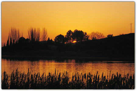
Depending on the water levels in the reservoir, the depth of the ravine of Cerrada de la Herradura varies. The best point from which to enjoy a panoramic view of the ravine is from the bridge which crosses it: the sense of security provided by the metal rail means you can lean out and look down at the trout and barbells thronging the crystalline waters of the River Guadalentín as it enters the Bolera reservoir.
This bridge was built during the 1970s, when the water building up in the dam submerged the Puente de Molinillo bridge which crossed the Guadalentín a little lower down and, since time immemorial, enabled road access to the track which linked the villages scattered across the high mountains (Nava de San Pedro, Puntal de Ana María, La Loma de la Sarga, Vadillo de Castril, etc.) to El Almicerán and Pozo Alcón. Much of the wheat grown in this mountainous area was ground into flour by a windmill which used to stand at the confluence of the Guazalamanco and Guadalentín rivers close to the aforementioned bridge, and which gave the area its name.
This historic route via road, which the march of progress finally cut off over 40 years ago, was mentioned as far back as medieval times: it was also the route used by the mesta, the association of shepherds and sheep farmers, who drove their livestock from Pozo Alcón and Castril to their winter pastures in the Morena mountains, where climate conditions were less harsh and more suitable for sheep and cattle. The stretch of road connecting the reservoir with the Vado de las Carretas ford, close to Nava de San Pedro, is a drovers' road which is officially, and revealingly, named the Cordel de Vistas Pintorescas, or “Route of Picturesque Views”. The first section of this route, which passes by Los Tontos farm, the Forest House at Puntal de Ana María and the farm at Raso del Peral (at 1320 metres this is the highest point on the route) is known as the Cañada del Mesto and is a most pleasant ramble (a round trip of around 8 kilometres from where you will have parked your vehicle) which will surprise visitors with the natural viewing points encountered along the way (Los Tontos Farm, Puntal de Ana María and Poyo del Raso) and the stunning views they offer. If you continue on for a further 5 kilometres, you will reach Vado de la Carretas ford and the Guadalentín and Canaliega ravines.
We recommend…
- Before heading off along the footpath to Cerrada de la Herradura, when you are approaching the Molinillo Forest House look out – with extreme caution – over the edge of the ravine and you will be rewarded with a splendid view of the reservoir and the final stretch of the River Guazalamanco, before it joins the Guadalentín. If water levels in the reservoir are low, you will be able to see the old Molinillo Bridge and what is left of the little old building where flour was produced; in this case we recommend that you descend alongside the banks of the stream, via the path leading off from the Forest House in front of the large bridge, and get closer to the windmill, where the remains of the old mechanisms used to mill the flour are still present.
LOCATION
Cerrada de la Herradura is situated at the end of La Bolera reservoir and is accessed via Dehesa del Rincón, a wide stretch of flat ground running along the right-hand side of the reservoir. From Pozo Alcón take the A-326 along the Avenida Bolera towards Castril. After 7 kilometres, and once you have passed the Bolera campsite, take the turn-off to the left that skirts the Bolera Forest House (there is a signpost indicating El Hornico). Continue along the dirt road, keeping to the main track, until you reach the Molinillo Forest House (now used to shelter livestock) some 7.7 kilometres further on. Leave your vehicle here and continue along the path, following the directions for Vado de las Carretas. After approximately 800 metres you will cross a narrow bridge over Cerrada de la Herradura. If you continue along the path for another 3.5 kilometres, until it begins to descend once more, you will have completed the route known as the Cañada del Mesto.
Follow us #JaénParaísoInterior


