


Ascensiones a la Peña de Jaén y Tajos de la Mella
Routes
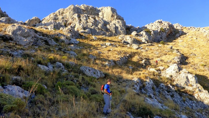
To ascend to the Peña de Jaén, undoubtedly the most spectacular peak of these mountains, the most convenient thing is to do it on the north slope.
Program
If we decide to ascend to the Peña de Jaén, to our left, we will take a goat trail that leads us towards the crest along the southern slope and that quickly disappears among the steep and sharp limestone cliffs that make up the entire upper area of ??this mountain. We will have to continue along this rocky terrain, trying to get closer to the ridge line and looking for the most suitable steps, so the ascent is quite difficult. After thirty minutes we will be in one of the "combs", as the mountaineers call these peaks, on some impressive cliffs that plummet towards the North. Few cities count in their environment
immediate with a viewpoint as majestic as the one that this emblematic rock offers us.
The descent can be done by the opposite slope, dropping to the hill formed by the two combs and taking a path that descends at the beginning with quite a slope between the cuttings, through apparently inaccessible terrain, and then turns to the left bordering the mountain below from the cliffs. It will lead us to the col of the trough.
If we decide to ascend to the Tajos de la Mella and “cut them” we will have to take from the same hill a path that goes up to the right and that, through a small climb, allows us to get on the ridge line. The path breaks down and it will be necessary to continue, as in the case of the Peña de Jaén, with great care, over the rocks, trying not to move away from the ridge, but paying attention to the precipice, since we walk over cliffs of up to 70 and 80 meters. It is worth it, however, for the views that we will enjoy all the way. We will continue to the highest part (1245 m) and once the mountain is finished, we will go down the west slope until we find an accessible pass. We will leave near a stone refuge and from there we will take the path that leads us down to the city.
From the hill we can also walk through the gullies at the bottom, following some of the animal trails that go up parallel to them. This option is less difficult and can be interesting for those looking for climbing routes. Along more than 1 km of rocky walls we will find a large number of them. It is a true paradise for climbers just a few minutes from the city.
Approximate distance: 3 Km
Difficulty: Low to the hill and medium-high along the ridges.
Estimated time: 1 hour
Approximate distance: 5.5 Km
Difficulty: Low to the hill and medium-high along the ridge.
Estimated time: 2 hours
Follow us #JaénParaísoInterior


