


Stage 2: Coto Ríos - La Zarza Forest House Refuge

The Guadalquivir Valley, in its head section, is the protagonist of this Stage, because we cross it during the first section and we can see it from the heights during the second. The route starts from the town of Coto Ríos and very soon passes a few meters from the great river of Andalusia. Then we will arrive at the Borosa River, at the starting point of the spectacular hiking route that goes up it, undoubtedly the most popular in the Natural Park.
In the surroundings of the Guadalquivir -Río Grande, as the Muslims called it- there are a series of facilities for public use that are among the most attractive of the Park: the Torre del Vinagre Visitor Center, the Botanical Garden of the same name and the Centro of Visitors Río Borosa. This area is the busiest and most visited in the Park, and although on peak dates it can be overcrowded, it is well worth taking advantage of the resources that are offered to us to inform ourselves, understand the natural values ??of the territory we are traveling or, simply, give a quiet walk through the exuberant vegetation of the Botanical Garden.
Further on, the route leaves the bottom of the Valley and ascends the slopes of its left slope, entering pine forests with a closed Mediterranean understory.
Several are the attractions of this second part of the route: the spectacular panoramic views over the Guadalquivir Valley that open up as we gain height; the mixed forests that we cross in some sections, where the large black pines and holm oaks mix with deciduous trees such as oaks (gall oaks), maples and mountain pear trees (Sorbus torminalis), which are dressed in yellow and orange in autumn; and the high possibility of spotting most of the species of large wild ungulates that make the Park famous, such as deer, fallow deer, wild boar and mountain goats.
The Stage ends at the Refuge set up in the La Zarza Forest House, a strategic place, not only because of the beautiful panoramic views that can be seen from its surroundings, but also because it is the starting or arrival point of Stages 9 and 10 of the Bosques del Sur Trail, the first towards the Sierra de
Las Villas and the second towards the towns of La Iruela and Cazorla.
Technical information
Route Name Rutas Bosques GR247
Rutas Bosques GR247 2: Stage 2: Coto Ríos - La Zarza Forest House RefugeHUSO 30S
Coto Ríos: x513292 y4211030
Refugio casa forestal La Zarza: x507483 y4206206
Coto Ríos: x513181 y4210822
Refugio casa forestal La Zarza: x507372 y4205999
TOTAL DISTANCE (IN KILOMETERS)15750
Asphalt or cement section 20,85 %
Section of track or forest road or promenade 67,55 %
Senda section 11,60 %
tramos-de-Vía-pecuaria 0 %
ESTIMATED RUN TIMEO
5 h 41 minMAXIMUM SLOPE640 m
DIFFICULTY. ASSESSMENT ACCORDING TO METHOD MEASURE
2
MEDIO.
Severity of the natural environment
2
Itinerary
Orientation in the itinerary
2
Displacement
Difficulty moving
3
EFFORT.
Amount of effort required
TOTAL DISTANCE (IN KILOMETERS) 19540 M
Start
Coto Ríos is accessed from Cortijos Nuevos and from Cazorla by the A-319 road.
Final
There is no access open to the public to road traffic, since the forest track that leads to the Casa Forestal de La Zarza is only accessible to personnel authorized by the Ministry of the Environment.
INTERMEDIATE POINTS
PLACE
POSITION
TYPE OF ROAD
Km 6,3
Carretera
CYCLABILITY
The path that starts from the vicinity of Torre del Vinagre towards La Zarza (kilometer 6.4), has about 400 meters with a steep slope.
WATER POINTS
Coto Ríos, Loma de María Ángela, start of the Borosa route, fountain in front of the Río Borosa Visitor Center, Río Borosa Visitor Center, Torre del Vinagre Visitor Center, near the Casa Forestal de la Zarza Refuge.
PREFRESHING POINTS
On the trail: Coto Ríos
Near the trail: Arroyo Frío
LINKS WITH OTHER TRAILS
GR 7, PR-A 192
Rutómetro
Coto Rios
This Stage begins in the town of Coto Ríos. It is very easy to find the starting panel, since the village is small and its streets have a rectilinear layout: if we look at the village from the bottom, that is, from the Guadalquivir, we must go through any street to the part located more above and further to the right.
Next to the panel we will see a door, which we will have to close as we pass, which gives access to a pleasant asphalt road. This passes through a narrow and fertile plain watered by the water of the Guadalquivir, between orchards and fruit trees. After 500 meters the asphalt ends and to the right we continue to see some unworked terraces and isolated olive trees, while in the distance the mountains of the Sierra de Las Villas rise. On our left we have an Aleppo pine forest with abundant holm oaks.
At kilometer 1.1 you have to open and close a new door and immediately we see, on the bottom right, the Guadalquivir River, to which a little further on we can go down without any difficulty. The grove is ...
Coto Rios
This Stage begins in the town of Coto Ríos. It is very easy to find the starting panel, since the village is small and its streets have a rectilinear layout: if we look at the village from the bottom, that is, from the Guadalquivir, we must go through any street to the part located more above and further to the right.
Next to the panel we will see a door, which we will have to close as we pass, which gives access to a pleasant asphalt road. This passes through a narrow and fertile plain watered by the water of the Guadalquivir, between orchards and fruit trees. After 500 meters the asphalt ends and to the right we continue to see some unworked terraces and isolated olive trees, while in the distance the mountains of the Sierra de Las Villas rise. On our left we have an Aleppo pine forest with abundant holm oaks.
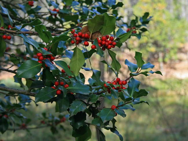
At kilometer 1.1 you have to open and close a new door and immediately we see, on the bottom right, the Guadalquivir River, to which a little further on we can go down without any difficulty. The grove is very varied, as the pines and oaks are joined by gall oaks (oaks), poplars and large ash trees. We are even surprised by some holly trees.
There is also a lot of mastic and some Montpellier maples (Acer monspessulanum). The heterogeneity and variety of this beautiful grove is due, on the one hand, to the combination of the low altitude of the area with the humidity provided by the proximity of the river, and on the other, to the mixture of species of spontaneous origin with others of anthropic origin, that is, planted or favored by humans.
The roads on which this first part of our route goes have a different aspect, both in width and firmness. The last section before reaching the village of La Loma de María de María Ángela is narrower and steeper. At kilometer 3.3 we cross a stream and 200 meters later we have to open and close one last door. Immediately, among large oaks, we reached the next milestone of the Stage.
Loma de Maria Angela
The route passes through this small town, in a privileged enclave surrounded by mountains, and where we will find the Puchardo Fountain on the left. We go down the small asphalt road that gives access to the village between orchards and small olive groves.
Borosa River Fish Farm
We arrive at the Borosa River, one of the most beautiful and wild tributaries that pour their waters into the Guadalquivir at its headwaters. It is an important crossing because it coincides with the start of the spectacular Borosa route, the most popular in the Natural Park. This route begins in the car park on the left –where there is a fountain- and is signposted by the Andalusian Regional Government's Environment Department until its end at the Salto de Los Órganos.
It should be noted that our Stage coincides from Coto Ríos to the fish farm with the GR 7, which here is separated by going up the Borosa route and overlapping with it to the Puente de los Caracolillos.
It is also noteworthy that the first section of this route, specifically up to the Arroyo de Las Truchas, which is just over 1 kilometer long, is suitable for people with reduced mobility, as it has hardly any unevenness and goes along a forest track with a good firm closed to the private motor vehicle traffic. On the other hand, it is ...
Borosa River Fish Farm
We arrive at the Borosa River, one of the most beautiful and wild tributaries that pour their waters into the Guadalquivir at its headwaters. It is an important crossing because it coincides with the start of the spectacular Borosa route, the most popular in the Natural Park. This route begins in the car park on the left –where there is a fountain- and is signposted by the Andalusian Regional Government's Environment Department until its end at the Salto de Los Órganos.
It should be noted that our Stage coincides from Coto Ríos to the fish farm with the GR 7, which here is separated by going up the Borosa route and overlapping with it to the Puente de los Caracolillos.
It is also noteworthy that the first section of this route, specifically up to the Arroyo de Las Truchas, which is just over 1 kilometer long, is suitable for people with reduced mobility, as it has hardly any unevenness and goes along a forest track with a good firm closed to the private motor vehicle traffic. On the other hand, it is interesting to know that the aforementioned Borosa route is considered of special ornithological interest, of which a panel located at its beginning informs us.
From the crossroads of the fish farm that we have discussed about our Stage, turn right, following the paved road and crossing the bridge over the rough waters of the Borosa River. We leave the fish farm on the right and a fountain on the left. After 200 meters, the Río Borosa Visitor Center is on the right, which has a large parking lot.
In this Center we can learn about the importance of water and river ecosystems in the Natural Park, in which emblematic species such as common trout and otters stand out.
Our route continues in the company of large gall oaks and crosses the Guadalquivir, which here is quite secluded and flanked by well-preserved riverside vegetation. A little further on we come to the emblematic place of Torre del Vinagre.
It should be noted that this 1.7-kilometer stretch between the Borosa fish farm and Torre del Vinagre has no marks or beacons, since the Ministry of the Environment has planned the creation of a new path for exclusively pedestrian use that would join both points and through which the Bosques del Sur Trail would pass.
In any case, the route that we have described along the current asphalt road has no loss, in addition to being very busy.
The Borosa route as a variant to climb Collado Bermejo on Stage 15
The popular Borosa Route, and its continuation towards the Valdeazores and Collado Bermejo lagoons, although it does not belong to the GR 247, can be used as a variant to go up to Stage 15. The route is signposted by the Ministry of the Environment to La Central Eléctrica . But the route can continue upwards, without possible loss, through the tunnel of the Los Órganos hydroelectric plant and the famous Valdeazores Lagunas, and then up to Collado Bermejo along a path that has no loss and is quite busy.
It is necessary to be attentive to possible landslides in the section before the tunnels. Once in the Collado we have already linked with Stage 15 of the Bosques del Sur Trail, 3.4 kilometers from the Fuente Acero Forest House Refuge. From the Borosa fish farm to Collado Bermejo there is a total distance of 16.5 kilometers and a total difference in altitude of 880 meters. This route, of extraordinary beauty, can therefore be used as a fourth transversal variant of the Bosques del Sur Trail.
Torre del Vinagre Visitor Center
The asphalt road leads to the A-319 road, which runs through the Guadalquivir Valley and the Tranco Reservoir, being the most visited communication axis in the Natural Park. To the right of the crossroads we have two places of essential visit and free entry.
The first is the Torre del Vinagre Visitor Center, the most important and best equipped in the Park, which offers information and has a variety of interactive resources, very attractive to guide us to understand the main values ??of the protected area that we are visiting. It has a Natural Park shop, toilets, cafeteria, audiovisual projection room and a children's play area outside.
The second place is located a few meters further and is the Torre del Vinagre Botanical Garden. This well-kept garden has a wide selection of plants from the Natural Park, from small herbaceous to large trees. It is a perfect place to observe them and learn to distinguish them or, simply, to take a pleasant walk among lush vegetation. Your visit helps to unde ...
Torre del Vinagre Visitor Center
The asphalt road leads to the A-319 road, which runs through the Guadalquivir Valley and the Tranco Reservoir, being the most visited communication axis in the Natural Park. To the right of the crossroads we have two places of essential visit and free entry.
The first is the Torre del Vinagre Visitor Center, the most important and best equipped in the Park, which offers information and has a variety of interactive resources, very attractive to guide us to understand the main values ??of the protected area that we are visiting. It has a Natural Park shop, toilets, cafeteria, audiovisual projection room and a children's play area outside.
The second place is located a few meters further and is the Torre del Vinagre Botanical Garden. This well-kept garden has a wide selection of plants from the Natural Park, from small herbaceous to large trees. It is a perfect place to observe them and learn to distinguish them or, simply, to take a pleasant walk among lush vegetation. Your visit helps to understand why the extraordinary botanical wealth of these mountains is one of the main reasons why they are declared as a protected natural area.
If we do not deviate towards these places, our route continues to turn left onto the A-319 road, which we abandon 100 meters later on a well-marked path that goes to the right, ascending the wrong way. From here the atmosphere changes completely. We leave the humanized areas –even, on occasions, overcrowded, as occurs between Borosa and Torre del Vinagre- to enter the forest gaining altitude over the Guadalquivir Valley.
The path twists steeply through a pine forest, under which grows a dense Mediterranean undergrowth, with a lot of mastic, and in which there are magnificent gall oaks (oaks) scattered around. It is advisable, during the first 500 meters of this section, to be aware of the numerous beacons that mark it. At kilometer 6.8 the path becomes a wider path, turning left, which soon flattens out.
At this point we will have already gained magnificent views of the mountains on the opposite side of the Guadalquivir Valley, that is, its right slope, and the great elevations of the Sierra de Cazorla that close it in front. The entire mountain that we are going to travel to the end of the Stage is very rich in fauna, so it is common to see deer, mountain goats, wild boars, etc. A little further on, the path becomes a forest track.
Forest track to La Zarza
The track we are walking on leaves at this point a wider one that we take towards the front, soon finding a fence that prevents the passage of vehicles. We are still in the middle of an Aleppo pine forest with abundant holm oaks and gall oaks, and on the left we leave the Barranco del Arroyo de la Torre del Vinagre and the farmhouse of the same name.
From kilometer 10 we begin again to enjoy spectacular views, since, from now on, the track intermittently turns into a wonderful balcony over the Guadalquivir Valley. The views can no longer be obtained in the sections where the route enters the folds and ravines of the slope, but in return, in these areas, we enjoy a particularly lush and cozy wooded environment. At kilometer 9.7 we ignore a track that goes to the right.
Collado de los Corzos
The route, which during the last section has been turning north to go around Los Torcalillos, reaches Collado de los Corzos, where it turns sharply west to regain its direction parallel to the Guadalquivir Valley. It is worth stopping for some memorable panoramic views. The name of the place also reminds us of one of the most important species of fauna in these mountains that became extinct in the middle of the 20th century.
In 1952 an attempt was made to repopulate with the release of ten specimens, but the experience failed. The reintroduction of this animal was one of the objectives of the Natural Park since its creation in 1986 but, despite the completion of several technical studies, so far it has not been addressed.
We continue the route, discarding at kilometer 10.5 a new track that reaches ours from the right, the wrong way. The Aleppo and Black pines are being replaced by the slender black pines as we gain altitude, and in the most sheltered sections of the slope the route runs immersed in a r ...
Collado de los Corzos
The route, which during the last section has been turning north to go around Los Torcalillos, reaches Collado de los Corzos, where it turns sharply west to regain its direction parallel to the Guadalquivir Valley. It is worth stopping for some memorable panoramic views. The name of the place also reminds us of one of the most important species of fauna in these mountains that became extinct in the middle of the 20th century.
In 1952 an attempt was made to repopulate with the release of ten specimens, but the experience failed. The reintroduction of this animal was one of the objectives of the Natural Park since its creation in 1986 but, despite the completion of several technical studies, so far it has not been addressed.
We continue the route, discarding at kilometer 10.5 a new track that reaches ours from the right, the wrong way. The Aleppo and Black pines are being replaced by the slender black pines as we gain altitude, and in the most sheltered sections of the slope the route runs immersed in a rich mixed forest, of great ecological relevance and scenic beauty, in which the pines and Holm oaks are mixed with deciduous trees such as gall oaks (Quercus faginea), mountain pear trees (Sorbus torminalis), Grenadian maples (Acer granatense) and Montpellier maples (Acer monspessulanum), which acquire their maximum chromatic splendor in autumn.
From kilometer 13.5 we again enjoy sensational views, dominated to the east by the impressive rocky mass of Las Banderillas, and to the south by the Sierras de Cazorla and del Pozo, whose high peaks girdle the bottom of a deep perspective whose axis is always the Guadalquivir Valley.
About 250 meters before reaching the end of our Stage is the fountain that served the old Casa Forestal de La Zarza. It cannot be seen from the road, but the place is easy to identify because we will see on our left a wide clearing, quite flat and with remains of small dry stone terraces, made at the time to smooth the ground and facilitate its tillage. We cross the clearing to a small stretch and there we will find a wooden turn and another construction trough with the fountain.
Following our route, a little further on we will see on the right, on the contrary, the crossroads with the path along which Stage 9 of the Bosques del Sur Trail runs, which comes from the Majalserbal Refuge in the Sierra de Las Villas.
La Zarza Forest House Refuge
We reached the end of the Stage, which coincides with the aforementioned Stage 9 and the beginning of Stage 10 towards La Iruela. La Casa Forestal is located in a privileged place due to its views towards the Banderillas Mountain Range and the Guadalquivir Valley, flanked by spectacular mountains.
A signposted path starts from the Casa Forestal that is not part of the GR 247, but whose route is highly recommended, especially in its initial section, which is very panoramic.
It is an old 3-kilometer bridle path that goes down quite steeply to the bottom of the Guadalquivir Valley, passing through the Barranco de la Tuerta, the Arroyo del Saúco and Los Huertezuelos. The trail ends at the A-319 road at kilometer 43, that is, about five kilometers from Torre del Vinagre.
Additional information
The carnivorous mammals of the Natural Park
It will be rare that the walker, if he is attentive, does not see any of the representatives of the famous group of the great herbivores of the Park on any GR 247 route. But you will have to be very lucky to see the members of the select group of carnivorous mammals: cunning, efficient, highly specialized and extraordinarily discreet beings, practically nocturnal, who are found in the highest part of the complex and motley trophic pyramid of the Park. .
It is likely that sooner or later the hiker will see a fox, even if it is just at the moment when he lands in the middle. It will be more difficult to spot a genet, that great long-tailed jumper and climber with black and white rings. Or a badger, looking like a chubby stuffed animal in a black and white mask.
Or a marten, or marten, as they call it around here, who never had much sympathy for these lands given his fondness for chickens and other farmyard animals. One must have a lot of luck to see a weasel, the smallest and most h ...
The carnivorous mammals of the Natural Park
It will be rare that the walker, if he is attentive, does not see any of the representatives of the famous group of the great herbivores of the Park on any GR 247 route. But you will have to be very lucky to see the members of the select group of carnivorous mammals: cunning, efficient, highly specialized and extraordinarily discreet beings, practically nocturnal, who are found in the highest part of the complex and motley trophic pyramid of the Park. .
It is likely that sooner or later the hiker will see a fox, even if it is just at the moment when he lands in the middle. It will be more difficult to spot a genet, that great long-tailed jumper and climber with black and white rings. Or a badger, looking like a chubby stuffed animal in a black and white mask.
Or a marten, or marten, as they call it around here, who never had much sympathy for these lands given his fondness for chickens and other farmyard animals. One must have a lot of luck to see a weasel, the smallest and most hyperactive of the four-legged hunters, and the one who can be considered touched by some divine design is the walker to whom a wild cat appears before his eyes. A real mountain, with its voluminous head, its powerful fangs and its large ringed tail, very different from the frequent cats hybridized with domestic specimens.
Agile, cunning, silent and almost always “out of the picture”, these animals are the true champions of the Park's fauna along with their winged pairs, the raptors, these are much more visible. The existence and abundance of both is the strongest demonstration that life flows in abundance through the Natural Park, since there are no hunters without prey, nor prey without… etc.

Follow us #JaénParaísoInterior


