


Etapa 1: Cazorla - Refugio Casa Forestal del Sacejo

This Stage connects the town of Cazorla with the El Sacejo Refuge, next to the Parador de Cazorla. Therefore, it runs between the southwestern outer edge of the Natural Park and the slopes that fall to the Guadalquivir Valley, the axis of the southern area of ??the Park.
Its route has many attractions, starting with the town of Cazorla itself, the most visited in the Park, and the path that starts from the population going up the lush Cerezuelo valley, closed by a rocky wall through which the La Escaleruela Waterfall falls. when the rainfall has been sufficient.
From the Mirador de Riogazas we will be able to contemplate some exceptional panoramic views of Cazorla and the mountains that surround it, with the great olive-growing countryside in the background. Later on, the path that we travel itself ceases to be a simple means of enjoying the landscape and becomes the protagonist of the route. Wide, with a good surface and built in the traditional way, with its dry stone lasts and chocks, it is a type of path that we can only find in this area of ??the Natural Park, as we also see ...
This Stage connects the town of Cazorla with the El Sacejo Refuge, next to the Parador de Cazorla. Therefore, it runs between the southwestern outer edge of the Natural Park and the slopes that fall to the Guadalquivir Valley, the axis of the southern area of ??the Park.
Its route has many attractions, starting with the town of Cazorla itself, the most visited in the Park, and the path that starts from the population going up the lush Cerezuelo valley, closed by a rocky wall through which the La Escaleruela Waterfall falls. when the rainfall has been sufficient.
From the Mirador de Riogazas we will be able to contemplate some exceptional panoramic views of Cazorla and the mountains that surround it, with the great olive-growing countryside in the background. Later on, the path that we travel itself ceases to be a simple means of enjoying the landscape and becomes the protagonist of the route. Wide, with a good surface and built in the traditional way, with its dry stone lasts and chocks, it is a type of path that we can only find in this area of ??the Natural Park, as we also see in other Stages of the GR 247.
Because of their quality, because of the effort and expertise that their construction required at the time, and because of the impressive landscapes they run through, these paths are part of the best of the Park's heritage.
Up to Collado del Gilillo we will enjoy great views towards the lowlands covered with olive groves, and once passed, the route changes slope and looks towards the mountains that flank the embedded Guadalquivir Valley, in a clear contrast between agricultural and forest landscapes. If in the aforementioned hill we choose to deviate briefly and climb to the summit of the same name, we will enjoy one of the most exciting scenic spectacles of the Natural Park, with views that range from the north of the Sierra de Segura to the Sierra Nevada.
The fauna richness of the whole area is great. Vultures are easy to see and golden eagles are common. And of course, at any moment the mountain goat, the deer, the fallow deer and the mouflon can surprise us.
Technical information
Route Name Rutas Bosques GR247
Rutas Bosques GR247 3: Etapa 1: Cazorla - Refugio Casa Forestal del SacejoHUSO 30S
Cazorla: x500111 y4195682
Refugio C.F. de El Sacejo: x503471 y4195414
Cazorla: x500000 y4195475
Refugio C.F. de El Sacejo: x503360 y4195207
TOTAL DISTANCE (IN KILOMETERS)15040
Asphalt or cement section 0 %
Section of track or forest road or promenade 24,60 %
Senda section 75,40 %
tramos-de-Vía-pecuaria 0 %
ESTIMATED RUN TIMEO
5 h 22 minMAXIMUM SLOPE927 m
DIFFICULTY. ASSESSMENT ACCORDING TO METHOD MEASURE
2
MEDIO.
Severity of the natural environment
2
Itinerary
Orientation in the itinerary
2
Displacement
Difficulty moving
3
EFFORT.
Amount of effort required
TOTAL DISTANCE (IN KILOMETERS) 19540 M
Start
Cazorla is accessed by the A-315 and A-319 roads from Torreperogil; by the A-322 from Quesada; and by the A-6204 from Santo Tomé. It can also be reached from El Tranco by the A-319.
Final
The Casa Forestal del Sacejo Refuge is accessed through Vadillo – Castril and Arroyo Frío along the JF-7094 road.
INTERMEDIATE POINTS
PLACE
POSITION
TYPE OF ROAD
Km 3,6
Road and forest track
CYCLABILITY
Most of the Stage runs on a path. Short sections with a steep slope at the exit of Cazorla. From Riogazas to about two kilometers before the end of the Stage, there are points and short sections with stony ground, stepping stones and a very narrow path.
WATER POINTS
Cazorla, Nacelrío, La Malena, fountain-watering hole in Cerro Cagahierro, Casa Forestal del Sacejo Refuge.
PREFRESHING POINTS
On the trail: Cazorla
Near the trail: La Iruela
LINKS WITH OTHER TRAILS
PR-A 312; PR-A 313; SL-A 7; SL-A8.
Rutómetro
Cazorla
The route starts from Cazorla, next to the Cerezuelo River –also called Cazorla-, very close to the Plaza de Santa María and on the road that goes up to the Castillo de La Yedra. This river and its surroundings have been restored a few years ago and it has a pleasant path to enjoy it. Our route turns left a few meters from its beginning, passing to the right bank of the river.
The steep slope makes us immediately gain altitude, always in a very leafy environment, between houses, orchards and chalets, linking various paths with different types of pavement whose crossings are well marked with four-color markings, since in this first section our GR it coincides with other Short Path Paths and a Local Path.
If we look back we will see a beautiful picture of the town of Cazorla crowned by its castle, and in the background, the olive-growing countryside and Sierra Mágina. The path that we travel is the one traditionally used by Cazorleños to climb the mountains on foot or on the back of their horses.
The valley th ...
Cazorla
The route starts from Cazorla, next to the Cerezuelo River –also called Cazorla-, very close to the Plaza de Santa María and on the road that goes up to the Castillo de La Yedra. This river and its surroundings have been restored a few years ago and it has a pleasant path to enjoy it. Our route turns left a few meters from its beginning, passing to the right bank of the river.
The steep slope makes us immediately gain altitude, always in a very leafy environment, between houses, orchards and chalets, linking various paths with different types of pavement whose crossings are well marked with four-color markings, since in this first section our GR it coincides with other Short Path Paths and a Local Path.
If we look back we will see a beautiful picture of the town of Cazorla crowned by its castle, and in the background, the olive-growing countryside and Sierra Mágina. The path that we travel is the one traditionally used by Cazorleños to climb the mountains on foot or on the back of their horses.
The valley that we have to our right deserves to be contemplated carefully for its lushness. We can also see, on the opposite slope to which we are traveling, the ruins of the Castillo de las Cinco Esquinas, or of Salvatierra, which is the name of the hill that crowns. It is a fortification from the end of the 12th century, whose tower has a curious plan in the shape of an irregular pentagon. We will pass by the humble Hermitage of San Sebastián, apparently from the end of the 15th century, which is on our left.
From time to time we will see at the bottom of the valley the small waterfalls that the river makes, whose waters once moved the stones of the Tíscar Mill. Meanwhile, for some stretches, the landscape could not be more pleasant, with orchards, terraces, fig trees, persimmons, poplars, some olive trees, and in the background, the wall of powerful cliffs of the Sinclinal rope, through which the long cliff falls. Horsetail of La Escaleruela Waterfall, whose visibility depends on the time of year and the rainfall.
The harmony between man and nature in these places is also expressed in their sounds: the bleating of the sheep, the water of the river, the bells of Cazorla and the song of the birds, which are as abundant and varied as the resources found here .
Nacelrío Fountain
About 100 meters after having crossed the river over a bridge we arrive at the Nacelrío spring, where there is a crossroads that we must take to the right. To the left we would go to the hermitage of the Virgen de la Cabeza in an hour. Stage 10 of the GR 247 passes through this sanctuary, one kilometer from its end, which should be taken into account if we want to do alternative routes.
From here we enter the forest and rocky territories, starting with a wide path in the middle of an Aleppo pine forest.
After crossing the Arroyo de La Malena at kilometer 2.7 we will find a new spring and a small recreational area with a good poplar grove and a beautiful viewpoint towards Cazorla.
A few meters further on (almost a kilometer after the Nacelrío fountain) we arrive at the fantastic Mirador de Riogazas, a large balcony from which we can see all the places we have traveled up to this moment, identified in an interpretive panel will help us to better know the landscape that we are enjoying, where the Peña de los Halcones on the right and the Loma del Castillo on the left form a large v at the foot of which is the town of Cazorla.
Riogazas Control Booth
We arrive at the old Riogazas Control Booth, which was formerly an inspection point for the vehicles that transported the abundant wood that these mountains have always produced. We find a wide forest track that leads to the Casa Forestal del Chorro and Collado Zamora to the right. If we followed it, we would link 3 kilometers later with Stage 11 of the Bosques del Sur Trail at kilometer 5.2.
We cross it to continue straight on along a path that immediately widens, turning into a good path with stones on the sides. 300 meters further on we cross the same track again and continue on our path ahead. We soon realized the importance of this traditional path due to its width and the dry stone blocks and lasts it has. We pass through an area repopulated with cypress trees and on the left we will see once again the Cascada de la Escaleruela.
At kilometer 4.4 we find another crossroads with the aforementioned forest track, which we take to the right, to leave it after a few meters along the path that comes ou ...
Riogazas Control Booth
We arrive at the old Riogazas Control Booth, which was formerly an inspection point for the vehicles that transported the abundant wood that these mountains have always produced. We find a wide forest track that leads to the Casa Forestal del Chorro and Collado Zamora to the right. If we followed it, we would link 3 kilometers later with Stage 11 of the Bosques del Sur Trail at kilometer 5.2.
We cross it to continue straight on along a path that immediately widens, turning into a good path with stones on the sides. 300 meters further on we cross the same track again and continue on our path ahead. We soon realized the importance of this traditional path due to its width and the dry stone blocks and lasts it has. We pass through an area repopulated with cypress trees and on the left we will see once again the Cascada de la Escaleruela.
At kilometer 4.4 we find another crossroads with the aforementioned forest track, which we take to the right, to leave it after a few meters along the path that comes out to the left and starts with a stagger. After passing a fountain-trough, the path enters a pine forest of black pine, denser than those that have accompanied us so far. The higher humidity causes mosses and ivy to appear, as well as some black pines, maples, hawks and guillomos or white hardwoods (Amelanchier ovalis).
The path, which ascends the slopes of Cerro de Cagahierro, is very panoramic in some sections.
At kilometer 6.2 we pass through a flooded area where we must follow the route, looking at the stones that mark the path.
Collado de Cagahierro
We arrived at the Cagahierro pass. To the right there is a path through which we would connect in just one kilometer with Stage 11, in the section between the Montesión monastery and the famous El Chorro spot. Our route continues in front, in a sustained ascent, passing through a pine forest of repopulation larices.
From kilometer 6.7, the pine forest is replaced by the holm oak, but as we climb, the terrain is soon more and more bare, with piornos, arlos thorn (Berberis hispánica) and some guillomos. towards the Jaen countryside. This marvelous section along the Lancha del Gilillo, up to the Collado of the same name, is undoubtedly one of the most distinctive of the entire Bosques del Sur Trail.
The path is wide and well built, with its dry stone lasts. On the right it is flanked by large cliffs, cliffs and detached rocks, while on the left the view is lost to distant horizons, with towns such as Quesada and Peal de Becerro in the foreground.
At kilometer 7.4 we pass a small hill behind which ...
Collado de Cagahierro
We arrived at the Cagahierro pass. To the right there is a path through which we would connect in just one kilometer with Stage 11, in the section between the Montesión monastery and the famous El Chorro spot. Our route continues in front, in a sustained ascent, passing through a pine forest of repopulation larices.
From kilometer 6.7, the pine forest is replaced by the holm oak, but as we climb, the terrain is soon more and more bare, with piornos, arlos thorn (Berberis hispánica) and some guillomos. towards the Jaen countryside. This marvelous section along the Lancha del Gilillo, up to the Collado of the same name, is undoubtedly one of the most distinctive of the entire Bosques del Sur Trail.
The path is wide and well built, with its dry stone lasts. On the right it is flanked by large cliffs, cliffs and detached rocks, while on the left the view is lost to distant horizons, with towns such as Quesada and Peal de Becerro in the foreground.
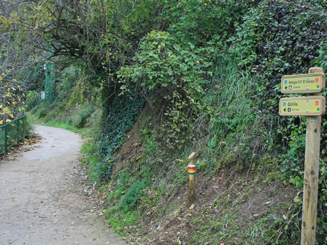
At kilometer 7.4 we pass a small hill behind which the Gilillo appears in front, very bare and rocky, while on the right, below, we will see the El Chorro cliffs.
Our extraordinary path continues winding, without being already stuck to the cliffs and with a softer relief. Spots of creeping juniper appear, perfectly adapted to the winds, snows and poor soils, and we are surprised by some specimens of mostajo (Sorbus aria), a relatively common seedling in northern Spain but quite rare in the Natural Park.
Collado de Gilillo
This point is an important milestone of the Stage because we change the slope and the direction of the trail stops being towards the southeast to head towards the northeast, opening up impressive views towards the mountains that flank the right slope of the Guadalquivir Valley, such as Calar de Juana and the Loma de La Mesa.
It is highly recommended to deviate from the route to climb the summit of Gilillo, which is only 500 meters away, and with its 1848 m altitude, it offers us incredible panoramic views in all directions. To the east we see Sierra Mágina, crowned by the peak of the same name, which is the highest in the province of Jaén (2,164 meters), with views extending beyond the Loma de Úbeda, in the countryside.
Further south, on clear days we can see the white peaks of the Sierra Nevada rising in the distance. The southern views, already on the mountains of the Park, are crowned by the Cabañas peak and include the Nacimiento del Guadalquivir. To the east we see the deep cleft of the Valley of thi ...
Collado de Gilillo
This point is an important milestone of the Stage because we change the slope and the direction of the trail stops being towards the southeast to head towards the northeast, opening up impressive views towards the mountains that flank the right slope of the Guadalquivir Valley, such as Calar de Juana and the Loma de La Mesa.
It is highly recommended to deviate from the route to climb the summit of Gilillo, which is only 500 meters away, and with its 1848 m altitude, it offers us incredible panoramic views in all directions. To the east we see Sierra Mágina, crowned by the peak of the same name, which is the highest in the province of Jaén (2,164 meters), with views extending beyond the Loma de Úbeda, in the countryside.
Further south, on clear days we can see the white peaks of the Sierra Nevada rising in the distance. The southern views, already on the mountains of the Park, are crowned by the Cabañas peak and include the Nacimiento del Guadalquivir. To the east we see the deep cleft of the Valley of this river and the mountains that flank it on the opposite side, such as Calar de Juana and Poyos de La Mesa.
And finally, to the north, the endless mountainous backdrops of the Sierras de Las Villas and Segura, where the Banderillas, El Yelmo and the Calares del Espino and Navalperal stand out.
Back on our route, we leave the wide path we have walked on to take a small path that goes to the left, next to the ruins of an old guardhouse. The trees reappear, at first with small black pines, and then we see a small and precious grouse. To the right we continue having great views towards the Guadalquivir Valley.
700 meters further on we come to a new hill with a pleasant meadow where we turn left again, ceasing to have views of the Valley. The path, very narrow at the beginning, passes through a pine forest and reaches a wide ravine that surrounds on the right. The landscape here is very striking, being dominated by a carpet of broom and creeping juniper, as well as rocks with jagged profiles and very whimsical shapes.
After a short ascent, we reach another small hill (kilometer 9.8) where we see the Guadalquivir Valley again, our narrow path running between brooms and over quite rocky ground.
Collado
The route, always along the Loma de Los Castellones, reaches another hill where, to the right, a wild and narrow ravine is born, formed by a tributary stream of the Arroyo Cerezo, a tributary in turn of the Guadalquivir. The views are spectacular, with the Guadalquivir Valley to the east.
Our narrow path continues along rocky ground, in which no other trees can grow than some small and twisted black pines, but in which the creeping juniper appears and, later, the box and creeping juniper. At kilometer 11.3 the route turns to the right, changing slope, descending in a zigzag through pine forest, which is now denser and reveals the Guadalquivir Valley in some sections.
The pines get bigger as we go down, although they have very little undergrowth, because under them only creeping juniper grows.
At kilometer 11.6 we pass through a very pleasant flat in the shape of a soft hole, which can get flooded in the center and on the right bank of which there is an alignment of rocks that seem to be buried in the ground. We left the hole to the right, paying attention to the corresponding mark, and again we took a wide path with a good firm surface. After flattening for a while, we descend again through a pine forest in which arlos, laureolas, rose bushes and guillomos appear, with intermittent views towards the Guadalquivir Valley.
Puerto del Tejo
In this hill, with beautiful views on both sides, our path reaches an important and clear fork. The one on the left would take us to the hermitage of the Virgen de la Cabeza, surrounding the Cerro de la Laguna on its southern slope. If we have plenty of time, it is recommended to travel one or two kilometers and return to Puerto del Tejo, just for the pleasure of enjoying the impressive views over the rugged ravine that runs, as well as the path itself, wide and well built in the manner traditional.
Our route, at the aforementioned fork, continues to the right, through pine forest of black pine with junipers, junipers and holm oaks. Little by little it widens until it becomes a forest track with some oaks (gall oaks). At kilometer 13.8 there is a fork where we must turn right. In the last section our track descends quite steeply.
Sacejo Forest House Refuge
Our Stage ends in this old Forest House, in which a refuge has been set up. It is located a few meters from the Parador de Cazorla, an establishment that was a pioneer in the tourist development of the Sierra de Cazorla. There is a fount.
Additional information
The golden age of forest roads
The splendid paths that we travel in this Stage (which are not modern forest tracks, but neither are ancient muleteers' paths), make us wonder about their origin. Here is the answer from Alfredo Benavente Navarro, one of the best connoisseurs of the Natural Park.
The oldest roads in these Sierras date back to medieval times and were used to cross it, such as the one that goes from Cazorla to Castril. On this the path that crosses Gilillo, Puerto de Juan de Baco and Puerto Pinillo was marked, but most of the roads that we see in the Sierra de Cazorla are from the last decade of the 19th century and the first three of the 20th century.
The original proposal for this road network was produced in 1883 by the Jaén Forest District in order to communicate the forestry houses planned for the forestry exploitation of the Sierras de Cazorla and Segura. These works began around 1900, when the construction of these houses was approached, in order to facilitate communication and monitoring of forestry work ...
The golden age of forest roads
The splendid paths that we travel in this Stage (which are not modern forest tracks, but neither are ancient muleteers' paths), make us wonder about their origin. Here is the answer from Alfredo Benavente Navarro, one of the best connoisseurs of the Natural Park.
The oldest roads in these Sierras date back to medieval times and were used to cross it, such as the one that goes from Cazorla to Castril. On this the path that crosses Gilillo, Puerto de Juan de Baco and Puerto Pinillo was marked, but most of the roads that we see in the Sierra de Cazorla are from the last decade of the 19th century and the first three of the 20th century.
The original proposal for this road network was produced in 1883 by the Jaén Forest District in order to communicate the forestry houses planned for the forestry exploitation of the Sierras de Cazorla and Segura. These works began around 1900, when the construction of these houses was approached, in order to facilitate communication and monitoring of forestry work, at a time when wood was taken from the mountain through rivers, jorros ( extraction roads) and muleteers' roads, many of which are currently under the asphalt of the roads or have been widened to become forest tracks.
The technical direction of these roads was carried out by the engineer on duty in the corresponding brigade. Thus, in the mountains of Navahondona, Guadahornillos, Vertientes del Guadalquivir, Torre del Vinagre, Hortizuela, Poyo Segura, etc., the network of roads was executed by Enrique Mackay, one of the most illustrious and competent forest engineers of the time at the national.
In the Sierra de Segura, however, few new roads were made at that time, because there was already a network of trails between farmhouses and villages, on which the new forest tracks were adapted. Therefore, most of the roads for the forest exploitation of these mountains were created between 1900 and 1936. After the Civil War, few more were made, except in the Cazorla-Segura National Hunting Reserve (1960) and a few to communicate new forest houses.

Follow us #JaénParaísoInterior


