


Sendero la Osera
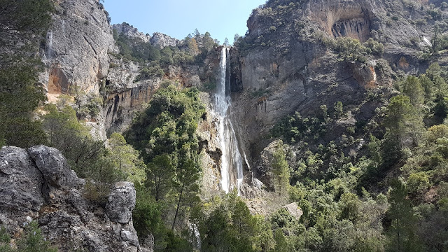
We find ourselves with one of the most charming routes in the entire Sierra de las Villas. The Sendero de la Osera is located 18,600 km east of Mogón within the Natural Park of Cazorla, Segura and Las Villas. Between large stone cuttings and valleys we will find a great wealth of flora, (maple, box, strawberry tree, yew, pine forests, walnut trees, holm oaks, ...) and fauna (griffon vultures, eagles, hawks, ...), as well as wonderful viewpoints from which we can observe unique landscapes.
TYPE OF TRAIL
Linear and circular
Difficulty
high
START POINT
The route begins around the Aguascebas reservoir from which we can see in front the majestic Navazalto peak until we reach the enclave known as the Aguardentero pass, all surrounded by large pine forests. From here we will continue descending little by little through the La Osera valley until we reach a viewpoint where we can see part of the Las Villas Region as well as the passage of the great protagonist of this valley, the Aguascebas Chico river.
TOTAL DISTANCE (IN KILOMETERS)
4
ESTIMATED RUN TIME
4 hours
Type of firm
Track and path
DIFFICULTY. ASSESSMENT ACCORDING TO METHOD MEASURE
0
MEDIO.
Severity of the natural environment
0
Itinerary
Orientation in the itinerary
0
Displacement
Difficulty moving
0
EFFORT.
Amount of effort required
SIGNALING
Sí
MUNICIPAL TERMS BY WHICH IT RUNS
Villacarrillo La Loma y Las VillasNATURAL ENVIRONMENT
Large cliffs, riverside vegetation, pine forest and panoramic views.
RECOMMENDATIONS
Bring drinking water and appropriate clothing and footwear. Sun protection in the summer
DESCRIPTION
From Chilluévar take the Crta de la Sierra towards the Aguascebas Reservoir. Continue on this road for the next 13.2 km. The beginning of the path is on the left according to the direction of advance. The risk of falling stones is warned at the beginning of the trail. If we continue along this road we will find the Aguascebas Reservoir just under 300 meters away.
Follow us #JaénParaísoInterior


