


Sendero de los Cuatro Términos
The path leads to a hill or point where four municipal districts coincide: Andújar, Villanueva de la Reina, Baños de la Encina, in the province of Jaén and Mestanza, in Ciudad Real. This route runs along the cattle track called Cañada Real de la Plata, within Mount Selladores Contadero, owned by the Ministry of Agriculture and the Environment. It is a mountaineering route that crosses places with little traffic, covered with an interesting natural vegetation.

TYPE OF TRAIL
Track
Difficulty
High average
START POINT
From Carolina (35 km): Take the JA-6100 road and continue for 18 km to El Centenillo. From there, take the local road JM 5005 towards Collado del Jardín, continue for 17 km until the beginning of the path. 100 m before the trail there is a location sign indicating the distance to the beginning of it. The starting point of the trail is a pedestrian gate in the mesh, behind which is the start sign. It is necessary that this door is closed once we access the path.
From Andújar (51.4 km, difficult access for cars other than off-road vehicles): Take the A-6177 Highway and travel it for 14.6 km to the Los Pinos tourist complex. From here take the JH-5002 road and continue 9.4 km until the Los Escoriales junction. Once here, continue along the JM 5003 dirt road for 27.4 km until the beginning of the path, which is 230 m beyond the Collado del Jardín. One hundred meters before the trail there is a location sign indicating the distance to the beginning of it. The starting point of the trail is a pedestrian gate in the mesh.
TOTAL DISTANCE (IN KILOMETERS)
4.000
ESTIMATED RUN TIME
1 hour and 20 minutes
Type of firm
Track
DIFFICULTY. ASSESSMENT ACCORDING TO METHOD MEASURE
0
MEDIO.
Severity of the natural environment
0
Itinerary
Orientation in the itinerary
0
Displacement
Difficulty moving
0
EFFORT.
Amount of effort required
SIGNALING
Sí
MUNICIPAL TERMS BY WHICH IT RUNS
Andújar Baños de la Encina Villanueva de la Reina Comarca NorteRECOMMENDATIONS
- In the face of COVID19, keep a safe distance and wear a mask, avoid agglomerations and contact with surfaces, wash your hands frequently, use hydroalcoholic gel and consult the digital materials available. Take care of your health and that of others.
- Help prevent fires. Do not throw cigarettes or any other object that produces combustion.
- Consuming local products and counting on companies in the area, you will contribute to rural development.
- Live respectfully with the locals and other users. Respect property and private property.
- Get around in a sustainable way: public transport, bicycle, on foot, shared vehicle ...
- Noise is another form of pollution. In silence you will enjoy your experience more.
- Facilitates use for people with special needs.
- Trash doesn't come back alone. Take it with you to the nearest container. Reduce, reuse, recycle.
- Do not leave a trace of your passage through nature.
- Practice responsible tourism and committed to the environment. Be a true ecotourist!
- Respect the facilities put at your disposal. We all pay for its maintenance.
- Check the weather forecast before starting your activity.
- Avoid going out alone. If you do, communicate the route and time of return to other people.
- Extreme caution in adverse conditions and in the occasional presence of animals or motor vehicles.
- Find out in advance about the possible existence of hunting activity.
- Bring water, sun protection, suitable clothing and footwear.
- Bring a mobile phone with enough battery in case of emergency (112), but remember that there is not always coverage.
- Do not disturb or feed the animals. You would negatively alter their behavior.
- For your safety and that of the environment, do not go off the marked path or take shortcuts.
- Remember that it is forbidden to capture animals, light fires, fish and collect plants or minerals.
- If you bring a dog, take it on a leash and make sure it does not disturb other animals or people.
- Your safety is our concern, but it is your responsibility.
Thank you for your collaboration!
DESCRIPTION
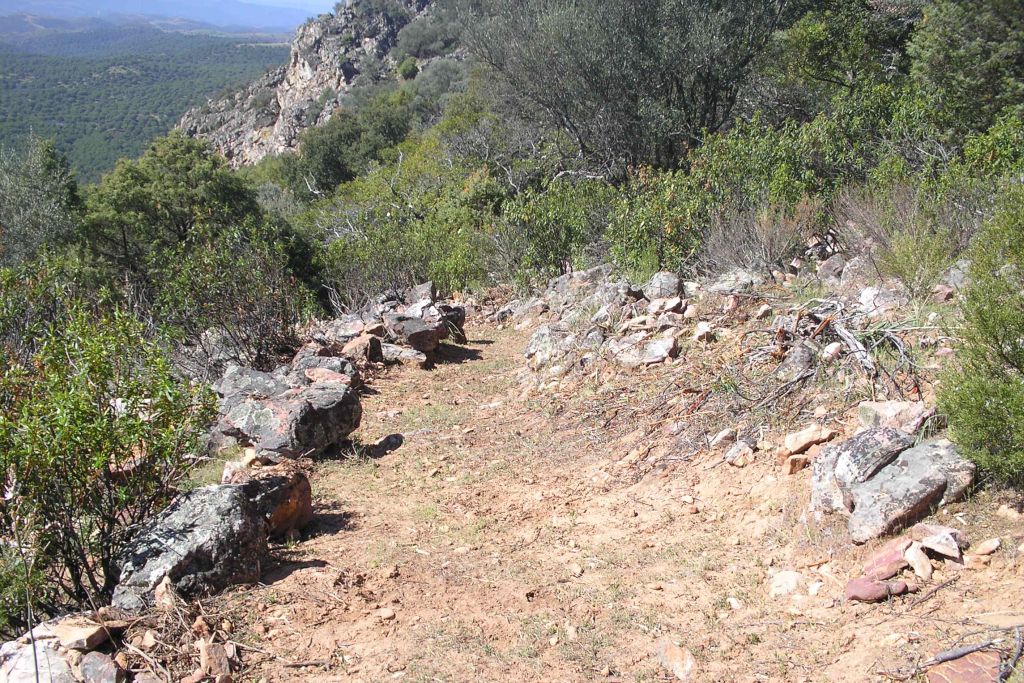
We start the march going up for about 350 meters, along a path between rockrose, until we reach a firebreak through which we will ascend for another 150 meters. We will then arrive at the base of a scree, where we will find a hollowed-out forest, formed by holm oaks, cork oaks, gall oaks and strawberry trees that grow among the loose rocks. Soon we will go to a juniper installed on the quartzites. A few meters from here we reach the Collado de Selladores.
We will then continue along a forest track, for about two and a half kilometers. In the first part of this section we will cross a dense shade of holm oaks and gall oaks. We can even see a Pyrenean oak grove that grows on Cerro Selladores higher than the gall oaks. Later we will cross a jaral, a cork oak plantation and a pasture, before reaching the base of the prop.
Finally the path ascends along a path, between rockrose and cork oaks, at the foot of the top of the Puntal de los Cuatro terms. From this point the panorama is impressive: towards the South, beyond the pine forests of Monte Selladores-Contadero, the mountains and meadows of the Sierra de Andújar Natural Park extend. In the distance we can see the Jándula reservoir and even the Sanctuary of the Virgen de la Cabeza. To the East you can see the town of Centenillo (Baños de la Encina) and La Carolina, and to the North, beyond the division of provinces, is Sierra Madrona.
Source of information
Follow us #JaénParaísoInterior


