


Sendero Aguacebas Gil y Cobo
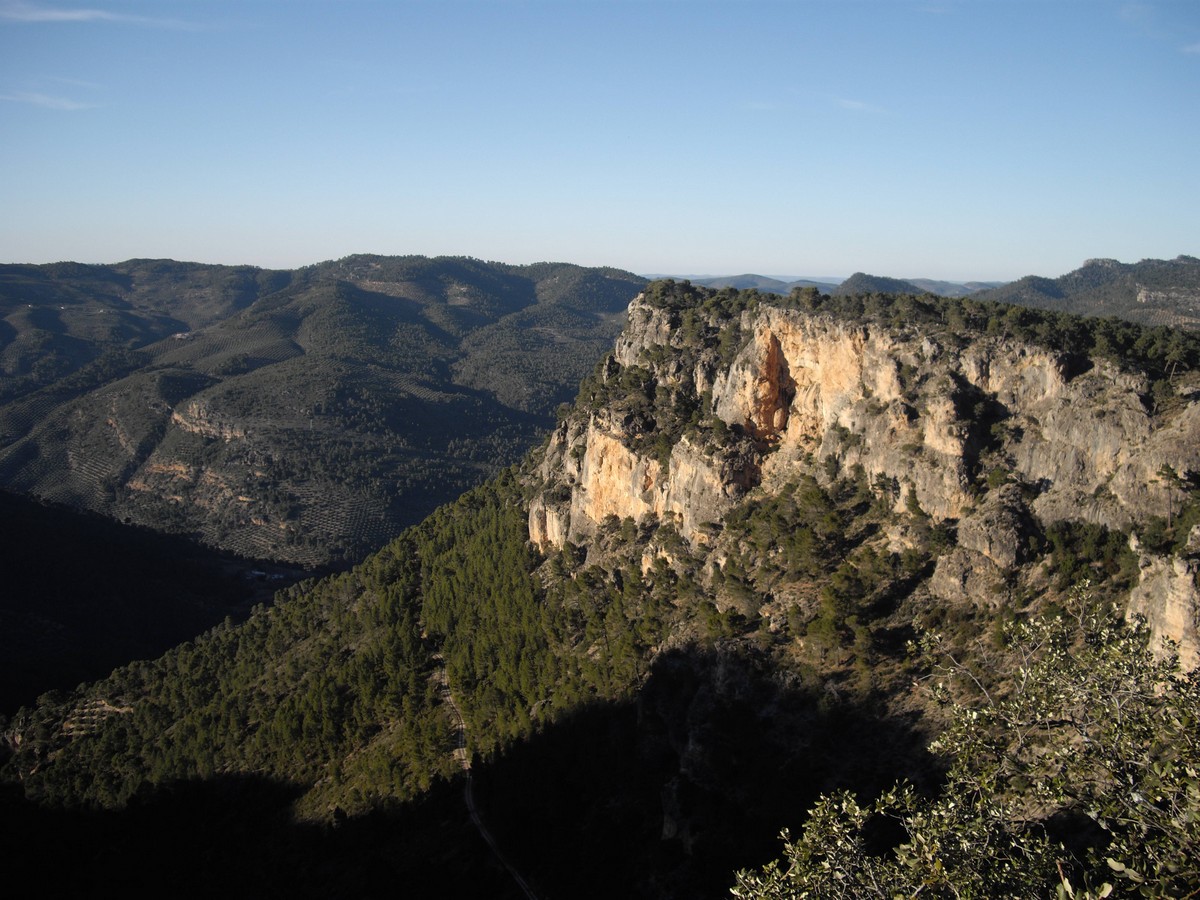
The Gil-Cobo stream is born in the Sierra de Las Villas, also called Aguascebas de la Cueva del Agua because there is a cave with that name nearby. The stream is a tributary of the Aguascebas Grande river, the most important channel in the mountains. The road is actually a gorge since it is strongly encased by the Sierra de las Cuatro Villas, on the one hand, and Los Rasos. In it, ash trees, walnut trees, yew trees and even holly trees abound.
TYPE OF TRAIL
Lane and track
Difficulty
Low
START POINT
We leave from the Aguascebas de Gil Cobo recreational area and cross the riverbed, which maintains a fresh and abundant flow even in summer, which will bring us pleasant surprises in the form of small waterfalls and, above all, the steep ravine known as Cerrada de San Ginés, which forms a unique setting.
TOTAL DISTANCE (IN KILOMETERS)
0,3
ESTIMATED RUN TIME
10 minutes
DIFFICULTY. ASSESSMENT ACCORDING TO METHOD MEASURE
0
MEDIO.
Severity of the natural environment
0
Itinerary
Orientation in the itinerary
0
Displacement
Difficulty moving
0
EFFORT.
Amount of effort required
SIGNALING
Sí
MUNICIPAL TERMS BY WHICH IT RUNS
Villacarrillo La Loma y Las VillasNATURAL ENVIRONMENT
Pine forests, rocky vegetation and riverside vegetation. Steep throat. Limestone pits. Ridge or rocky. Tuff formations and caves.
OTHER INFORMATION OF INTEREST (ARCHITECTURAL OR HISTORICAL-CULTURAL, GEOLOGICAL-ECOLOGICAL)
There is a car park with about 20 spaces at the beginning of the trail, in the Cueva del Peinero recreational area.
RECOMMENDATIONS
Bring drinking water and appropriate clothing and footwear. Make sure the drinking water from the sources.
DESCRIPTION
From Chilluévar take the Crta de la Sierra towards the Aguascebas Reservoir and Charco de La Pringue (This road connects with the Crta de Vva del Arzobispo to the Tranco Reservoir). Continue along this road for the next 28km, at which point we will find the beginning of the trail and the pleasant recreational area of Cueva del Peinero.
Follow us #JaénParaísoInterior


