


Nacimiento del Guadalquivir

This long diversion of more than 16 kilometers brings the Southern Forest Trail closer to one of the most visited places in the entire protected area, the Nacimiento del Guadalquivir, developing for the most part on a track closed to vehicle traffic, so It is one of the most pleasant walks that can be done next to streams of crystalline waters, boats, castellones and exceptional black pine forests, with cornicabras and hawthorns that dot the autumn landscape with color.
It is a privileged alternative on foot, which runs along paths parallel to the traditional forest track to access the Nacimiento from Puente de las Herrerías, much more traveled by vehicles.
Going through the quiet valley formed by the Arroyo de los Habares, at the foot of the Poyos de la Mesa, we will gradually ascend to later walk along the Arroyo Amarillo, which below us, by rushing over the Guadalquivir, forming spectacular waterfalls and impregnating the grayish limestone rocks on which it runs are colored.
Later we will cross the Barranco de Navahondona, the heart of the Navahondona-Guadahornillos Res ...
This long diversion of more than 16 kilometers brings the Southern Forest Trail closer to one of the most visited places in the entire protected area, the Nacimiento del Guadalquivir, developing for the most part on a track closed to vehicle traffic, so It is one of the most pleasant walks that can be done next to streams of crystalline waters, boats, castellones and exceptional black pine forests, with cornicabras and hawthorns that dot the autumn landscape with color.
It is a privileged alternative on foot, which runs along paths parallel to the traditional forest track to access the Nacimiento from Puente de las Herrerías, much more traveled by vehicles.
Going through the quiet valley formed by the Arroyo de los Habares, at the foot of the Poyos de la Mesa, we will gradually ascend to later walk along the Arroyo Amarillo, which below us, by rushing over the Guadalquivir, forming spectacular waterfalls and impregnating the grayish limestone rocks on which it runs are colored.
Later we will cross the Barranco de Navahondona, the heart of the Navahondona-Guadahornillos Reserve Area, one of the three most protected areas of this protected space where many of the existing botanical endemisms and ecosystems barely altered by man are found. The highest point of this route is when you reach the forest track at Puerto Llano, at an altitude of 1600 meters, very close to the Pino de las Tres Cruces and the head of the Gualay Valley, a place well known and frequented by mountaineers who visit the Natural Park.
From there, descending, we will discover the seasonal waterfall of Los Goterones, where the Arroyo de la Luz falls from the peaks towards the ravine and the Barranco de los Tejos Milenarios, which we can access by another signposted path. In the Cañada de las Fuentes several streams converge between ash trees, maple trees and hawthorn trees, seasonally nourishing the riverbed of the Rio Grande, which is how the Arabs knew the Guadalquivir, and very close to there we end the route in what is officially considered the Birth, located next to a plaque that reproduces a poem by the Álvarez Quintero brothers.
Technical information
Route Name Rutas Bosques GR247
Rutas Bosques GR247 11: Nacimiento del GuadalquivirHUSO 30S
Puente de las Herrerías: x505516 y4195037
Nacimiento del Guadalquivir: x502372 y4188163
Puente de las Herrerías: x505405 y4194829
Nacimiento del Guadalquivir: x502261 y4187956
TOTAL DISTANCE (IN KILOMETERS)16200
Asphalt or cement section 0 %
Section of track or forest road or promenade 100 %
Senda section 0 %
tramos-de-Vía-pecuaria 0 %
ESTIMATED RUN TIMEO
4 h 16 minMAXIMUM SLOPE589 m
DIFFICULTY. ASSESSMENT ACCORDING TO METHOD MEASURE
1
MEDIO.
Severity of the natural environment
1
Itinerary
Orientation in the itinerary
2
Displacement
Difficulty moving
3
EFFORT.
Amount of effort required
Rutómetro
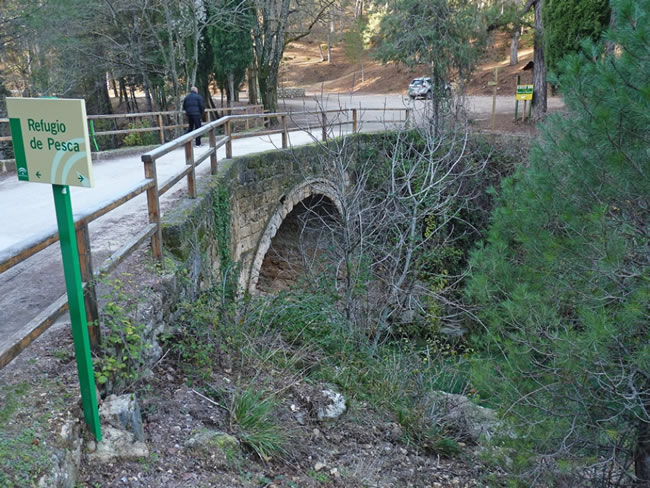
Bridge of the Herrerías
They say in the area that in the 15th century, when Isabel La Católica traveled to the conquest of Granada from Córdoba, she reached this point where the Guadalquivir was so high that it did not allow her to pass. In a single night –according to the legend- her knights raised this robust bridge that allowed her to reach Baza and Guadix.
The start of this Bypass is located right on the bridge, having to take a narrow forest track to the south, which has a barrier to prohibit access to motor vehicles and which initially runs parallel to another, wider forest track through which Stage 2 of Variant GR 247.3 is developed. The Guadalquivir River initially runs between both tracks, with a magnificent black pine forest that accompanies us throughout the tour.
Track Arroyo de los Habares
We leave the main channel to deviate to the left through the valley of Arroyo de los Habares, one of the main tributaries of the Guadalquivir at its head, which runs through the base of the Poyos de la Mesa, a very characteristic calcareous formation that we will see later from other sections of the route. We will have to wade through its bed on several occasions, as the track runs on both sides indistinctly.
It is a very favorable area for the observation of fauna linked to the forests and rocks through which we will pass, so we will be able to observe any of the large mammal species existing in the park.
Fork
We found a fork in the tracks. The one on the left, with the appearance of an old jorro, we must discard it, to cross the Arroyo de los Habares again by the track on the right and continue our route. At this point there are signs for other trails that indicate Poyos de la Mesa to the left and
Pino de las Cruces to the right. At 200 meters we will find a bifurcation of streams and our path continues along the right stream known as the Cañada del Halcón, leaving the Arroyo de los Habares to the left. From this moment on, our route begins a much more demanding ascent and soon winds its way up.
Views of the Guadalquivir Valley
Above 1300 meters of altitude, we can see to the west, the embedded Valle del Guadalquivir, opposite Castellón de los Cierzos and La Lagunilla. Below, in the valley, we can see the Cortijo del Calerón, recently restored, and a little further on the Parador de Cazorla, which stands out for its whiteness and its location, among the green of the forests.
Towards the east, a magnificent view over the Poyos de la Mesa, the Picón de los Halcones and the Torcales de Pedro, all above 1600 meters, which are a clear exponent of characteristic formations of the karst landscapes, as well as the lapiaces that we will observe along the entire route. Lapiaces are rocky soils covered by small grooves and holes separated by sharp partitions or walls, which form an environment that is not very passable for humans, but unbeatable for the queen of these mountains, the mountain goat.
Yellow Stream
In the months of rain and thaw, the waters of Arroyo Amarillo will accompany us for a short stretch. This small tributary owes its name to the color with which the limestone rocks are impregnated as they rush towards the Guadalquivir River, in front of the Picón del Rey, forming numerous spectacular waterfalls. This chromaticism is visible above all from the valley of the Guadalquivir River, where the traditional access path to the Nativity from the Puente de las Herrerías passes.
When we finish our tour we will have two options to return to Puente de las Herrerías, the first one by the same way out, and the second by the Guadalquivir valley, always accompanying the river. If we opt for this second option, we will pass in front of the Arroyo Amarillo falls.
Crossing
At this point we will discard a path to the right that has signs for other short-distance trails. We continue straight on to pass near the Navahondona Meadow, in front of the rocky hill of the same name, which we will leave on the right. We continue along the track without deviating from it.
The landscape has changed profoundly since we started the tour, since we are now in a high mountain area, above 1500 meters, and the harsh winter conditions cause abrupt erosive phenomena, the rock outcropping in its purest form, except in the small valleys and hollows, where there are more fertile lands. Black or salgareño pines adapt to all conditions, dotted with hawthorn, maples and some junipers.
Barrier
We cross a barrier that limits the access of motor vehicles and we come out onto the Puerto Llano forest track, which we must take to the right to continue the itinerary. This is the highest point of the route, at an altitude of 1600 meters, from which we will descend until the end of it. Before doing so, it is worth turning to the left for about 600 meters to admire the Pine of the Three Crosses, one of the oldest extant examples of laricio, of considerable dimensions.
The views from the place are worth it, and it is also the access point to the Arroyo de los Tornillos de Gualay, where the famous Cerrada del Pintor is located.
Following our route, we continue down the forest track to which we had left after the barrier, enjoying exceptional views over the Barranco de los Tejos, Loma de los Agrios and Aguilón del Loco to the southwest. At kilometer 14.2 we pass the beautiful seasonal waterfall of Los Goterones, formed by the Arroyo de la Luz, also known as Arroyo de Santo Domingo.
In this area, the amount of ...
Barrier
We cross a barrier that limits the access of motor vehicles and we come out onto the Puerto Llano forest track, which we must take to the right to continue the itinerary. This is the highest point of the route, at an altitude of 1600 meters, from which we will descend until the end of it. Before doing so, it is worth turning to the left for about 600 meters to admire the Pine of the Three Crosses, one of the oldest extant examples of laricio, of considerable dimensions.
The views from the place are worth it, and it is also the access point to the Arroyo de los Tornillos de Gualay, where the famous Cerrada del Pintor is located.
Following our route, we continue down the forest track to which we had left after the barrier, enjoying exceptional views over the Barranco de los Tejos, Loma de los Agrios and Aguilón del Loco to the southwest. At kilometer 14.2 we pass the beautiful seasonal waterfall of Los Goterones, formed by the Arroyo de la Luz, also known as Arroyo de Santo Domingo.
In this area, the amount of mistletoe (Viscum album) existing on the black pines is striking. It is a parasitic plant - magical for Celtic culture - that needs the cooperation of various birds (mainly thrushes and blackbirds) for the propagation of its seeds. The birds eat its sticky fruits and, after passing through their stomach, the seeds are deposited together with their excrement on the branches of new hosts, growing another generation of mistletoes that will directly obtain the sap from said branches.
15 kilometers from the beginning, we left a narrow and closed track to the left, which would take us into the Barranco de los Tejos Milenarios, located 1.2 kilometers from the point where we are.
Cañada de las Fuentes
The Cañada de las Fuentes Forest House is nestled in a privileged place that invites you to rest, between streams and green meadows with ash trees, holm oaks and cornicabras. We found a fountain and a small pool next to some stone tables and benches. It seems that this could be the true source of the river, since the word sources could refer to different streams found here. To finish the route, we will continue the track leaving the Casa Forestal on the right.
Source of the Guadalquivir
We cross a bridge over the Arroyo de la Cañada de las Fuentes and to the right a small viewpoint, from which we can see a large vertical rock under which this upwelling is located. Just 100 meters further on, to the right, there is an access to it.
We can return by the same way out, or continue the track down another 100 meters, turn right and continue without deviating the dirt forest track to the Puente de las Herrerías. In this second option, 12 kilometers long, we will walk for most of the way along the crystal clear waters of the Guadalquivir, passing along the Cerrada Picón del Rey, the Arroyo Amarillo waterfalls and the Cerrada de los Cierzos, among other places of interest.

Follow us #JaénParaísoInterior


