


Etapa 2: Refugio CF El Sacejo - Refugio CF Fuente Acero

This Stage begins in a Refuge located next to one of the most famous places in the Park, the Parador de Cazorla, from whose surroundings you can enjoy good views over the forests of the southern area. From there it descends to the narrow and leafy valley of a newborn Guadalquivir, over which it crosses in the emblematic place of Puente de Las Herrerías, an important crossroads that also has various infrastructures for the rest and enjoyment of the walker, such as a camping, a recreational area and a kiosk-bar.
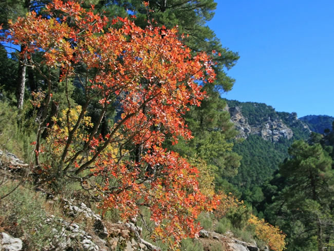
Then it separates from the Guadalquivir Valley to reach one of the most popular forest trails in the Park: the old Camino de Castril, now known as the Pista de las Navas. Always walking through pine forests with abundant holm oaks and many oaks (gall oaks), our route is marked out by various viewpoints equipped with interpretive panels.
One of them is the Mirador de Los Poyos de La Mesa, in front of this great cove whose rotund figure presides over much of our route. Another, also memorable, is the Strait of Los Perales, on a spectacular gorge flanked by rock formations of c ...
This Stage begins in a Refuge located next to one of the most famous places in the Park, the Parador de Cazorla, from whose surroundings you can enjoy good views over the forests of the southern area. From there it descends to the narrow and leafy valley of a newborn Guadalquivir, over which it crosses in the emblematic place of Puente de Las Herrerías, an important crossroads that also has various infrastructures for the rest and enjoyment of the walker, such as a camping, a recreational area and a kiosk-bar.
Then it separates from the Guadalquivir Valley to reach one of the most popular forest trails in the Park: the old Camino de Castril, now known as the Pista de las Navas. Always walking through pine forests with abundant holm oaks and many oaks (gall oaks), our route is marked out by various viewpoints equipped with interpretive panels.
One of them is the Mirador de Los Poyos de La Mesa, in front of this great cove whose rotund figure presides over much of our route. Another, also memorable, is the Strait of Los Perales, on a spectacular gorge flanked by rock formations of capricious shapes. At some points, such as La Trinchera, we will see the Guadalentín Valley at our feet, one of the most beautiful and rugged in the Park.
The navas, from which the track that runs through the second half of the Stage owes its name, are flat and fertile lands at mid-mountain altitudes, which have historically been deforested and used by man as agricultural lands. They are quite scarce, but the few that exist introduce a wonderful factor of landscape diversity, with its cultivated fields, its fruit trees, its orchards and its poplar groves, all surrounded by forests and mountains.
In this stage we will find two, that of Espino, already practically abandoned, and that of San Pedro, much more extensive and that retains all its appeal.
The abundance of fauna is another of the great attractions of this Stage. Deer, fallow deer, mouflon, wild boar and ibex are easily sighted, sometimes from close range. Not in vain this was another of the favorite areas of the naturalist Félix Rodríguez de la Fuente to record shocking sequences of his documentary series El Hombre y la Tierra.
Today, it is precisely in the Nava de San Pedro where the Bearded Vulture Breeding Center is located, a fundamental place for the conservation of the Iberian fauna. Thanks to their work, the rugged territories that this Stage covers are once again flown over by the bearded vulture, whose flight sometimes crosses in the sky with that of griffon vultures and golden and Bonelli's eagles.
Technical information
Route Name Rutas Bosques GR247
Rutas Bosques GR247 3: Etapa 2: Refugio CF El Sacejo - Refugio CF Fuente AceroHUSO 30S
Refugio C.F. El Sacejo: x503471 y4195414
Refugio C.F. de El Sacejo: x513049 y4194859
Refugio C.F. El Sacejo: x503360 y4195207
Refugio C.F. de El Sacejo: x512938 y4194651
TOTAL DISTANCE (IN KILOMETERS)23590
Asphalt or cement section 0 %
Section of track or forest road or promenade 87,62 %
Senda section 12,38 %
tramos-de-Vía-pecuaria 0 %
ESTIMATED RUN TIMEO
7 h 14 minMAXIMUM SLOPE478 m
DIFFICULTY. ASSESSMENT ACCORDING TO METHOD MEASURE
2
MEDIO.
Severity of the natural environment
2
Itinerary
Orientation in the itinerary
2
Displacement
Difficulty moving
4
EFFORT.
Amount of effort required
TOTAL DISTANCE (IN KILOMETERS) 19540 M
Start
The Casa Forestal del Sacejo Refuge is accessed through Vadillo – Castril and Arroyo Frío along the JF-7094 road.
Final
The Fuente Acero Forest House Refuge is accessed from the Empalme del Valle, on the A-319 road. From there, take the JF-7091 road and the track that continues to Nava de San Pedro.
INTERMEDIATE POINTS
PLACE
POSITION
TYPE OF ROAD
Km 2,9
Pista forestal
Km 6,4
Highway
Km 10,6
Road and forest track
CYCLABILITY
There are no special difficulties.
WATER POINTS
El Sacejo, Puente de las Herrerías, La Garganta fountain, Nava de San Pedro, Fuente Acero Forest House Refuge.
PREFRESHING POINTS
On the trail: Puente de las Herrerías
Near the trail: Cazorla, La Iruela, Arroyo Frío
LINKS WITH OTHER TRAILS
PR-A 314, PR-A 315, GR7
Rutómetro
El Sacejo Forest House Refuge
This Stage begins at the Casa Forestal El Sacejo, located next to the Parador de Cazorla. The route begins passing behind it, between cypresses, and taking a forest track closed to the passage of vehicles that goes down to the Arroyo de los Cierzos. To our left and in front we have wide views towards the head section of the Guadalquivir Valley and elevations such as Loma de la Mesa and Calar de Juana.
We walk among black pines with holm oaks and junipers and, after passing a couple of streams, we pass the ruins of a farmhouse on the left. Under the pine forest, gall oaks, cornicabras and some maples begin to appear and as we go down towards the Arroyo de los Cierzos, the vegetation becomes more exuberant, with wild fig and walnut trees, ivy, good-sized maples and even some yew. After 2 kilometers we arrive at the aforementioned stream and walk alongside it, and a little further on we cross another small tributary of it.
If you carry a lot of water, it may be necessary to help yourself by placin ...
El Sacejo Forest House Refuge
This Stage begins at the Casa Forestal El Sacejo, located next to the Parador de Cazorla. The route begins passing behind it, between cypresses, and taking a forest track closed to the passage of vehicles that goes down to the Arroyo de los Cierzos. To our left and in front we have wide views towards the head section of the Guadalquivir Valley and elevations such as Loma de la Mesa and Calar de Juana.
We walk among black pines with holm oaks and junipers and, after passing a couple of streams, we pass the ruins of a farmhouse on the left. Under the pine forest, gall oaks, cornicabras and some maples begin to appear and as we go down towards the Arroyo de los Cierzos, the vegetation becomes more exuberant, with wild fig and walnut trees, ivy, good-sized maples and even some yew. After 2 kilometers we arrive at the aforementioned stream and walk alongside it, and a little further on we cross another small tributary of it.
If you carry a lot of water, it may be necessary to help yourself by placing some stones to pass. At this point there are signs for the PR-A 314 Trail, as well as another that indicates to the right the ascent to Puerto del Gilillo in three hours by route without signposting.
The Arroyo de los Cierzos, always on our left, is embedded between rocks in its last section, with the boxwood appearing on its bank. We pass a small dam and immediately the Guadalquivir Valley appears in the background.
Guadalquivir Valley
After passing a fence that closes the passage to vehicles, our track ends in a wider one with a better firm. We have reached the Guadalquivir Valley, wider than the one we have traveled so far. If we turn right we will arrive at the source of this river, but our route turns to the left passing over a bridge over the Arroyo de los Cierzos, very close to the point where it spills its waters into the Guadalquivir and in an area of ??great scenic beauty.
After a few meters we pass through a tunnel dug into the rock, and at kilometer 4.1, in a curve to the left in the place of La Caracolilla, there are great views: to the east, the Poyos de La Mesa and Castellón del Calerón, and to the north, in the distance, the Sierra de Las Villas, while from below, to our right, the murmur of the waters of the newborn Guadalquivir rises.
At kilometer 4.8 there is a fence for vehicles, corresponding to the Andalusian Hunting Reserve of Cazorla-Segura, which closes between 9:00 p.m., although the passage on foot is always free. Further on, at kilometer 5.1, we pass the great Casa del Calerón on the right, walking through pine forest of black pine with an abundance of gall oaks, holm oaks and cornicabras.
Las Herrerías Bridge
This point is very strategic for several reasons. We found a Recreation Area with tables, a fountain and a kiosk-bar, and very close by, a campsite, as well as a small road (JF-7092) that would take us to the Empalme del Valle, connecting with the towns of Arroyo Frío and Burunchel. There is also an important crossroads of signposted paths, since the Bosques del Sur Trail intersects with the GR 7, through which we could go to Cazorla or Coto Ríos.
Also, on the right bank of the Guadalquivir, we can go in the opposite direction to the one we bring to the source of this river, by Derivation 11 of the Bosques del Sur Trail that passes through the place of Pino de las Tres Cruces.
Another 1.3 kilometer trail, signposted by the Ministry of the Environment, would allow us to reach the emblematic place of Fuente del Oso, not far from the Parador de Cazorla by road (JF-7094), which would allow us to articulate a circular route with the section of the Bosques del Sur Trail that we have traveled so far.
T ...
Las Herrerías Bridge
This point is very strategic for several reasons. We found a Recreation Area with tables, a fountain and a kiosk-bar, and very close by, a campsite, as well as a small road (JF-7092) that would take us to the Empalme del Valle, connecting with the towns of Arroyo Frío and Burunchel. There is also an important crossroads of signposted paths, since the Bosques del Sur Trail intersects with the GR 7, through which we could go to Cazorla or Coto Ríos.
Also, on the right bank of the Guadalquivir, we can go in the opposite direction to the one we bring to the source of this river, by Derivation 11 of the Bosques del Sur Trail that passes through the place of Pino de las Tres Cruces.
Another 1.3 kilometer trail, signposted by the Ministry of the Environment, would allow us to reach the emblematic place of Fuente del Oso, not far from the Parador de Cazorla by road (JF-7094), which would allow us to articulate a circular route with the section of the Bosques del Sur Trail that we have traveled so far.
The place is cool and shady, with abundant riverside vegetation, and the Las Herrerías Bridge over the Guadalquivir is simple but very beautiful, with its semicircular arch built with tuff stone. Tradition says that one night Queen Isabel la Católica arrived here with her entourage from Quesada in the direction of Baza, a city in the Kingdom of Granada that she wanted to conquer.
Faced with the difficulty of fording the river, which had been swollen by the autumn rains, the legend states that his knights built or renovated the bridge in a single night so that the queen could continue her journey without delay. Ours, more peaceful and calm, uses the same bridge and after a few meters leaves the road that goes to the aforementioned Empalme del Valle, taking a wide path that leaves to the right.
The landscape changes, as we separate from the Guadalquivir to go uphill through a beautiful black pine forest, initially following the Arroyo de La Mesa, which is on our left. Soon, to the right, we will see the imposing walls of Los Poyos de La Mesa rise on its north face, the most abrupt and vertical. At kilometer 7.9 we cross a stream and discard a path that goes to the left, and 400 meters later, at a fork, we leave the path to take a jorro (wooden harvesting road) to the right.
At kilometer 9.4 we take a forest track to the left and shortly after we pass a fence that closes the passage for vehicles, arriving at the so-called Las Navas track. During this last section we pass very close to the so-called Grandfather Pine, a centenary black pine that dried up many years ago, but is still standing, standing out for its large size among those around it.
Las Navas track
We arrive at this forest track that is a classic in the best-known routes of the Natural Park due to the attractiveness of the places it runs. To the left, the track immediately becomes asphalted and would take us to the Empalme del Valle passing by such emblematic places as the Linarejos Recreational Area, the Cerrada del Utrero (covered by a short and fantastic path) and Vadillo Castril.
Our route, however, turns to the right. During a section it is marked with white, red and yellow stripes to coincide with the PR-A 315.
Some 300 meters further on we arrive at the impressive Mirador de los Poyos de la Mesa, facing south and equipped with an interpretive panel that will help us identify the most significant landmarks of the great landscape that we contemplate. Among them, the plateau of Los Poyos de La Mesa stands out once again, at 1635 meters of altitude, with its rugged walls. Large pine groves spread out before us, as well as holm oaks and mixed forests.
They are territories of great fauna wealt ...
Las Navas track
We arrive at this forest track that is a classic in the best-known routes of the Natural Park due to the attractiveness of the places it runs. To the left, the track immediately becomes asphalted and would take us to the Empalme del Valle passing by such emblematic places as the Linarejos Recreational Area, the Cerrada del Utrero (covered by a short and fantastic path) and Vadillo Castril.
Our route, however, turns to the right. During a section it is marked with white, red and yellow stripes to coincide with the PR-A 315.
Some 300 meters further on we arrive at the impressive Mirador de los Poyos de la Mesa, facing south and equipped with an interpretive panel that will help us identify the most significant landmarks of the great landscape that we contemplate. Among them, the plateau of Los Poyos de La Mesa stands out once again, at 1635 meters of altitude, with its rugged walls. Large pine groves spread out before us, as well as holm oaks and mixed forests.
They are territories of great fauna wealth, much loved by the mountain goat and the deer, as well as by raptors such as the griffon vulture and the golden eagles, calzada and short-toed, hence the unforgettable Félix Rodríguez de la Fuente recorded some of his best documentaries on the television series El Hombre y La Tierra.
Our track gently ascends through a beautiful forest, initially with a mixture of black and white pines, and dominating the latter as we gain altitude. There is a lot of holm oak and good oaks (gall oaks). From time to time excellent views open to both sides of the track. At kilometer 14 there is a track closed to vehicular traffic that goes up to Cerrillo del Piornal on the left. Our track is flat before reaching Nava del Espino.
Nava del Espino
At this point, to the right, a beautiful and clear plain opens up where the Casa Forestal de la Nava del Espino is located, already in ruins. Pine forests and meadows make up a harmonious landscape where you can see fallow deer come to feed in the late afternoon. Next to the House there is a road to Los Poyos de la Mesa, 7 kilometers long and a cumulative ascent of 225 meters.
If we decide to go through it, once at the top we will have extraordinary views over the Guadalquivir Valley and the Vadillo Castril area.
At kilometer 14.8 there is a track cut off to the left by vehicles, through which you can access, among other places, the Raso del Madrigal, from where you can enjoy splendid views. Our route continues in a gentle descent, having on our left the Arroyo de la Garganta and the beautiful image of Mount Cabeza del Tejo.
Throat Fountain
This fountain with three pipes is located in the stream of the same name, in a cool and relaxing place with tables to eat. Further on we can enjoy another splendid viewpoint with an interpretive panel dedicated to the reintroduction of the bearded vulture in the Natural Park.
Nava de San Pedro
Our Stage arrives at Nava de San Pedro, one of the places with the most marked personality in the Natural Park. The landscape, until now dominated by the forest, suddenly opens up before our eyes, becoming more human, because the navas are very fertile lands that are located at a certain altitude and that have been deforested and used by man since time immemorial as fresh pastures or as agricultural land.
At the foot of the old cortijo de la Nava, now converted into a small bar-restaurant, an extraordinarily harmonious and relaxing view extends where the orchards and farmlands, the scattered fruit trees, the poplars -yellow in autumn- and the high mountains covered with forests and crowned by steep cliffs.
In addition, this place houses the Bearded Vulture Breeding Center, an emblematic place for the conservation of Iberian fauna that can be visited between mid-May and the end of September - that is, outside the breeding season - by prior appointment with the Foundation Gypaetus.
At kilometer 17.9 ...
Nava de San Pedro
Our Stage arrives at Nava de San Pedro, one of the places with the most marked personality in the Natural Park. The landscape, until now dominated by the forest, suddenly opens up before our eyes, becoming more human, because the navas are very fertile lands that are located at a certain altitude and that have been deforested and used by man since time immemorial as fresh pastures or as agricultural land.
At the foot of the old cortijo de la Nava, now converted into a small bar-restaurant, an extraordinarily harmonious and relaxing view extends where the orchards and farmlands, the scattered fruit trees, the poplars -yellow in autumn- and the high mountains covered with forests and crowned by steep cliffs.
In addition, this place houses the Bearded Vulture Breeding Center, an emblematic place for the conservation of Iberian fauna that can be visited between mid-May and the end of September - that is, outside the breeding season - by prior appointment with the Foundation Gypaetus.
At kilometer 17.9 the Valdetrillo path starts to the left, signposted by the Ministry of the Environment, 6.3 kilometers long, which runs alongside the Valdecuevas and Valdetrillo Streams and has a spectacular viewpoint towards the Strait de los Perales. Continuing along our route, the track begins to rise again and we pass a repopulated pine forest on the right.
At kilometer 18.7, in the area of ??La Trinchera, we can enjoy to our right one of the most celebrated views of the Natural Park: those that correspond to the Guadalentín Valley, split by the famous Barranco of the same name, an extraordinary landscape that closes with the peaks of Sierra Nevada and through which the Stage 14 of the Bosques del Sur Trail runs.
About 200 meters further on, the Barranco del Guadalentín Circular Ornithological Path comes out to the right, at the beginning of which there is an interpretive panel. This route, which would take us about five hours, coincides in its section next to the Guadalentín with part of the aforementioned Stage 14.
Our track continues ascending between flat areas and holm oaks, in the middle of a landscape of great sweetness and harmony, passing a barrier at kilometer 21 that closes the passage to vehicles between 9:00 and 9:00.
Strait of the Pear trees
A viewpoint with an interpretive panel makes it easier for us to contemplate the Strait of Perales, a spectacular gorge flanked by irregular rock formations. In the area it is frequent to see such distinctive animals as the mountain goat and the golden eagle, which is very expressive of its great ecological wealth.
In fact, we will see small signs on our left that mark the limit of the Navahondona-Guadahornillos Reserve Area, a large area where human activities are strongly restricted to preserve its extraordinary natural values.
Fuente Acero Forest House Refuge
Our long Stage comes to an end in the old Forest House of Fuente Acero, now in disuse, but which in its good days was an essential point of reference in this entire area, and where one of the shelters of the Bosques del Sendero has been set up. South. It is a very beautiful place in which the old and gigantic black pine or Salgareño stands out, located in the middle of the flat in front of the Casa Forestal.
There is a signposted fountain 150 meters away. Fuente Acero is also one of the strategic points of the Bosques del Sur Trail, as it is the arrival or departure point of Stages 14 and 15, in addition to the one just described.
Additional information
Introduced and reintroduced animals
This Stage runs through places belonging to the Cazorla y Segura Andalusian Hunting Reserve, managed by the Junta de Andalucía and whose first name was Cazorla-Segura National Hunting Reserve. El Coto was created in 1960 and occupies 67,000 hectares, almost a third of the Natural Park.
Its creation was the result of a policy of promoting big game hunting, which is why a series of introductions and reintroductions of various species of large wild ungulates were previously made.
In 1952, 37 deer, 7 wild boars and 10 roe deer were reintroduced, all species that had become extinct in these mountains. The first two are very abundant today, while the third failed. 5 mouflon were also brought in, a species that had never been present in the area but which adapted without any problem. Later, in 1956, 25 fallow deer were introduced, which, like mouflon, expanded rapidly despite not being indigenous.
Finally, in 1960, the introduction of the chamois, which is not indigenous, was attempted w ...
Introduced and reintroduced animals
This Stage runs through places belonging to the Cazorla y Segura Andalusian Hunting Reserve, managed by the Junta de Andalucía and whose first name was Cazorla-Segura National Hunting Reserve. El Coto was created in 1960 and occupies 67,000 hectares, almost a third of the Natural Park.
Its creation was the result of a policy of promoting big game hunting, which is why a series of introductions and reintroductions of various species of large wild ungulates were previously made.
In 1952, 37 deer, 7 wild boars and 10 roe deer were reintroduced, all species that had become extinct in these mountains. The first two are very abundant today, while the third failed. 5 mouflon were also brought in, a species that had never been present in the area but which adapted without any problem. Later, in 1956, 25 fallow deer were introduced, which, like mouflon, expanded rapidly despite not being indigenous.
Finally, in 1960, the introduction of the chamois, which is not indigenous, was attempted with the release of 4 specimens, which died shortly after. In reality, the chamois had been part of the fauna of the area, but in the Neolithic, when the climate was much colder and wetter than today.
Nowadays, fortunately, capricious introductions of non-native species are no longer carried out, which can cause serious ecological imbalances. Thus, the abundance of fallow deer and mouflon, together with important populations of other large ungulates and an important cattle herd, and in the absence of the wolf, which was the species that formerly regulated herbivore populations, has brought as a consequence an inordinate pressure on many species of flora, some of them endemic and in danger of extinction.

Follow us #JaénParaísoInterior


