


Sendero El Junquillo
Here is a suggestive and easy path that runs through a very representative area of Sierra Morena and this Natural Park. It is full of pastures on almost flat land and patches of Mediterranean mountain, both populated by numerous animal species, including various birds, easily visible, or mammals, such as deer, wild boar, foxes or martens, which are difficult to see but whose traces can be found fairly easily. The Madrona and Quintana mountains on the horizon behind these plains evoke the many legends that these depopulated lands have inspired throughout history.

TYPE OF TRAIL
Track
START POINT
Along the A-6178 road, some 19 kilometres from the Virgen de la Cabeza sanctuary, you will reach a junction with signs to Valdelagrana and Las Tapias, which is where the path begins.
TOTAL DISTANCE (IN KILOMETERS)
11.4
ESTIMATED RUN TIME
2 hours 23 minutes.
Type of firm
Track
SLOPE
54 m
54 m
DIFFICULTY. ASSESSMENT ACCORDING TO METHOD MEASURE
2
MEDIO.
Severity of the natural environment
1
Itinerary
Orientation in the itinerary
1
Displacement
Difficulty moving
2
EFFORT.
Amount of effort required
SIGNALING
Sí
MUNICIPAL TERMS BY WHICH IT RUNS
Andújar La CampiñaRECOMMENDATIONS
It is recommended that you bring drinking water and appropriate clothing and footwear. Make sure that the water in the fountains is drinkable. Be careful with road traffic. This trail can be done all year round. In summer, due to the special conditions of altitude, the sunshine is very strong which, together with the lack of shade, requires significant sun protection. The months of October and November are especially recommended, coinciding with the rutting of the deer.
POINTS OF INTEREST
- Mediterranean forest and oak and cork oak pastures.
- El Junquillo area.
- Ancient Moorish oven.
- Sierra Quintana, with the Burcio del Pino peak (1,291 m.)
DESCRIPTION
At the beginning of the path you can access the A-6178 road coming from the sanctuary of the Virgen de la Cabeza, nineteen kilometres away. You will find the signposting for the path at a junction in the road with a track on the left towards Valdelagrana (see map) in a place known as Junquillo. We'll start the path along the track towards a geodesic vertex that we'll see very close by.
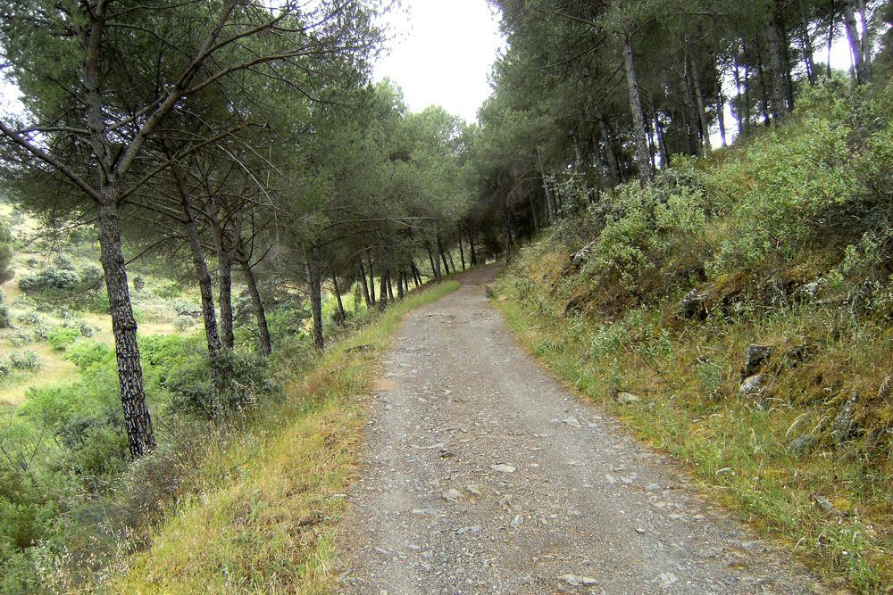
We'll do the whole route along this track, almost always flanked by fences of farms dedicated to livestock and hunting, and secondarily to the cultivation of cereals. The vegetation varies between authentic holm oak forests and more or less dense pastureland. Many other plants typical of the Mediterranean forest find their space here, such as the pyrethrum or wild pear tree, with shiny deciduous leaves, of which we can see some specimens shortly after starting our journey. You will also pass under a high voltage line from Puertollano to the Guadalquivir valley to the south, where you will see the prominent Peñón de Rosalejo (805 m).
A little further on, you will leave the Las Losas farmhouse on your right, surrounded by a lighter area. Half a kilometre further on you will come to the so-called Moorish oven, a small stone building located among the holm oaks on the left hand side of the road.
In just over a kilometre you will come to a crossroads and firebreak. You will have seen the combination of both, that there are paths that you can walk along that have their edges cleared so that they can be used as firebreaks at the same time. This helps to prevent and extinguish fires, which are a major threat, especially to hunting estates with scrubland, which are home to populations of wild boar, deer, fallow deer or mouflon, but also to other lighter areas, such as the meadows, which are predominantly used for livestock. The high biodiversity of both types of forest is protected by these infrastructures, and also by other complementary ones, such as the rafts that abound in both types of exploitation.
Almost a kilometre later, we find another crossroads, this time belonging to neighbouring farms. Continue forward and a few metres further on you will turn south, approaching a more wooded area once again.
This is a good place to stop and contemplate the mountain ranges that rise up on the horizon to the northwest. About ten kilometres away we will see the Sierra Quintana, whose peaks mark the boundaries of the provinces of Jaén and Ciudad Real, and also of the Natural Park. Here we can make out Burcio del Pino (1,291 m), the highest peak in the Andalusian Sierra Morena. Further west is Sierra Madrona, where the highest peaks of the Sierra Morena are found. Between the two mountains is the main pass to the famous Alcudia valley, where Fuencaliente is located, a town in the province of Ciudad Real that we can see further on. Already in the last section of the path we pass through a new crossing near a large farmhouse. One kilometre further on the path ends in a suggestive meadow next to a Canadian pass.
Source of information
Follow us #JaénParaísoInterior


