


Pontones - La Toba

This is, without a doubt, one of the most contrasting stages of the entire Bosques del Sur trail. It is the third and last of those that run through the sober purely livestock landscapes of the extensive municipality of Santiago-Pontones, ending in a vertiginous descent to the valley of the Segura River, where water is abundant and the environment is once again forest.
The pontoneros, who are called the inhabitants of the town in which the stage begins, are of old cattle lineage, and therefore excellent connoisseurs of the secrets of their territory, because for centuries they have the Segureño sheep as the basis of their economy. They also retain a deep attachment to their customs and traditions.
Most of the stage takes place in a territory of pastures, with little trees and a high average altitude (1400-1600 meters), although the abundance of shrub vegetation and the presence of some crops give it a less severe air than that of the Campos de Hernán Perea covered by the previous stages. They are lonely places, but the human presence will not fail to be perceived: shepherds, flock ...
This is, without a doubt, one of the most contrasting stages of the entire Bosques del Sur trail. It is the third and last of those that run through the sober purely livestock landscapes of the extensive municipality of Santiago-Pontones, ending in a vertiginous descent to the valley of the Segura River, where water is abundant and the environment is once again forest.
The pontoneros, who are called the inhabitants of the town in which the stage begins, are of old cattle lineage, and therefore excellent connoisseurs of the secrets of their territory, because for centuries they have the Segureño sheep as the basis of their economy. They also retain a deep attachment to their customs and traditions.
Most of the stage takes place in a territory of pastures, with little trees and a high average altitude (1400-1600 meters), although the abundance of shrub vegetation and the presence of some crops give it a less severe air than that of the Campos de Hernán Perea covered by the previous stages. They are lonely places, but the human presence will not fail to be perceived: shepherds, flocks of sheep, sheepfolds, small farmhouses ...
The route ends by descending towards the Segura valley through a place with a name as significant as the Cuesta de Despiernacaballos and, already under the black or salgareños pines, you can enjoy the vision of the steep Poyos de la Toba, rock formations with impressive contours, with the background noise of the Segura river and a remarkable leafiness at the end of the route. The stage ends in the village of La Toba, where the hiker can enjoy its views over the Segura valley, its abundance of springs and its placid rural environment.
Technical information
Route Name Rutas Bosques GR247
Rutas Bosques GR247 18: Pontones - La TobaHUSO 30S
Pontones: x529345 y4219291
La Toba: x538617 y4225989
Pontones: x529242 y4219084
La Toba: x538505 y4225782
TOTAL DISTANCE (IN KILOMETERS)19100
Asphalt or cement section 36,66 %
Section of track or forest road or promenade 21,38 %
Senda section 41,96 %
tramos-de-Vía-pecuaria 0 %
ESTIMATED RUN TIMEO
5 h 34 minMAXIMUM SLOPE730 m
DIFFICULTY. ASSESSMENT ACCORDING TO METHOD MEASURE
2
MEDIO.
Severity of the natural environment
2
Itinerary
Orientation in the itinerary
2
Displacement
Difficulty moving
3
EFFORT.
Amount of effort required
TOTAL DISTANCE (IN KILOMETERS) 19540 M
Start
A Pontones is accessed by the A-317 road.
Final
La Toba is accessed from Juntas de Miller and from Río Madera by the JF-7038 that runs through the Segura River Valley.
INTERMEDIATE POINTS
PLACE
POSITION
TYPE OF ROAD
Km 7,4
Highway
CYCLABILITY
Very uneven ground and steep slopes between points 3 and 5. In Despiernacaballos, steep slopes. Alternative route along the paved forest track.
WATER POINTS
Pontoons, fountains-watering holes in La Hoya del Cerezo, Cañada Hermosa and start of the Despiernacaballos trail; The Toba.
PREFRESHING POINTS
On the trail: Pontones, La Toba
Near the trail: Santiago de la Espada
LINKS WITH OTHER TRAILS
PR-A 100, PR-A 128, GR 147, GR 7
Rutómetro
Pontoons
The starting point of this stage is located on the A-317 road at the exit of Pontón Bajo towards Santiago de la Espada, in a small viewpoint with a wooden fence and a white hut. Initially, it is traveled by road for about 500 meters in the direction of Santiago de la Espada. After that we turn left along a narrow forest track that gives access to various herds used by the numerous herds of Segureña sheep, which feed on these cool pastures for most of the year.
The first 8.3 kilometers of the stage coincide with the GR 7, which connects no less than Tarifa (Spain) with Athens (Greece), and later, during the last 7.1 kilometers, with another of the great routes of the park natural, the GR 147, called the Sierra Profunda trail.
Tiná de Enmedio
Walking along the forest track, we pass one of the many cattle herds in the Los Palancares area on the left. During this first part of the tour we walk near a power line. Just 500 meters away, at the foot of the track, we will pass some metal troughs on the left. The landscape is characteristic of the Segureña high mountains, with pastures, arros thorns (Berberis hispanica) and some hawthorns.
Cattle trail
On a hill, to the left, another one of the Los Palancares tines rises. Without reaching it, our path runs to the right to it. It is an area full of narrow paths caused by the transit of cattle, so you have to be very attentive to the signs. In addition, to help us in our orientation, it is convenient to know that our path runs parallel to a power line, and sometimes under it, for a little over a kilometer.
Tornajos in the Hoya del Cerezo
After leaving the power lines, and on a slight descent, we find a small valley through which we will climb little by little. It is the Barranco de la Fuente del Cerezo, at the bottom of which is located the aforementioned watering hole. It is a mainly spring stream in the middle of a rugged and rocky landscape. In spring it becomes colorful thanks to the yellow flowers of the abundant broom.
Asphalt track to Poyotello
Climbing up this narrow ravine we reach a paved track, which we must take to the right to continue our ascent through this brave landscape.
At this point, we could opt for another, very attractive possibility to reach our destination in the village of La Toba. If we turn left, after 2.7 kilometers we reach the village of Poyotello. At the entrance, in the era, the spectacular signposted and conditioned path begins towards the Cueva del Agua and the village of Huelga Utrera through the embedded Segura valley. It is a trail that is not part of the Bosques del Sur trail, but whose route is recommended because it is one of the best in the park. From Huelga Utrera there would be 7 kilometers along the narrow and quiet road that accompanies the Segura river. This option would take us to La Toba for a journey of 15.5 kilometers from here.
The option that we describe below, following our stage along the Bosques del Sur trail, reduces the path to be made by just over two kilometers. Following the paved track to the right, we briefly continue the climb until we pass a hill next to the Hoya del Toro tinada. To the right, the Almorchón (1914 meters) looms before us. From here there is a slight descent towards Cañada Hermosa.
Beautiful Glen
The asphalt track leads to the A-317 road, already in the Cañada Hermosa, a narrow valley whose name says it all, between mountains that do not stand out much, since the Cañada is located at almost 1600 m of altitude.
We must take the aforementioned road to the left, to deviate 100 meters later to the right, opening a rudimentary livestock gate that gives us access to a livestock resting place, which is located here because we are on a livestock road, as its name indicates. When crossing the Cañada we find another cattle gate that we must also open. It is important to close both doors after passing, as he has usually won and can get out of limited space for him. The oldest of the place say that this is one of the coldest areas of the natural park, and proof of this was the death of a muleteer with two beasts, who was surprised by the night in this place and decided to rest.
In the Cañada Hermosa area, it is common to find some of the few existing cattle ranches in the natural park, both of wild and tame cattle dedicated to meat production.
Collado
At one of the foothills of the Almorchón we come to a crossroads with a track that goes off to the right and runs along a series of hills that approach this peak. It is worth taking a detour along it to see magnificent and wide panoramic views, just 400 meters away, from La Vega de Santiago and Cañada Hermosa itself with its poplar groves and large meadows. If we continue a little more than a kilometer along this detour, we arrive at Cerro de la Morra, above 1700 meters of altitude, in front of the Almorchón.
To continue our route we will have to go down the track to the left. Just ahead, a great mountain looms in the distance. It is La Sagra, which with its 2380 m altitude is one of the most important mountain peaks in the neighboring province of Granada. At this point we leave the GR 7, which has accompanied us since the beginning of the stage and through which we could travel to Santiago de la Espada, Almorchón municipal seat of the extensive municipal area of ??Santiago-Pontones, the largest in the natural park and that ...
Collado
At one of the foothills of the Almorchón we come to a crossroads with a track that goes off to the right and runs along a series of hills that approach this peak. It is worth taking a detour along it to see magnificent and wide panoramic views, just 400 meters away, from La Vega de Santiago and Cañada Hermosa itself with its poplar groves and large meadows. If we continue a little more than a kilometer along this detour, we arrive at Cerro de la Morra, above 1700 meters of altitude, in front of the Almorchón.
To continue our route we will have to go down the track to the left. Just ahead, a great mountain looms in the distance. It is La Sagra, which with its 2380 m altitude is one of the most important mountain peaks in the neighboring province of Granada. At this point we leave the GR 7, which has accompanied us since the beginning of the stage and through which we could travel to Santiago de la Espada, Almorchón municipal seat of the extensive municipal area of ??Santiago-Pontones, the largest in the natural park and that of higher average altitude. We will not regret it if we choose to deviate to Santiago de la Espada, where we will enjoy, among other attractions, its fertile plain, at a remarkable altitude, surrounded by large mountains and dotted with small villages where the most authentic mountain environment and way of life is preserved. Segureña.
Continuing our stage, along the track to the left, we begin a descent, gentle at the beginning but very steep later, which will take us from the 1607 m altitude at which we are in the Collado to 960 m in the vicinity of La Toba .
At kilometer 9.1 we cross the A-317 road again and enter a wide track, recently paved and along which our route will run for several kilometers.
Collado de Los Ruejos
Upon reaching this Collado, a forest track emerges to the right that leads to Los Puestos, another of the emblematic mountains in the area, which houses several telecommunication antennas. Here we connect with the GR 147 through which we will also travel until the end of our stage (and through which we could deviate to the right to reach Santiago de la Espada). We continue on the asphalt for one kilometer, beginning a drastic change of landscape, which begins to be much more leafy. On the left we see a small white building on top of the rocks that tells us about the forest landscape in which we are going to enter, since it is one of the many fire guard huts, known as La Campana.
Despiernacaballos and The Steps
We deviate from the asphalt track to the left to enter one of the steepest landscapes in the natural park, with unlikely slopes that we will circumvent along an old bridle path. The descent is vertiginous, with spectacular vertical cliffs and walls that have given these places their name. The vegetation begins to abound, specifically black pine or salgareño forests, with a lot of scrub, which climb from the depths of the valley to the peaks.
After a kilometer of path, we come to a step, through which we will come out again to the asphalt track that we had left previously. Now we take it to the left to continue with our hectic descent. We are in the valley of the river Segura, the typical mountain river valley with its characteristic "V" shape, where the green of the forests mixes with the gray and ocher of the rocks.
At 2.1 kilometers from the stairway (kilometer 15.1 from Pontones), we go back into, to the left, along a path that quickly leads to the old bridle path, which we have traveled previously and which was partly lost to the coincide with the layout of the asphalt track. The larice forest here is much denser and we will soon be accompanied by the uninterrupted noise of the white waters of the Segura River. On the other side of the valley, the Calar del Pino and the Puntal de la Misa delimit the horizon.
Forest track in orchards area
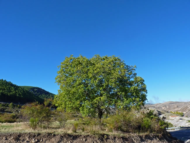
Already very close to the river, we pass by small orchards, mostly abandoned, which show what the subsistence economy of the area must have been in the past. We will cross over the Agua del Buitre stream, which maintains its course all year round, and a few meters away we come to a narrow forest track that again replaces the bridle path. The great color and quantity of walnut trees that are in this last section are striking, splashing the landscape with their leafiness and, in autumn, with their colors.
Village of La Toba
In the village of La Toba the hiker will find a well-deserved rest for this long stage. You will be able to enjoy extraordinary views over the Segura Valley, the abundance of springs –especially the one known as El Nacimiento– and its quiet and charming rural atmosphere. From this village, in addition, derivation 7 of the path that runs near the beautiful Las Anchuricas reservoir and another well-marked path, the PR-A 100, that leads to the beautiful village of Miller. In La Toba there is accommodation, being advisable to book in advance because the offer is limited.
Additional information
A lamb for gourmets
The municipality of Santiago-Pontones, through which this stage passes, is one of the largest livestock producers in Spain. The Segureña sheep, which owes its name to the Sierra de Segura and the Segura River, is one of the officially defined Iberian breeds, and one of the few that have not been affected by the general regressive process of indigenous livestock breeds.
It is one of the best Spanish breeds as a producer of meat, both for its high yield and for the excellent taste of lamb, which is a well-known and sought-after delicacy. The Segureña sheep is irreplaceable for its perfect adaptation to our climate and the mountainous characteristics of the natural park. It is easy to herd due to its marked gregarious nature. It has a strong maternal instinct and high fertility. It is very resistant to diseases, grows quickly and is very walker, an essential virtue in these broken lands. At present, an important part of the park's cattle hut is exploited according to the norms of organic farming and subjected to transhumant practices.

Follow us #JaénParaísoInterior


