


Cazorla - Refugio Casa Forestal Collado Zamora

This tour takes place in the western part of the park. It starts in the Historic-Artistic Complex of Cazorla and ascends to soon gain height over the countryside, providing great views over it and the towns of Iznatoraf, Chilluévar, Villacarrillo, Santo Tomé, Peal de Becerro and Quesada.
Near the beginning of this stage, where the Cerezuelo river meets the urban area of ??Cazorla, it also begins from the GR 247.3 variant, as explained in its corresponding chapter of this topoguide.
Leaving Cazorla and its castle of La Yedra behind, we will soon be surprised by the Castillo de las Cinco Esquinas or Salvatierra, a defensive tower whose construction dates from the 12th century, nestled on a hill with steep slopes and without tree vegetation. Another of the important points of this stage is the monastery of Montesión, belonging to the order of hermits of San Antonio and San Pablo, for a long time inhabited by a single person, Brother Antonio, dedicated daily to prayer and recollection.
The small groves of Aleppo pines at the beginning are followed by holm oaks, black pine fore ...
This tour takes place in the western part of the park. It starts in the Historic-Artistic Complex of Cazorla and ascends to soon gain height over the countryside, providing great views over it and the towns of Iznatoraf, Chilluévar, Villacarrillo, Santo Tomé, Peal de Becerro and Quesada.
Near the beginning of this stage, where the Cerezuelo river meets the urban area of ??Cazorla, it also begins from the GR 247.3 variant, as explained in its corresponding chapter of this topoguide.
Leaving Cazorla and its castle of La Yedra behind, we will soon be surprised by the Castillo de las Cinco Esquinas or Salvatierra, a defensive tower whose construction dates from the 12th century, nestled on a hill with steep slopes and without tree vegetation. Another of the important points of this stage is the monastery of Montesión, belonging to the order of hermits of San Antonio and San Pablo, for a long time inhabited by a single person, Brother Antonio, dedicated daily to prayer and recollection.
The small groves of Aleppo pines at the beginning are followed by holm oaks, black pine forests and, in the final part, by larices, mixed with cornicabra and hawthorn.
Los Cortados del Chorro, in the middle of the stage, is one of the best places in the park for observing griffon vultures, raptors and corvids. Even in the summer months, we can observe a couple of Egyptian vultures, who find a peaceful stay in this place before beginning their return to sub-Saharan Africa, where they remain during the coldest months.
The rocky folds that emerge near Collado Zamora are impressive, with striking forms that show the force of nature and the relative youth of these mountains, since the different layers or strata that make them up emerged from the seabed millions of years ago, as proof the presence of fossils of marine animals that we will see with relative ease.
When we arrive at Collado Zamora, the panoramic view overflows us, as we can see the Barranco de Béjar, Cerro Frío and the Loma del Leganillo, the Guadiana Menor Depression, the Cerro de la Magdalena, Vítar and the Sierra Mágina massif, another of the natural parks of the province of Jaén. On days with good visibility we can also contemplate the Sierra Nevada National Park in the province of Granada, crowned by the highest peaks of the Iberian Peninsula.
Technical information
Route Name Rutas Bosques GR247
Rutas Bosques GR247 11: Cazorla - Refugio Casa Forestal Collado ZamoraHUSO 30S
Cazorla: x499847 y4195751
Refugio C.F. Collado Zamora: x500164 y4188084
Cazorla: x499736 y4195543
Refugio C.F. Collado Zamora: x500053 y4187877
TOTAL DISTANCE (IN KILOMETERS)13060
Asphalt or cement section 1,38 %
Section of track or forest road or promenade 85,45 %
Senda section 13,17 %
tramos-de-Vía-pecuaria 0 %
ESTIMATED RUN TIMEO
4 h 23 minMAXIMUM SLOPE656 m
DIFFICULTY. ASSESSMENT ACCORDING TO METHOD MEASURE
2
MEDIO.
Severity of the natural environment
2
Itinerary
Orientation in the itinerary
2
Displacement
Difficulty moving
3
EFFORT.
Amount of effort required
TOTAL DISTANCE (IN KILOMETERS) 19540 M
Start
Cazorla is accessed by the A-315 and A-319 roads from Torreperogil; by the A-322 from Quesada; and by the A-6204 from Santo Tomé. It can also be reached from El Tranco by the A-319.
Final
The refuge is accessed by the forest track JF-7093 from La Iruela or from the source of the Guadalquivir. This track can also be accessed from Quesada by track JV-7107.
INTERMEDIATE POINTS
PLACE
POSITION
TYPE OF ROAD
Km 5,2
Forest track
CYCLABILITY
There are no special difficulties
WATER POINTS
Cazorla, source at the beginning of the route, source in El Chorro, source of Los Tejuelos. There is no fountain at the end of the Stage.
PREFRESHING POINTS
On the trail: Cazorla
Near the trail: La Iruela, Quesada
LINKS WITH OTHER TRAILS
PR-A 312, SL-A 8, GR 7
Rutómetro
San Isicio Road
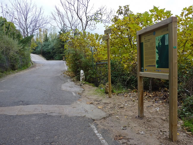
We access the San Isicio road from the Plaza de Santa María de Cazorla, taking the street that starts after the Renaissance fountain of Las Cadenas and is regulated by a traffic light. When leaving the town, by paved road, we will find the starting panel and the signs for this route. After one hundred meters we turn left along a cement track, until we find the La Pedriza fountain at another crossroads two hundred meters from the start. If we continue ahead for another two hundred meters we will reach the hermitage of San Isicio, but our route turns to the left, following a cement track that zigzags steeply.
Our route coincides in various sections with several local and short-distance trails, in addition to the GR 7, so the beacons and signs that we find at some points may be red, yellow and green. In any case, to follow the Bosques del Sur trail, we must pay attention to the specific GR 247 signs, in white and red.
The path follows a narrow track and over a significant unevenness. On the left we see a bare h ...
San Isicio Road
We access the San Isicio road from the Plaza de Santa María de Cazorla, taking the street that starts after the Renaissance fountain of Las Cadenas and is regulated by a traffic light. When leaving the town, by paved road, we will find the starting panel and the signs for this route. After one hundred meters we turn left along a cement track, until we find the La Pedriza fountain at another crossroads two hundred meters from the start. If we continue ahead for another two hundred meters we will reach the hermitage of San Isicio, but our route turns to the left, following a cement track that zigzags steeply.
Our route coincides in various sections with several local and short-distance trails, in addition to the GR 7, so the beacons and signs that we find at some points may be red, yellow and green. In any case, to follow the Bosques del Sur trail, we must pay attention to the specific GR 247 signs, in white and red.
The path follows a narrow track and over a significant unevenness. On the left we see a bare hill crowned by the ruins of the Cinco Esquinas or Salvatierra castle, which we will observe more closely later on. This site of Muslim origin underwent renovations at different times. Meanwhile, to the right, we see large areas of olive groves. The cemented section soon disappears to become a dirt track. The path is unambiguous, and although we find several entrances to the right to olive groves, we must simply follow the main path that skirts the treeless hill of Castillo de las Cinco Esquinas, which we keep to the left. Very close to the track we see small forests of Aleppo pine and holm oaks that delimit the large extensions of olive groves.
Collado Montesión
After several zigzags we come to a hill where we are surprised by the Montesión monastery, located next to some cypress trees and in a natural shelter. Founded in 1625 by San Julián Ferrer, to whom according to tradition the Virgin Mary appeared in a nearby cave, it has undergone several renovations, more numerous after the confiscation of Mendizábal. Later, from the seventies of the 20th century, the return of the hermit brothers meant the repair of some dependencies. In recent years, a single brother of the hermit order of San Antonio and San Pablo, Antonio Rodríguez Roldán, now of advanced age, has kept alive the flame of the contemplative life.
To the left we leave the ascending track because our path borders the monastery on its left side, to later exit to another narrow track that passes next to a recent construction of water canalization. After crossing the Montesión valley, we pass a recently built forest track to the right that is closed to motor traffic by means of a cable. Our path continues uphill to the left, with a great panoramic view of the Monastery, the valley and the entire countryside.
Crossing in Loma del Bellón
We find a crossroads of narrow tracks, just when we reach a small hill. On the right track, downhill, the GR 7 continues, with which we had coincided from the beginning and which we now abandon. Our route continues straight ahead, continuing uphill along an increasingly narrow track that soon becomes a wide bridle path.
The Aleppo pine forests give way to black and especially black pines, along with hawthorn and cornicabras. The path then crosses a fence provided with a gate, and immersed in the forest, the views are impressive as we ascend, soon exceeding 1,300 meters of altitude.
Forest Trail JF-7093 La Iruela to Nacimiento Guadalquivir
We come out onto a wide forest track that we must continue to the right. Backwards, that is, to the left, this track would take us to Cazorla and La Iruela. If we took that direction, we would find a junction with the GR 247.3 bypass that connects Cazorla and El Sacejo through the Gilillo pass, just over 3 kilometers away.
Continuing along our route, just 20 meters further on we will see that a path emerges to the left that also connects with the aforementioned variant after 1.2 km, specifically in the Collado de Cagahierro.
If we do not look for the links with the variant, our route placidly flattens allowing us to enjoy spectacular views over Quesada and Sierra Mágina.
Path through the Cortados del Chorro
After 1200 meters of forest track, we turn off to the right to follow a path that runs just above the rocky wall of Los Cortados de El Chorro. There is a magnificent view, but also in the cuts there is a colony of griffon vulture, being relatively easy to observe. There are stone benches where we can recreate with the sailboat flight of these great scavengers. We must be extremely respectful, since it is also a nesting area for other species of raptors and diverse birds.
To the left of the esplanade where the cliffs are located is the El Chorro forest house, right at the foot of the track we have traveled, and in front of us we can also see the limestone walls of El Chorro, since they have here a certain semicircular shape. There is a wooden observatory on the other side of the valley that we will arrive at later.
Detour in El Chorro
We leave a small descending track on the right, and in front we find another that is closed to vehicles with a cable. We will have to go towards the cable and just as we pass it, deviate to the right along a descending path, to find a magnificent fountain a hundred meters away. Then we cross the Arroyo de El Chorro and along a narrow path we go to the other area of Los Cortados. The Arroyo de El Chorro, which gives its name to this place, forms an exceptional waterfall of almost 70 meters below us in times of rain and thaw.
Bird observatory in El Chorro
After skirting the cliffs, we went to another esplanade where we found a wooden observatory with information panels on the most common birds to see in this place. The cavities used by griffon vultures to rest and nest are easily identifiable by the white color of their droppings.
To continue our itinerary, we must take the dirt forest track in front of some cypress trees, at the entrance of which there is a large sign that indicates "Nacimiento del Guadalquivir 11.9 km"; there is also the proper signposting of the GR 247 towards the Collado Zamora refuge. At 150 meters we find another crossroads of tracks, which we must take to the right. Towards the left we would return to the track we have traveled until we reach the cuttings. Later, and 8.2 kilometers from the beginning, we leave the Fuente de los Tejuelos on the left, an ideal place to stock up on water. From here we go through a magnificent black or salgareño pine forest dotted with some holm oaks. The rocky stratification that can be seen from kilometer 10.6 on Loma de la Tejadilla is striking, showing us the colossal forces that must have caused the elevation of the seabed from which these mountains emerged millions of years ago. A very visible evidence that these strata come from the bottom of the sea is the presence of fossil remains of marine animals that we find at these altitudes.
Collado Zamora
After a slight final ascent that takes us above 1,400 meters of altitude, we arrive at Collado Zamora. On the right we leave Cerro Frío, 1480 meters high and with some bare areas, and on the left a line of abrupt and stark rock peaks, an extension of El Gilillo, which exceeds 1,700 meters. The views to the south are deep, contrasting the large ravines and rocky Quesada mountains of the park with the landscapes that are seen outside the protected space in which the view is lost, both the most humanized and gentle that make up large areas of cultivation, or even semi-desert areas.
Collado Zamora Forest House Refuge
The stage ends at a widening of the track, the starting point of stage 12 of the GR 247 Bosques del Sur trail that will take us to Belerda. There are several informative and interpretive panels in this place. To the south, on days with good visibility, we can see the Sierra Nevada massif, and to the east, after the Guadiana Menor depression, we see Sierra Mágina, another natural park where the roof of the province of Jaén is located, the peak Magina, with 2167 meters of altitude. A hundred meters further on, following the main track, you will find the refuge in an old forest house, an appropriate place to rest before continuing on our way.
Additional information
The bearded vulture returns, the great jewel of the Park's fauna
Until 1986, the skies of the natural park were flown over by the impressive figure of one of the most emblematic birds of the Iberian fauna: the lammergeier. Located at the top of the trophic pyramid. This reddish ghoul is able to take advantage of the bones of the corpses of sheep, deer, mouflon, mountain goats, etc., something that no other animal is capable of doing.
It was abundant in various Andalusian mountains and other areas of the Iberian Peninsula, until its population was reduced to the Pyrenees, in an inexorable regression caused by gunfire, the looting of nests and, above all, by the use of poisoned baits used by some ranchers and hunters to kill foxes, feral dogs and so-called vermin, a term used to designate all predators whose existence they considered contrary to their interests.
Today, thanks to a long and complex reintroduction process carried out by the Gypaetus Foundation with the support of the Junta de Andalucía, the bearded vulture is r ...
The bearded vulture returns, the great jewel of the Park's fauna
Until 1986, the skies of the natural park were flown over by the impressive figure of one of the most emblematic birds of the Iberian fauna: the lammergeier. Located at the top of the trophic pyramid. This reddish ghoul is able to take advantage of the bones of the corpses of sheep, deer, mouflon, mountain goats, etc., something that no other animal is capable of doing.
It was abundant in various Andalusian mountains and other areas of the Iberian Peninsula, until its population was reduced to the Pyrenees, in an inexorable regression caused by gunfire, the looting of nests and, above all, by the use of poisoned baits used by some ranchers and hunters to kill foxes, feral dogs and so-called vermin, a term used to designate all predators whose existence they considered contrary to their interests.
Today, thanks to a long and complex reintroduction process carried out by the Gypaetus Foundation with the support of the Junta de Andalucía, the bearded vulture is returning to these skies. In spring 2006, the first specimens were released, although reintroduction can only be considered consolidated when the bearded vultures are adults and have reproductive success. In any case, the return of the bankruptcy is not only another incentive to walk through these mountains, but a reason for intimate satisfaction when seeing that human beings are not only capable of damaging the environment, but also of learning from mistakes and retrace paths that should never have been traveled.

Follow us #JaénParaísoInterior


