
The Relief
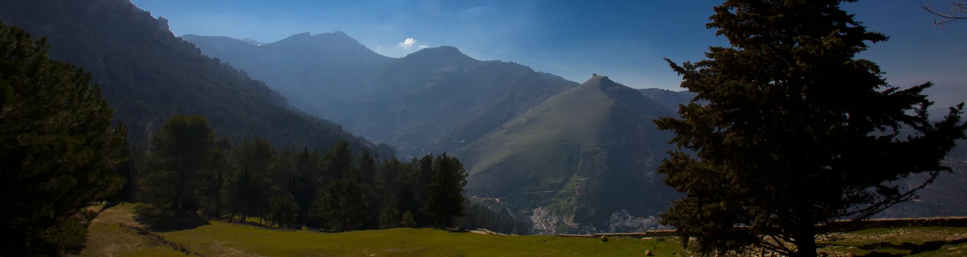
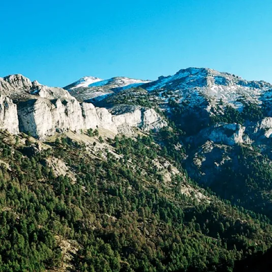
When you enter the Serras de Cazorla, Segura and Las Villas you will be in one of the most important mountain sets on the Iberian peninsula. Most of the villages are between 700 and 1,000 metres of altitude. More than half of the area of the park is between 1,000 and 1,500 m of altitude, but there are summits that are fired above 2,000 m, such as the Cabañas peak (2,028 m), the Cabilla Alto (2,039 m) and the Empanadas peak (2.107 m), which is the highest point of the Park. Among these, more than fifty summits exceed 1,600 m of altitude.
This set is available in abrupt north-south-west-direction alignments, which sometimes intersect and are often separated by deep valleys carved by rivers, flanked by rocky scarves.
The east of the park is the most mountainous part. In the north-east area you will discover numerous calares, which are elongated mountains lying on the four sides and which are crowned by extensive plains. Following south, you will find one of the most original and unexpected landscapes of the park: the great altiplanicie of Los Campos de Hernán Perea, at 1,600-1,700 m altitude. Further south, always in the east, you will see the Sierras del Empanadas and la Cabrilla, where the natural park is more acutely and reaches its highest levels, with ten summits exceeding 2,000 m.
In the west of the park, the mountains begin in the north with moderate altitudes and simple profiles in the Silas de Calderón, Oruña and Summits of Beas, always below 1,350 m of altitude. The Sierra de Las Villas will impress you with a complex and intricate relief, with summits that rise on the steep slopes above 1,800 m of altitude.
crowned by extensive plains. Following south, you will find one of the most original and unexpected landscapes of the park: the great altiplanicie of Los Campos de
Hernán Perea, at 1,600-1,700 m altitude. Further south, always in the east, you will see the Sierras del Empanadas and la Cabrilla, where the natural park is more acutely and reaches its highest levels, with ten summits exceeding 2,000 m.In the west of the park, the mountains begin in the north with moderate altitudes and simple profiles in the Silas de Calderón, Oruña and Summits of Beas, always below 1,350 m of altitude. The Sierra de Las Villas will impress you with a complex and intricate relief, with summits that rise on the steep slopes above 1,800 m of altitude.
At the southern end of the Park, an impressive set of mountains rises on the Jiennense olive countryside and the subdesert areas of Huesa and Hinojares (where the lowest height of the Park is given, with 470 m). These are the Sierras de Cazorla and El Pozo, which reach their roof in the Cabañas peak (2,026 m).
Many of these mountain alignments are separated by rivers that have carved the landscape with deep canyons, ripples, throats, closed; enclosed valleys that will constitute for you one of the most unique landscape attractions in the Park.
Among the valleys, the Guadalquivir. The beautiful corridor between mountains that opens this river in the north-east direction. Beyond the Tranco reservoir it turns west, to reach the great depression, watched from above by the Yelmo, one of the most emblematic summits of the Park for its altitude (1.808 m), and for being a famous free flight station. Near him, in another depression covered by olive groves, runs the Guadalimar River. They'll both find miles down. Other rivers have also dug in the mountain numerous valleys, sometimes wild, sometimes domesticated, but always attractive for the charm and harmony of the scenarios they make up.
Natural Architectures
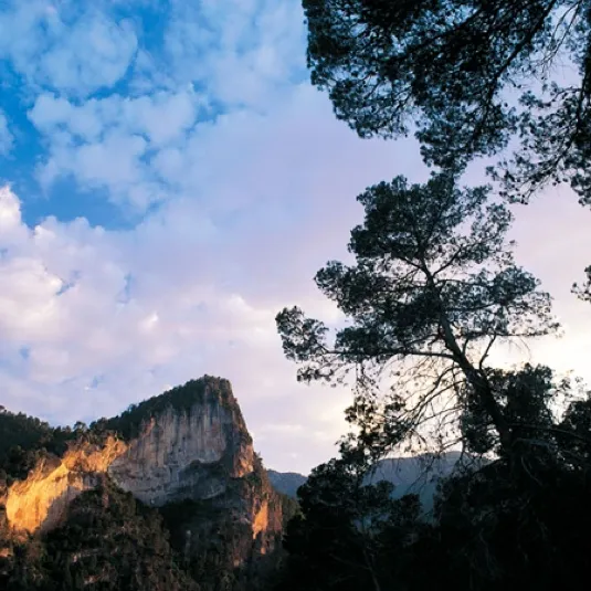
The rocks of the Park exhibit a very suggestive form. As limestone, they do not react uniformly to the action of water, but their different parts offer an unequal resistance, configuring capricious natural profiles and architectures of the cartic landscape - limestone rocks dissolved by the waters. You will be hit by the pigeons, which are large rocks in the form of a needle or a torreon, the teeth and castles, vertical rocks with a flat summit, and the poyos, colossal blocks of horizontal contours that crown some mountains. alt
Other very characteristic formations are the tomas, beautiful lime plates that sediments under the water in waterfalls and rezorating walls. The rocky soils are sometimes densely sculpted by water, forming labyrintic networks of cracks, slices and depressions. They are the lapiaces, known in these saws as lancars. Sometimes, stone plates have a lot to do, so the action of water is less noticeable. In these areas they are called lastras.
You will also find, in high areas, the amazing torches or dolins, ground sinking, rounded contours and funnel shape. Its bottom makes rain water sink, so they are called sorbiors in these saws, and they usually have continuity in the form of deep simas.
In the flanks of the rock formations you will see large pedestals, here called crabs, formed by the accumulation of stones that have fallen down the slope after the fragmentation of the rock located in the high area of the mountain. Some plants are adapted to live in this hostile environment, because although their external appearance is very discreet, they have an extensive system of roots and their stems are easily renewed even if they are cut off by the movement of stones.
You will also find, in high areas, the amazing torches or dolins, ground sinks, rounded contours and shape of
funnel. Its bottom makes rain water sink, so they are called sorbiors in these saws, and they usually have continuity in the form of deep simas.In the flanks of the rock formations you will see large pedestals, here called crabs, formed by the accumulation of stones that have fallen down the slope after the fragmentation of the rock located in the high area of the mountain. Some plants are adapted to live in this hostile environment, because although their external appearance is very discreet, they have an extensive system of roots and their stems are easily renewed even if they are cut off by the movement of stones.
The plant landscape
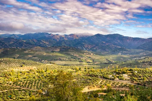
First of all, this park is a huge pine tree. But, as you will see, it is a varied, diverse pine tree, where pine trees, of different species and sizes, are harmonically mixed with many other trees and bushes. Here you will not find monotonous successions of pines that seem cloned as columns on soils without vegetation. As it rises in altitude, you will find carrasco, black and larix pines. Of the latter, the Park is proud to have the best forests in Spain. With their right trunks of white bark, these large pine trees are the masters of the landscape in the high areas. Even above, the summits are the space of the rock and the great panoramic. Below the wide pineapple strip, the landscape has been harmonically humanized by the implantation of olive groves with an intense serrana personality, as they climb up to the limit where this cultivation is possible. But in addition to olive groves, pine trees and panoramic summits, Spain's largest protected territory reserves many surprises.
Here are very different combinations of altitude and orientation, which produces many nuances in the plant landscape. The protective shadow of the pineapple is dense, sotoforested, which in turn are a kettle of animal life. The pinars up to an altitude of 1,000-1100 m, which are those of carrasco pine (Pinus halepensis), are rich in rosemary and various jars on dry and sunny slopes, while in more favourable situations an arbustive stratum is developed with species of other formations that preceded the current pinars. For example, we find the coscoja (Quercus coccifera), the lentisco (Pistacia lentiscus), the labiérnago or ciserno (Phillyrea angustifolia) and the peach (Viburnum tinus). The strip starring the black pine (Pinus pinaster), also called a resinero and a rodenum, is between 1,000 and 1,300 m of altitude. Seat juniperus oxycedrus (Juniperus oxycedrus), the hard root of which was previously made
the big balls used in the popular game of the serrano bowling, and cornicabra (Pistacia terebinthus), whose leaves become intensely scarlet in autumn. This bush, here called cornite, owes its name to the curious shape of the guts it develops in response to the bites of certain lugons. Above, in the band dominated by the laricio or salgareño pine (Pinus nigra ssp. salzmanii), the forest is rich in wild rosals, of which the Park has 13 different species, which in spring and summer will offer you its flowers of five petals whose colors go from white to various pink tones. Its aovated red fruits, known as skirmishes, have been consumed since ancient times by human beings for their strong astringent properties. Another abundant bush in this area is the albar thorn or majuelo (Crataegus monogyna), which in spring is completely covered with white flowers that perfuse all its surroundings with a very sweet aroma, and in autumn offers you its spherical red strawberries - the majolites - that are perfectly edible when they are well ripe.... and much moreBut, although the pineapple takes on most of the landscapes, diversity is one of the Park's identity marks. So, many other trees and bushes will get your attention. Sometimes you will see them mixed with the pines and others become protagonists of the landscape as formations with their own personality. You will find oaks (Quercus faginea, complaining) that come to form forests. Some old specimens have a majestic bearing from which a magic is evident which is a symbol of the fertile past of these saws, when the obledals occupied more surface than they are today. You will also see encinars and even sabinars of black sabina (Juniperus phoenicia). You will discover melojars (Quercus pyrenaica), so rare in the southeast, with its beautiful lobulated leaves. Also madrognals, stitched red and orange in the fall. Disperse
Here and there, you will find maples, both the granadine (Acer granatensis) and that of Montpellier (Acer monspessulanum), the latter very little in the south and both with a sensational frost chromatism.What is most surprising will be the finding of trees much more typical of northern latitudes than of the Iberian southeast, such as the acebo (Ilex aquifolium), the hazelnut (Corylus avellana), the mountain olmo (Ulmus montana), the tejo (Taxus baccata) and even some birch (Betula pendula sp. fontqueri). The flora of this Park is a box of surprises that opens to those who are curious and know how to appreciate the strategies of life to adapt to all corners.
The olive tree
Most of the human footprint inside the Park is seen in the northern area, that is, in the region of Segura. In the lower parts we will find olive groves climbing the slopes, with numerous forest spots and interspersed bushes. The olive tree is the basis of the park's economy and its extensive area of influence, and a key element of its landscape, culture and the daily life of its people. In fact, it is a clear forest that, although artificial and lacking the structure and diversity of natural forests, constitutes an agrosystem complex where many species of plants and animals are present.

The mountain pastures
In much of the high areas of the same region, the human footprint is manifested in a completely different way: the livestock landscape. They are high mountain territories with little tree vegetation or which have historically been deforposed to open pastures to the Segurean sheep. Its landscape sometimes overcomes the amplitude of its panorama, always flanked by large elevations and spilled by shroud spots and rock formations. In winter it is the territory of snow. In spring, of the green pastures of height. And always, home to an ancient livestock culture that deserves the highest recognition.

The villages and cortijos
Apart from the larger villages, the spread of isolated villages and tiny cortijos is another feature that gives a marked personality to this part of the Park. In the areas of higher altitude, many of these human enclaves are no longer populated, or only during the months of more benign climate. The traditional architecture of the villages is unevenly preserved, but the presence of these nuclei is not only pleasant from the aesthetic point of view, but touching as a testimony to a way of life that has historically been hard and has been able to adapt with mastery to the difficult conditions of the mountain.

The gardens
Next to these human enclaves are the small gardens, thehorses. They are in thestrikesas here is called the few more or less flat and fertile lands located on the river and the stream. The mountain farming in these saws has always been of pure subsistence, so many of these gardens have run the same fate as the villages and cortijos to which they were linked: abandonment. But in the low areas near the villages, many gardens, which produce exquisite vegetables, are still active. Each strike, even if it is already abandoned, is a small landscape prodigy that brings diversity to the whole in which it is integrated. Its balance results from the most relaxing, because it reconciles the wise gardener touch of the human hand - terraces, pools, walnuts, chopos... - with the grandiosity of the surrounding mountains, always close.

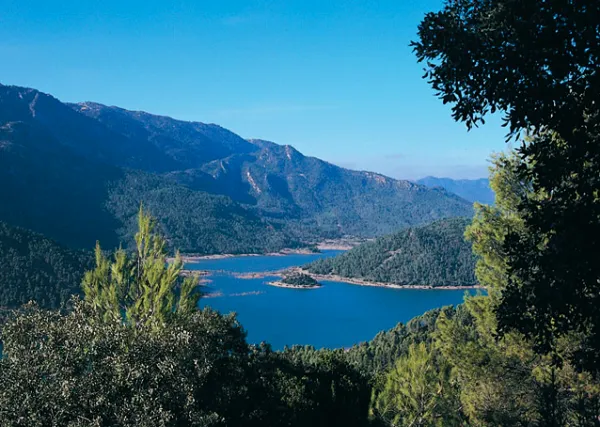
The reservoirs
The abundance of water from the Park has led to the construction of reservoirs of very different extent, capacity and use. They are all a heritage of great economic and landscape importance, but, at the time, their construction had a painful social impact, especially as they were treated in most cases in a time when the political conditions were very harsh. Today, the park reservoirs are an attractive recreational and sports resource. In this website you will find various references to these aspects. But here, in the context of the relationship between the landscape and the serrans, we will put point and end by rescuing the experiences of a inhabitant of the Vega de Hornos affected by the construction of the large reservoir of the Tranco. His words are very illustrative of the role that, for centuries, was assigned to the inhabitants of the mountains from the instances of power. Today, fortunately, there are other times.
"In 1940, what we had been afraid of for so long came: we were told that we had to vacate immediately and bring down the houses (...). They entered large bands of hashers and tronzers with large hashes cutting it all together, classifying the wood and burning the wood and the thousands of centenary oak that had until then covered the lands of the Vega, which then turned into coal. Those lands soon remained as if they had received an atomic bomb. We, like all of the Vega, emigrate from the place with all of our beings and animals. We changed land, landscapes, customs, neighbors and many other things that have no name, but that were real and remained within each of those people. For everyone that change was very hard, although we each suffered it in silence."
Submersed memories, 1931-1941
Angel Robles Rodríguez, born in the corrijada of El Chorreón, which was expropriated for the