
Route de las Lagunas
Datos de la ruta
ROUTE NAME
Ruta de las Lagunas
TRAIL TYPE
--
DIFFICULTY
Baja
TOTAL DISTANCE (IN KILOMETERS) 21 km
-
Stretch of asphalt or concrete: --
-
Section of track, forest road, or dry watercourse: --
-
Trail section: --
-
Sections of livestock trails: --
HUSO 30S
ESTIMATED TRAVEL TIME
2 h 30 min
ROAD SURFACE TYPE
Road
ELEVATION CHANGE
200mm
200mm
DIFFICULTY. RATING ACCORDING TO THE MIDE METHOD
--
MEANS
Severity of the natural environment
--
ITINERARY
Route guidance
--
DISPLACEMENT
Difficulty moving about
--
EFFORT
Amount of effort required
ACCESSIBILITY TYPE
TIME OF YEAR
Winter
SIGNALING
No
MORE INFORMATION
TUNNELS
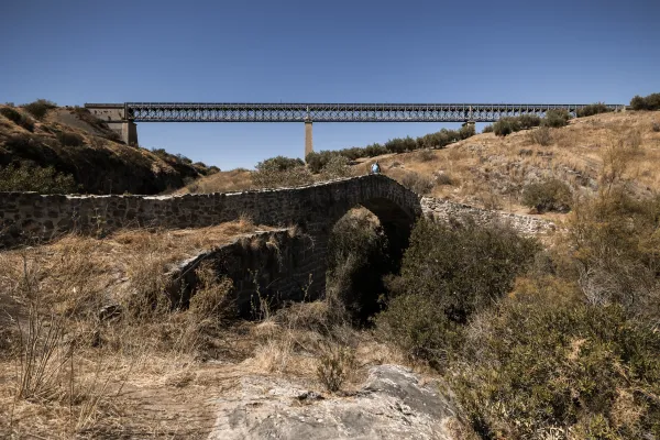
STEEL VIADUCTS
METAL WALKWAYS
WATER POINTS
PONTOONS
GUARD BOOTHS AND BARRIERS
SWITCHMAN'S CABINS
CYCLABILITY
RECREATIONAL OR SPORTS AREAS NEAR THE TRAIL
AID STATIONS
LINKS TO OTHER TRAILS
SHELTERS
RECOMMENDATIONS
The tour is suitable for all. They do not overcome large levels and the roads are in good condition; the only difficulty lies in the first down, something tilted and with grooves. The best time to visit the gaps is in winter; the railway platform itself is a strategic observation point. A lot of patience, a little silence and good prismatics are all you need to enjoy this place.
OTHER INFORMATION OF INTEREST (ARCHITECTURAL OR HISTORICAL-CULTURAL, GEOLOGICAL-ECOLOGICAL)
Technical Description
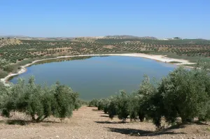
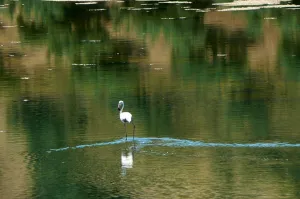
From the road A-316 to Córdoba you take the region to the old station of Alcaudete, which soon after is abandoned (km 2,3) by a lane of land to the right. Just after coronating an altozane (km 3.2), a fork appears. To the right you start to descend with strong slopes and then lead to a crossing (km 4.8). The route then turns left and, past a ruined cortijo, links with the platform of the old Oil Train (km. 5.4). Its unmistakable layout, indifferent to the vicissitudes of the land, raises no doubt. Trinches and taludes occur before reaching the old Alcaudete station. A little later, the recently built autonomous road cuts the railway platform. It must be passed with caution to link with the tracks, which are now heading for the encounter of the Honda Lagoon. In winter the reserve gives shelter to a large number of aquatic birds.
The route continues along the road, however, next to a raft (10.8) it moves to the right and soon reaches the cortijo del Chinche, from where the second lagoon is already seen. Although it is smaller in size than the previous one, it also has anatides; the best way to observe them is from a lane that leaves to the left, past the cortijo. If you take the one on the right, soon after there is another crossing (km. 13.4) where from the front you will go to a road and immediately to the autonomous one.
To return to Alcaudete the best thing is to choose the region that goes up from the same station. The Honda and Chinche lagoons arise as by magic in the middle of the jiennese countryside. They are part of the Spanish Natural Wetlands Network; in 1989 they were declared Natural Reserves. They are seasonal lagoons, that is, in summer they dry and the autumn rains feed it, remaining flooded in winter and part of spring. The surrounding vegetation gives shelter to numerous aquatic birds; the royal anades, the elusive water cock or the common focal, which is recognized for its frequent immersions, usually visit it. Occasionally there comes the rare evil or even some small flock of flamingos that use it as a resting place for their migration trips.