



Stage Martos - Alcaudete
Description
The stretch between Martos and Alcaudete is a 23 km stage with a moderate level. This is an ideal way for those looking for an immersion into the rural and historical landscape of Jaén, as we will find one of the best preserved medieval bridges in the province or enter the mythical Via Verde del Oil.
_
We leave from Martos, across the city on Avenida de los Olivares. We left the "old" Martos behind and headed towards its newest area, until we reached a roundabout that marks the beginning of our road to Alcaudete. Once the roundabout has been saved, we move on to the right-hand side, taking the Belda Friar Road.
This stretch enters us into the extensive olive tree that characterizes the region, considered the largest in the world. During the tour, two "pinets" serve as a reference, announcing the cortijo that gives name to this road. We left the cortijo to our left and continued to reach a tree, where we will meet the Green Way of Oil. Without deviating from this route, we continue straight, moving forward among large trees.
When we reach a crossing, we turn left to wade the Salty Arroyo. Here we begin a slight rise, in which two paths are presented: we take the one on the right to finally join the Green Way of Oil.
_
The Green Way of Oil accompanies us for several kilometers, allowing us to enjoy meringers where pilgrims can rest. We passed under the old N-321 road, and continued to reach an old railway building, at which time we must turn left to leave the green road.
From here on, the road becomes a peculiar way, leading us to a cortijo and later to the impressive "Ponton del Río Víboras," a medieval bridge that served as a link of union in an old royal canyon. This is one of the best preserved medieval bridges in the province and a perfect place to stop, enjoy the landscape and lunch surrounded by nature.
_
After crossing the bridge, we started a rise of about 4 kilometers that will take us to Alcaudete. This stretch requires a moderate effort, but is rewarded with the impressive views of the environment and the satisfaction of approaching our destination. After the rise, we are expected a smooth down of almost 3 km that will allow us to reach the town.
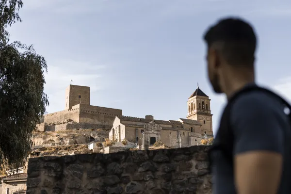
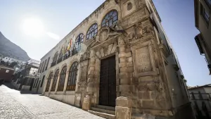
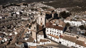
As we enter Alcaudete, we seek the signage of the Way that leads us to the City Hall Square, information point to the pilgrim. Among its most prominent points of interest are the Calatravo Castle, the Church of St. Peter and the Sanctuary of the Virgin of the Fuensanta. The city offers a rich historical heritage and a quiet environment for pilgrims.
CONCLUSION OF THE RECORRID
The arrival in Alcaudete is the link of union with the other way of the Mozarto road that comes from Granada and that will take us to Córdoba. This municipality not only offers us an important tour of historical and natural heritage, but we will be able to find rest in the city's pilgrims' hostel or just take a break in Fuente Amuña before continuing our journey.
Datos de la ruta
ROUTE NAME
Etapa Martos - Alcaudete
TRAIL TYPE
--
DIFFICULTY
Moderada
TOTAL DISTANCE (IN KILOMETERS) 25 km
-
Stretch of asphalt or concrete:
-
Section of track, forest road, or dry watercourse:
-
Trail section:
-
Sections of livestock trails:
HUSO 30S
ESTIMATED TRAVEL TIME
ROAD SURFACE TYPE
Road
ELEVATION CHANGE
400mm
400mm
DIFFICULTY. RATING ACCORDING TO THE MIDE METHOD
--
MEANS
Severity of the natural environment
--
ITINERARY
Route guidance
--
DISPLACEMENT
Difficulty moving about
--
EFFORT
Amount of effort required
ACCESSIBILITY TYPE
TIME OF YEAR
SIGNALING
No
PERFIL DE ALTURAS

MORE INFORMATION
TUNNELS
STEEL VIADUCTS
METAL WALKWAYS
WATER POINTS
PONTOONS
GUARD BOOTHS AND BARRIERS
SWITCHMAN'S CABINS
CYCLABILITY
RECREATIONAL OR SPORTS AREAS NEAR THE TRAIL
AID STATIONS
LINKS TO OTHER TRAILS
SHELTERS
RECOMMENDATIONS
OTHER INFORMATION OF INTEREST (ARCHITECTURAL OR HISTORICAL-CULTURAL, GEOLOGICAL-ECOLOGICAL)