Trail Fundición de la Tortilla
Description
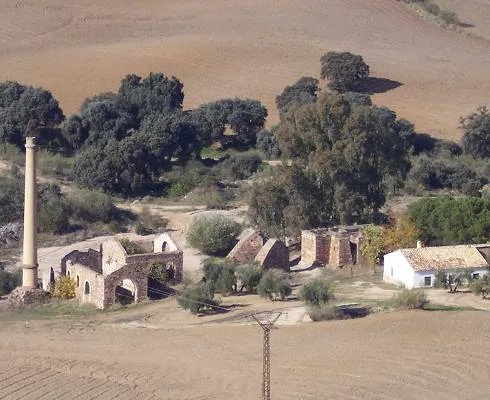
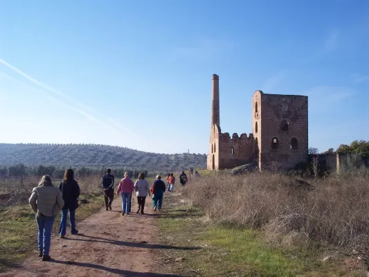
To walk this path is to move in memory to a period in the history of Linares: its mining industry which, during the 19th and mid-20th centuries, meant the way of life for many Linarians and whose heritage is scattered throughout its term. Mines, wells and smelters, today abandoned, where you can still see the melted granite constructions, the high chimneys of the smelters and the old "Cabrias" for the extraction of the material. A path that runs along the road of the Tortilla, very passed by the Linarians and that has no loss. 2 km. is found the Foundry of the Tortilla, a crossroads of roads and numerous buildings in ruins denote its importance in the mining past of Linares.
Datos de la ruta
ROUTE NAME
Sendero Fundición de la Tortilla
TRAIL TYPE
Linear
DIFFICULTY
--
TOTAL DISTANCE (IN KILOMETERS) --
-
Stretch of asphalt or concrete:
-
Section of track, forest road, or dry watercourse:
-
Trail section:
-
Sections of livestock trails:
HUSO 30S
ESTIMATED TRAVEL TIME
ROAD SURFACE TYPE
Road
--
--
DIFFICULTY. RATING ACCORDING TO THE MIDE METHOD
--
MEANS
Severity of the natural environment
--
ITINERARY
Route guidance
--
DISPLACEMENT
Difficulty moving about
--
EFFORT
Amount of effort required
ACCESSIBILITY TYPE
On foot
TIME OF YEAR
All year round
SIGNALING
Sí
MORE INFORMATION
TUNNELS
STEEL VIADUCTS
METAL WALKWAYS
WATER POINTS
PONTOONS
GUARD BOOTHS AND BARRIERS
SWITCHMAN'S CABINS
CYCLABILITY
RECREATIONAL OR SPORTS AREAS NEAR THE TRAIL
AID STATIONS
LINKS TO OTHER TRAILS
SHELTERS
RECOMMENDATIONS
OTHER INFORMATION OF INTEREST (ARCHITECTURAL OR HISTORICAL-CULTURAL, GEOLOGICAL-ECOLOGICAL)
Technical Description
After passing through an alpechenera and under an old bridge of the mining railway the path ascends along the stony coast of San Pedro to the Cañada de Incosa; from which we continue, to the right, a stretch that presents, to the west, magnificent views of the population of Baños de la Encina.
Walking this path is moving in memory to a period in the history of Linares.
After 1.4 Km we connect with the road and by a wooden step we take the Green Way until we reach a crossing (connection to the path of the Gitana Mine PR-A 264), then we pass through the solid waste treatment plant and continue on the old steep path of Siles that will lead us back to Linares.