Trail del Paño Pico

Description
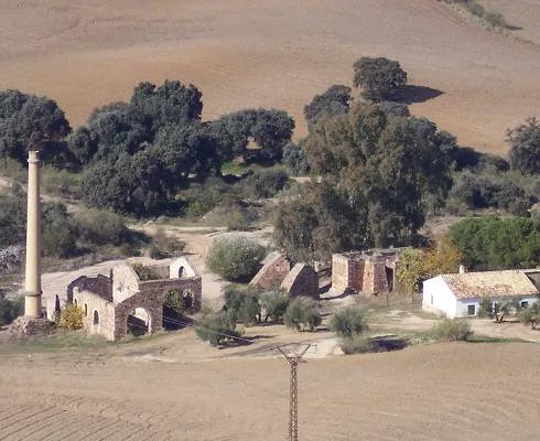
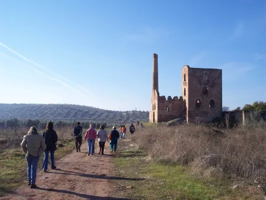
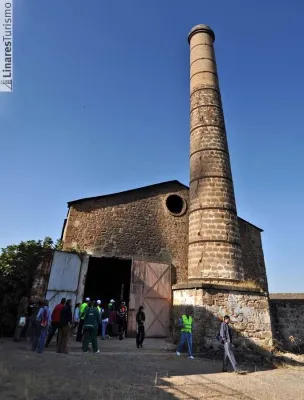
This practically flat-profile Path, born in the Barrio de Arrayanes and follows one of the most important roads that the Minas de Arrayanes communicated with Linares. The itinerary after passing the Pozo Acosta, where the house of extraction machines, fireplace and auxiliary buildings are still preserved, crosses on two occasions the tracks of the old mining tram, today dismantled: one, at its pass through the Pozo Restoration, and another, before reaching the Pozo San José and the Central Electric. The stretch between the two wells is consistent with the path PR-A 261 "Cerro de las Manciebas" which allows us to combine the route.
Datos de la ruta
ROUTE NAME
Sendero del Paño Pico
TRAIL TYPE
Linear
DIFFICULTY
--
TOTAL DISTANCE (IN KILOMETERS) --
-
Stretch of asphalt or concrete:
-
Section of track, forest road, or dry watercourse:
-
Trail section:
-
Sections of livestock trails:
HUSO 30S
ESTIMATED TRAVEL TIME
ROAD SURFACE TYPE
--
--
DIFFICULTY. RATING ACCORDING TO THE MIDE METHOD
--
MEANS
Severity of the natural environment
--
ITINERARY
Route guidance
--
DISPLACEMENT
Difficulty moving about
--
EFFORT
Amount of effort required
ACCESSIBILITY TYPE
On foot
TIME OF YEAR
All year round
SIGNALING
Sí
MORE INFORMATION
TUNNELS
STEEL VIADUCTS
METAL WALKWAYS
WATER POINTS
PONTOONS
GUARD BOOTHS AND BARRIERS
SWITCHMAN'S CABINS
CYCLABILITY
RECREATIONAL OR SPORTS AREAS NEAR THE TRAIL
AID STATIONS
LINKS TO OTHER TRAILS
SHELTERS
RECOMMENDATIONS
OTHER INFORMATION OF INTEREST (ARCHITECTURAL OR HISTORICAL-CULTURAL, GEOLOGICAL-ECOLOGICAL)
Technical Description
In the well restoration, open between 1844 and 1850, the building that housed the garage and locomotives workshop of the mining railway stands out. In the well of San José, next to the road, you can still see the place called "Bajada de la Reina," made for a visit by Elizabeth II to the first gallery.
We pass by the well Cadenas and later through the Vimora Lavadero, example of natural regeneration of the vegetation of the area...
The path continues to Paño Pico (geodetic vertex) and the Mina de La Mexicana, don enclaves from where it is possible to enjoy an unbeatable panorama of the area: far away La Carolina and Baños de la Encina, closer to the Hoyo de San Bartolomé, Cerro de las Manciebas, etc. From Mexico an ancient road between oak trees, interrupted by an olive grove, leads to the Fireplace de la Cruz, one of the highest in the area that reached a height of 100 m (today it is 57 m), and where the path reshares route with the PR-A 261. We passed by the Pozo Cadenas and later on through the Vimora Lavadero, an example of natural regeneration of the vegetation of the area, to go around the urbanization until the end of the La Cruz Foundry, where all types of lead products were made, and that will be the seat of the future Interpretation Centre.