Trail de La Gitana
Description
This Path, in its journey, not only recovers the pecuary path of the Way of Mayecosas at its beginning, but also does so by returning to Linares on the old way of Siles, also called the Way of the Stones. This road has no loss and is marked by some other stone wall. We leave the pecuaria road turning left at the first crossing, a few meters from another crossing with the road of the well of San Adriano, which we can visit if we leave the route. Our tour continues to cross the Green Way and reach a crossing where we turn right on a road next to an electric tower that continues between olive trees.
Datos de la ruta
ROUTE NAME
Sendero de La Gitana
TRAIL TYPE
Linear
DIFFICULTY
--
TOTAL DISTANCE (IN KILOMETERS) --
-
Stretch of asphalt or concrete:
-
Section of track, forest road, or dry watercourse:
-
Trail section:
-
Sections of livestock trails:
HUSO 30S
ESTIMATED TRAVEL TIME
ROAD SURFACE TYPE
Road
--
--
DIFFICULTY. RATING ACCORDING TO THE MIDE METHOD
--
MEANS
Severity of the natural environment
--
ITINERARY
Route guidance
--
DISPLACEMENT
Difficulty moving about
--
EFFORT
Amount of effort required
ACCESSIBILITY TYPE
On foot
TIME OF YEAR
All year round
SIGNALING
Sí
MORE INFORMATION
TUNNELS
STEEL VIADUCTS
METAL WALKWAYS
WATER POINTS
PONTOONS
GUARD BOOTHS AND BARRIERS
SWITCHMAN'S CABINS
CYCLABILITY
RECREATIONAL OR SPORTS AREAS NEAR THE TRAIL
AID STATIONS
LINKS TO OTHER TRAILS
SHELTERS
RECOMMENDATIONS
OTHER INFORMATION OF INTEREST (ARCHITECTURAL OR HISTORICAL-CULTURAL, GEOLOGICAL-ECOLOGICAL)
Technical Description
The well of the Gitana, ideal place of rest where we can be surprised by a spectacular rainbow effect produced in the mouth of the well.
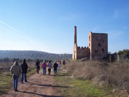
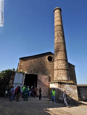
A lane connects right to the path. We follow on the right and about 100 meters away there are ruins, later leading a short and slight descent to the urbanization of San Roque in front of a slender fireplace on the Carretera de Guarroman. On the road and on the left you have to walk about 250 meters to a track between chalets that we take to turn left again. The path gently descends through an area of dehesa to reach the well of the Gypsy, not before opening and closing a wire that as a door prevents the free passage.
The well of the Gitana, ideal place of rest where we can be surprised by a spectacular rainbow effect produced in the mouth of the well. We arrive at the well of Las Animas, there at a table of interpretation the most interesting places in the area are recognized. The crossing is located with the mines of Adaro. Without deviating, during the descent to the left is the Pozo de San Isidro, below a vaguada the road ascends leaving at its pass and to the right the Pozo San Francisco 2nd, and culminates in the Solid Waste Plant, where it continues along the road, which is only to be left after passing the crossing with the Mina de Los Quinientos and taking a path that leaves to the left through the Via Verde next to a ruined shed linking with the Fundado de la Tortilla, PRA 265, which together use the Camino de Siles to reach Linares.