




Route del Aceite (Primera jornada)
Description
The route from Martos, the Plaza de la Cruz del Lloro is a good reference to leave the town without difficulties
Datos de la ruta
ROUTE NAME
Ruta del Aceite (Primera jornada)
TRAIL TYPE
--
DIFFICULTY
Baja
TOTAL DISTANCE (IN KILOMETERS) 14 km
-
Stretch of asphalt or concrete:
-
Section of track, forest road, or dry watercourse:
-
Trail section:
-
Sections of livestock trails:
HUSO 30S
ESTIMATED TRAVEL TIME
2 h 30 min
ROAD SURFACE TYPE
Road
ELEVATION CHANGE
280mm
280mm
DIFFICULTY. RATING ACCORDING TO THE MIDE METHOD
--
MEANS
Severity of the natural environment
--
ITINERARY
Route guidance
--
DISPLACEMENT
Difficulty moving about
--
EFFORT
Amount of effort required
ACCESSIBILITY TYPE
TIME OF YEAR
All year round
SIGNALING
No
MORE INFORMATION
TUNNELS
STEEL VIADUCTS
METAL WALKWAYS
WATER POINTS
PONTOONS
GUARD BOOTHS AND BARRIERS
SWITCHMAN'S CABINS
CYCLABILITY
RECREATIONAL OR SPORTS AREAS NEAR THE TRAIL
AID STATIONS
LINKS TO OTHER TRAILS
SHELTERS
RECOMMENDATIONS
This first stage has no difficulty. We just have to save strength for the ramps at the end. The vado of the Salado stream is reinforced with cement. Any time of the year is good for starting the route, the feast of the olive that is held in Martos on December 8 can be a good pretext.
OTHER INFORMATION OF INTEREST (ARCHITECTURAL OR HISTORICAL-CULTURAL, GEOLOGICAL-ECOLOGICAL)
Technical Description
The avenue of Los Olivares then leads to the outskirts of the city, crosses the new circumvalation and follows from the front by an asphalt lane. In the next few miles it will be rolled through the vast olive countryside surrounding Martos. The route, always marked, does not give rise to any doubt. After leaving two other paved lanes on the left and crossing the tracks of the old oil rail, a crossing is reached (km. 5.3). Straight is beginning to descend to the Salado stream, and the impressive metal structure of the old oil train viaduct that saves the first ravine is seen. The route will do it a little later in a fenced way, after having crossed a stretch along the margins of the stream. There is no choice but to face a very steep slope, which is softened just by recrossing the railway platform.
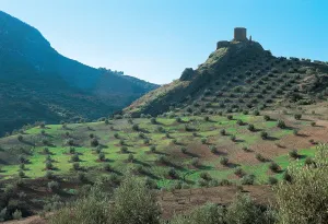
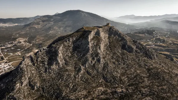
In the next fork is thrown on the left to link, shortly after, with the road to Las Casillas (km. 8.7). For a little more than a kilometer it is circulated through the region that barely supports traffic. In the middle of a hill a dirt lane is taken to the right (km. 10), which after a short rewind descends in the direction of a quarry and immediately to the same foot of the castle Víboras, located on a sharp rocky promontory. To the left the lane leads to the Casillas bordering what in the future will be a reservoir. A wave of soft hills subject to strict olive geometry surrounds Martos. Beyond, these same loins are raised, the ravines are deepened and then the landscape is haunted.
The mountains of the Caracolera, of moderate opulence, and Achillos, of more sharp appearance, truncate the horizon to almost 1,500 meters. The obstinate olive trees roar their tops, while at their feet the oil route runs. The road first savors the sweetness of the jiennese countryside, then it is adventure through the ravine of the Salado and finally stops at the bitter serrano orographic wall.


