Section Alcalá la Real - Castle of Locubín
Description
This stretch of the Mozário de Santiago Road connects Alcalá la Real with Castillo de Locubín over 16 kilometres. The tour goes not only through the characteristic olive trees that come along the road, but we find cherry trees that define the municipality of Castillo de Locubín. The stage has a moderate level and is an excellent option for those who enjoy nature, combined with the historical wealth of the peoples of southern Jaén.
_
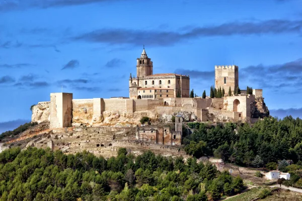
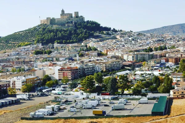
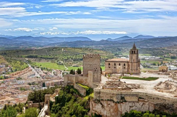
Alcalá la Real, a city of great historical value, extends to the feet of the impressive Fortaleza de la Mota, declared National Monument since 1931. Before leaving this town, it is recommended to visit its points of interest of important religious value. The church of Consolation, the church of Santo Domingo, the church of Our Lady of the Angustias, the church of St. John the Baptist, the Abacial Palace and the fountain of the Pilar of the Alamos. They are some of the highlights that reflect the rich cultural heritage of the city. >
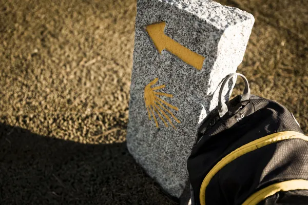
From the centre of Alcalá la Real, we seek the signs of the yellow arrows that will lead us to Castillo de Locubín. When we reach a traffic light, we must decide whether to continue directly to Alcaudete or take the variant by Castillo de Locubín. In this case, we continue to head for our destiny.
A NATURALEZA FLOWER
As we leave Alcalá la Real, we take the old street that leads to the village of Charilla, gradually ascending a well-defined lane. As we move forward, the road offers a spectacular view of the environment, splattered with cords surrounded by olive and cherry fields.
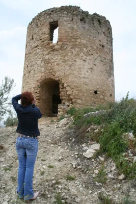
After a short and later climb, we reached the village of Charilla, a quiet and picturesque place, dominated by its historic tower, which has been a crossroads of roads since ancient times.
> After leaving Charilla behind, the road goes down gently to the Arroyo de Guadalcontón. Along this descent, the landscape is enriched with a variety of trees, such as walnuts, complaints and crocodices. In the plain, we accompany the stream for several kilometres, crossing it up to four times. This section is covered with views of a densely covered saw of forests.
Soon after, we arrived at the birth of the San Juan River, one of the most special places in the South Sierra. Here we can see how water flows directly from the ground, giving rise to the river. It is a perfect place to pause, relax and enjoy the serenity of nature.
_
From the birth of the San Juan River, we continue along the way, crossing a bridge and slowly ascending to Castillo de Locubín. When we reach the town, we find the Church of San Pedro on the main street, next to the City Hall. This church has a special connection to the Way of Santiago, as one of its architects, Ginés Martínez de Aranda, also worked in the Cathedral of Santiago de Compostela.
In the City Hall, pilgrims can get information about the municipal hostel, where to rest after this stage. Castillo de Locubín is a quiet village, ideal for relaxing before continuing with the next stretch of the Mozarto Road.
CONCLUSION OF THE RECORRID
This stretch between Alcalá la Real and Castillo de Locubín offers an immersion into the natural beauty of the Sierra Sur, combined with the historical heritage of the region. Along the course, the landscape varies between extensive olive trees, lush forests and cherry fields, a very important crop in Castillo de Locubín, which is known for the quality of its cherries, protagonists of the local economy and the famous Cherry Festival.
Datos de la ruta
ROUTE NAME
Tramo Alcalá la Real - Castillo de Locubín
TRAIL TYPE
--
DIFFICULTY
Moderada
TOTAL DISTANCE (IN KILOMETERS) 17 km
-
Stretch of asphalt or concrete: --
-
Section of track, forest road, or dry watercourse: --
-
Trail section: --
-
Sections of livestock trails: --
HUSO 30S
ESTIMATED TRAVEL TIME
ROAD SURFACE TYPE
ELEVATION CHANGE
400mm
400mm
DIFFICULTY. RATING ACCORDING TO THE MIDE METHOD
--
MEANS
Severity of the natural environment
--
ITINERARY
Route guidance
--
DISPLACEMENT
Difficulty moving about
--
EFFORT
Amount of effort required
ACCESSIBILITY TYPE
TIME OF YEAR
SIGNALING
No
PERFIL DE ALTURAS

MORE INFORMATION
TUNNELS
STEEL VIADUCTS
METAL WALKWAYS
WATER POINTS
PONTOONS
GUARD BOOTHS AND BARRIERS
SWITCHMAN'S CABINS
CYCLABILITY
RECREATIONAL OR SPORTS AREAS NEAR THE TRAIL
AID STATIONS
LINKS TO OTHER TRAILS
SHELTERS
RECOMMENDATIONS
OTHER INFORMATION OF INTEREST (ARCHITECTURAL OR HISTORICAL-CULTURAL, GEOLOGICAL-ECOLOGICAL)