Hiking Route El Cambrón
Description
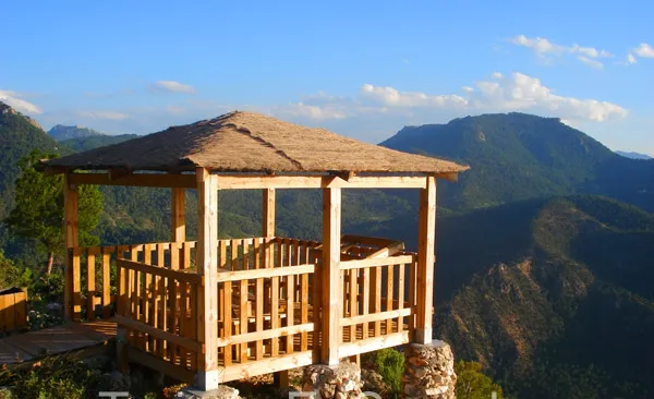
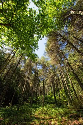
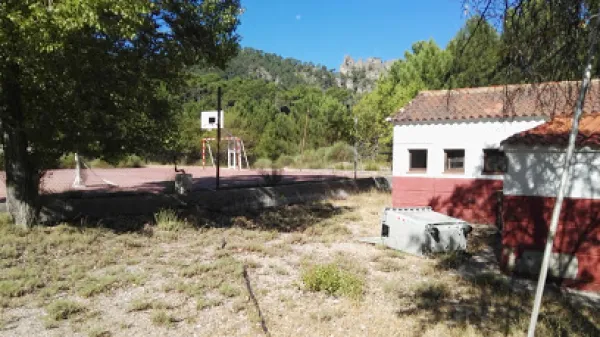
This route links the Recreative Area of the Dehesa del Bear with the Cambrón summit, a pétrea mole whose walls rise almost vertical on a pine sea. In the Dehesa del Bear we have a fountain with abundant flow, stone tables, small meadows and beautiful walnuts. The road gently ascends along a narrow forest track, in the middle of a closed black pine forest with abundant oak and some complaints, from which you enjoy views that go from the valley of the Onsares to Calar del Mundo, valley of the head of the Guadalimar and saw of Alcaraz, in Albacete.
Is part of

Datos de la ruta
ROUTE NAME
PR-A 173 Cumbre del Cambrón
TRAIL TYPE
Linear. Round trip
DIFFICULTY
Media
TOTAL DISTANCE (IN KILOMETERS) 4,6 km (solo ida)
-
Stretch of asphalt or concrete: 0
-
Section of track, forest road, or dry watercourse: 82.61%
-
Trail section: 17.39%
-
Sections of livestock trails: 0
HUSO 30S
30S x = 537973 and = 4257077
ESTIMATED TRAVEL TIME
2 h 45 min
ROAD SURFACE TYPE
Sandy and rocky
ELEVATION CHANGE
439mm
12mm
DIFFICULTY. RATING ACCORDING TO THE MIDE METHOD
2
MEANS
Severity of the natural environment
1
ITINERARY
Route guidance
2
DISPLACEMENT
Difficulty moving about
2
EFFORT
Amount of effort required
ACCESSIBILITY TYPE
Horse, on foot and bike
TIME OF YEAR
All year round
SIGNALING
No
PERFIL DE ALTURAS

MORE INFORMATION
TUNNELS
STEEL VIADUCTS
METAL WALKWAYS
WATER POINTS
PONTOONS
GUARD BOOTHS AND BARRIERS
SWITCHMAN'S CABINS
CYCLABILITY
RECREATIONAL OR SPORTS AREAS NEAR THE TRAIL
Dehesa del Bear
AID STATIONS
LINKS TO OTHER TRAILS
SHELTERS
RECOMMENDATIONS
The forest track of access to the Dehesa del Bear coincides with part of the PR-A 151 Siles- Villarrodrigo route.
OTHER INFORMATION OF INTEREST (ARCHITECTURAL OR HISTORICAL-CULTURAL, GEOLOGICAL-ECOLOGICAL)
Technical Description
This route links the Recreative Area of the Dehesa del Bear with the Cambrón summit, a pétrea mole whose walls rise almost vertical on a pine sea. In the Dehesa del Bear we have a fountain with abundant flow, stone tables, small meadows and beautiful walnuts.
The road gently ascends along a narrow forest track, in the middle of a closed black pine forest with abundant oak and some complaints, from which you enjoy views that go from the valley of the Onsares to Calar del Mundo, valley of the head of the Guadalimar and saw of Alcaraz, in Albacete. In the end it climbs through a path of pastors that opens way between the rocks, to reach the impressive stone platform of the calar, typical carstic landscape of lapiaz with some hills, in which only few isolated black pine trees dare grow.
From the fire surveillance shed there is a superb panoramic from the manchegan plains of Ciudad Real and Albacete to Sierra Nevada. Crossing to the other end of the calar is another house belonging to Castilla-La Mancha. In the area there is plenty of the rocky plane and the piquirred chova, and we can see the flight of the lion vulture and the pilgrim hawk. You can also see flocks of muflons.
In the Collado de Las Lagunillas, we would continue to the village of El Bellotar, in the province of Albacete. Instead, we turn the track to the right. From here, the track remains without possible loss until it ends at the foot of the calar, which will have to go up a sidewalk.
At the end of the track, we take a path of shepherds to the left that goes up in zig@-@ zag. As we enter the plateau platform, the path loses some definition. We must follow the marks that we will find in stone milestones, pine trees and plates that mark the limits of the Natural Park.
We finally arrived at the Jaén fire site. It is highly recommended to cross the calar to the place in its eastern part, belonging to Castilla-La Mancha, where it will take about 15 'to arrive.