DETOUR 02: Forestrand House Refuge del Campillo - Summit ofl Yelmo
Hiking, GR247 Forest Routes
Segura de la Sierra



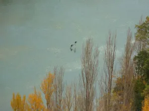

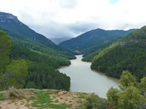
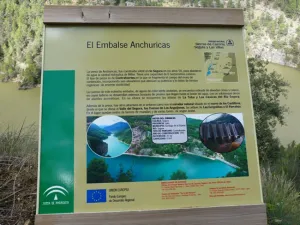
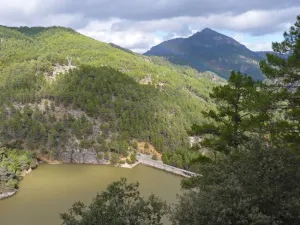

This small reservoir, set between dense pine trees and high mountains, is a delicious surprise to the visitor, because its level is usually high and, really, looks like a narrow lake. It collects the waters of the Segura River once it leaves the town of La Toba behind and extends for 4 - 5 km to its dam. Depending on the sunlight of the moment your waters can have different tonalities, from an intense blue to an emerald green, which adds more mystery to those already hidden...
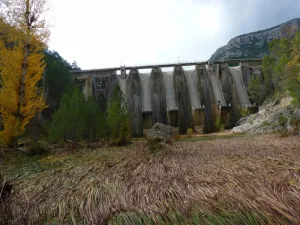
Under its waters is flooded the old village of Las Casicas. The dam that gave rise to the reservoir was completed in 1957 to supply the Miller hydropower plant with water, and upon receiving the Segura water, the village became a refuge more of the trout and barbs that swim in its waters.
As a faithful witness to the presence of the village has remained its church, a simple rectangular construction, damaged by the passage of time, that is serenely located on the waters of the reservoir above a mound surrounded by oaks, majuelos and jars.
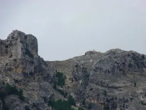
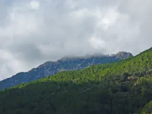
It is common to observe lethonated vultures flying over the reservoir. The surrounding mountains offer shelter to these rapes, and they are also a spectacular lookout for their waters. The views from the Puntal of the Mass, the Umbria of the Eguijones or the peak of the Majalon are possibly the most spectacular in this area.
ROUTE NAME
Embalse de Las Anchuricas
TRAIL TYPE
Linear. Round trip
DIFFICULTY
Media
TOTAL DISTANCE (IN KILOMETERS) 5,7 km
Stretch of asphalt or concrete: 0
Section of track, forest road, or dry watercourse: 0.01
Trail section: 0
Sections of livestock trails: 0
HUSO 30S
ESTIMATED TRAVEL TIME
2 h 3 min
ROAD SURFACE TYPE
Forest track
MAXIMUM ELEVATION CHANGE 167mm
330mm
411mm
DIFFICULTY. RATING ACCORDING TO THE MIDE METHOD
1
MEANS
Severity of the natural environment
1
ITINERARY
Route guidance
1
DISPLACEMENT
Difficulty moving about
2
EFFORT
Amount of effort required
ACCESSIBILITY TYPE
TIME OF YEAR
SIGNALING
Sí
MORE INFORMATION
TUNNELS
STEEL VIADUCTS
METAL WALKWAYS
WATER POINTS
PONTOONS
GUARD BOOTHS AND BARRIERS
SWITCHMAN'S CABINS
CYCLABILITY
RECREATIONAL OR SPORTS AREAS NEAR THE TRAIL
AID STATIONS
LINKS TO OTHER TRAILS
SHELTERS
RECOMMENDATIONS
OTHER INFORMATION OF INTEREST (ARCHITECTURAL OR HISTORICAL-CULTURAL, GEOLOGICAL-ECOLOGICAL)
El inicio de esta derivación se ubica en el nacimiento de agua de La Toba, lugar muy visitado, al que se accede desde la aldea caminando junto al arroyo que la atraviesa. Al dejar las últimas casas, paseamos entre una exuberante vegetación en torno al agua y a la zona de huerta que nos rodea. Entre berros y nogales, llegamos a una pared caliza donde se sitúa la cueva que da origen a esta caudalosa surgencia.
A partir del depósito de agua hay que seguir la estrecha pista que nos ha llevado hasta allí desde la aldea, para encontrar a los pocos metros la eras de trilla del cereal, ubicadas siempre en los lugares más estratégicos para aprovechar las corrientes de aire necesarias para el proceso del aventado. El camino discurre por zona de umbría, a cierta altura sobre el embalse, entre un frondoso bosque de pino laricio o salgareño, salpicado con bojedas, encinas, sabinas, enebros y arces.
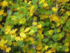
En la parte inicial del recorrido llaman la atención los antiguos bancales, sobre los que cultivaban los habitantes de estas tierras, ahora en desuso, con cantidad de nogales y otros frutales que tapizan el paisaje de color en los meses otoñales.
A los 500 metros del inicio, pasamos junto a unos nogales con una pequeña fuente. Bajo nosotros, a orillas del embalse, observamos la pequeña iglesia de Las Casicas, vestigio de la primitiva aldea que fue reubicada algo más arriba en el valle cuando se construyó la presa. Arriba en la cumbre nos llamará la atención el Puntal de la Misa, la Cuerda del Mosco y Poyo Alto, y bajo ellos, los cortijos de Los Barranquillos o del Fontarrón resaltan entre los verdes bosques.
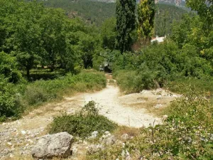
La pista discurre serpenteando y con escaso desnivel, con lo que el paseo es tranquilo y placentero entre abundantes plantas aromáticas. En una pequeña explanada se nos abre la magnífica vista que ha dado nombre a este lugar. A partir de este punto la pista comienza a descender para dejar a la izquierda y bajo la misma, la presa de Anchuricas.
Llegamos a un vado sobre el Río Segura, rodeados de mimbreras y chopos. A la izquierda se alza sobre nosotros la presa del embalse, construida en 1957, con fines hidroeléctricos fundamentalmente. En este punto se sitúa el final de este sendero, ya que vadear el río entraña cierto peligro pues puede haber subidas de caudal sin previo aviso, como indican las señales allí existentes.