
DETOUR 02: Forestrand House Refuge del Campillo - Summit ofl Yelmo
Description
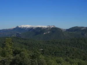
Because of its altitude and central situation in the Sierra de Segura, El Yelmo is an emblematic mountain in the popular culture of this region, as well as being a national and international point of reference in the world of free flight.
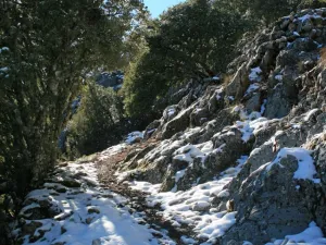
The route goes for the most part on a narrow and sometimes rather steep path, which was used earlier by cavalry and has been removed to be part of the Southern Forest Path.
This path is a magnificent alternative to reach the Yelmo summit by avoiding its forest track, which was paved some years ago to facilitate access to the free flight take-off enabled at the summit. We will walk through pine pineapple pineapples, by oak trees and by mixed forests of both species, being the abundant complaint in the first half of the way. We'll just see beautiful maples and albar thorns. Above the 1600 meters of altitude the piornal appears, splashed by the few and twisted lariffs that resist the harsh conditions of cold, snow, insolation and wind of the high mountain.
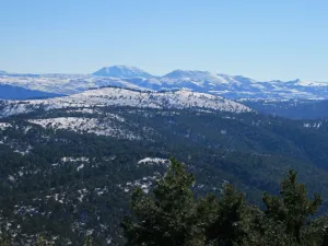
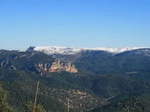
The views that we are gaining as we ascend are among the best we can get in the Natural Park, as we see the immense forests of the whole protected space, the distant Albaceteña and granadine summits and the manchegos.
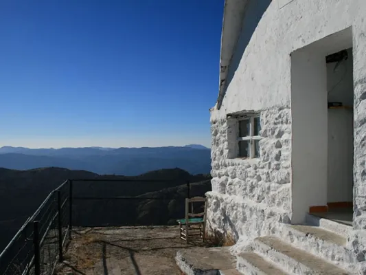
In the harmonious set of forests and olive groves in the low areas, the beautiful villages of Hornos de Segura and Segura de la Sierra, as well as the waters of the El Tranco reservoir, stand out in view of a bird. The summit's forest surveillance shelter, in which it is possible to see groups of mountain goats, is an exceptional viewpoint that we will hardly forget.
Datos de la ruta
ROUTE NAME
Refugio Casa Forestal del Campillo - Cumbre del Yelmo
TRAIL TYPE
Linear. Round trip
DIFFICULTY
Media
TOTAL DISTANCE (IN KILOMETERS) 3,15 km
-
Stretch of asphalt or concrete: 6.35%
-
Section of track, forest road, or dry watercourse: 0
-
Trail section: 93.65%
-
Sections of livestock trails: 0
HUSO 30S
According to Projection UTM Datum ETRS89
ESTIMATED TRAVEL TIME
1 h 36 min
ROAD SURFACE TYPE
Trail
MAXIMUM ELEVATION CHANGE 348mm
347mm
0mm
DIFFICULTY. RATING ACCORDING TO THE MIDE METHOD
1
MEANS
Severity of the natural environment
1
ITINERARY
Route guidance
2
DISPLACEMENT
Difficulty moving about
2
EFFORT
Amount of effort required
ACCESSIBILITY TYPE
On foot
TIME OF YEAR
Spring, summer and autumn
SIGNALING
Sí
MORE INFORMATION
TUNNELS
STEEL VIADUCTS
METAL WALKWAYS
WATER POINTS
PONTOONS
GUARD BOOTHS AND BARRIERS
SWITCHMAN'S CABINS
CYCLABILITY
RECREATIONAL OR SPORTS AREAS NEAR THE TRAIL
AID STATIONS
LINKS TO OTHER TRAILS
SHELTERS
RECOMMENDATIONS
OTHER INFORMATION OF INTEREST (ARCHITECTURAL OR HISTORICAL-CULTURAL, GEOLOGICAL-ECOLOGICAL)
Rutómetro
Km 0
Refugio Casa Forestal del Campillo
Salimos por la pista asfaltada que hay junto a la Casa Forestal y la abandonamos a los pocos metros para tomar el ancho camino que sale a la derecha.
Caminamos por un pinar de pino laricio salpicado de quejigos, viendo El Yelmo al frente. Las balizas de esta ruta llevan los colores blanco y amarillo, pues aunque está incluida en el Sendero Bosques del Sur, coincide en su totalidad con el PR-A 194. Al poco encontramos una bifurcación que tomamos a la derecha, apareciendo encinas y algunos arces.
A los 750 metros del inicio tomamos a la derecha la pequeña senda tradicional que sube a la cumbre, abriéndose a la izquierda magníficas vistas que van anticipando las que gozaremos desde la cumbre. La senda serpentea entre laricios y encinas, ganando altura a la vez que amplitud de panorámicas, para llegar a un collado con dos viejos y retorcidos quejigos en el que aparecen extraordinarias vistas hacia la otra vertiente, que se pierden en las llanuras de La Mancha.
Km 1,9
Pista del Yelmo
En este punto la senda llega a la pista asfaltada del Yelmo, que recorremos durante unos 100 metros para retomar nuestra senda a la izquierda, estando atentos a la baliza que la señala. Pronto volveremos a encontrar y abandonar la pista para seguir por la retorcida senda, ya por terreno rocoso y pelado.
Km 3,1
Cumbre del Yelmo
Alcanzamos la cumbre del Yelmo, que aunque tiene numerosas infraestructuras de telecomunicaciones, es el pico de toda la zona norte del Parque Natural que ofrece las mejores vistas: el valle de Cortijos Nuevos y sus aldeas hacia el oeste, y más allá, las llanuras manchegas de Ciudad Real; hacia el sur, el gran embalse del Tranco, las altas montañas de las Sierras de Las Villas, Cazorla y El Pozo, así como el pico de La Sagra, ya en Granada, que roza los 2400 metros de altitud; y hacia el este el norte, los numerosos telones que conforman los calares de la Sierra de Segura, hendida por los valles de los ríos Madera y Segura, y el Calar del Mundo, en la provincia de Albacete.