Is part of




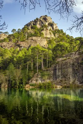
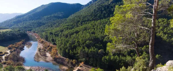
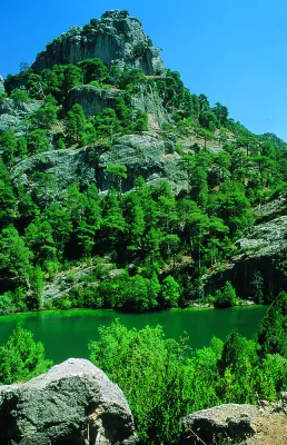
The Guadaltiín River in its journey has cultivated a valley of great beauty. Its shores are covered by lush vegetation: maples, strawberries, chopos, and complaints accompany it on its way. It stops in remnants of crystalline waters where the otter and the Iberian crab live; and sometimes the slopes narrow and form closed that accelerate the passage of the water. This is an essential excursion for anyone who wants to know this Natural Park.
A road to the right is about 400 metres from the forest house of the source of Steel that will take us to the top of the Guadaltiín River.
From the Fuente de los Chorros, which can be considered its birth, to Vado Carretas, the Guadalanimin is watched by a high wall, the Cabrilla saw, which rises almost 1000 meters above its waters, and is shown in a succession of poyos and cliffs. In this Sierra there are some of the highest peaks of the Natural Park, such as the Cerro de los Tornajos, the Pico las Covachas or the Empanadas, which exceed 2,000 m. This saw is also the limit with the province of Granada.
The river is surrounded by beautiful pastures, cortijos and fields of abandoned crops, and with them great nogueras and other fruit trees that show us life in other times. Some of these corijos are in places that are remnants of peace and invite us to make a stop and enjoy the landscape.
We suggest...
In Cazorla take the Sierra road (A-319) until the crossing known as the Empalme del Valle. Turn right on the JF-7092 road and after passing the bridge over the Guadalquivir River (4 km from the Empalme) follow the left track (JF-7091). Passing the Sail of San Pedro and the Strait of the Perals we find on the right the ruins of the forest house of Fuente Econo.
Is part of