ALTERNATIVE GR 247.1 STAGE 1: Prado Maguillo and Forestrand House Refuge El Bodegón - Río Madera
Hiking, GR247 Forest Routes
Santiago Pontones



It is a beautiful route that has also been very well conditioned and marked. If it is addressed from bottom to top, the route begins at the detour on the road that leads to the Utrera Strike from the JF-7038, by asphalt track in just 900 meters. The route is described starting from here. From above it starts in Poyotello. At the entrance to this village, on the left, there is an era (steep platform) from which it starts our path.
ROUTE NAME
HUELGA UTRERA A CUEVA DEL AGUA Y POYOTELLO
TRAIL TYPE
Linear. Round trip
DIFFICULTY
Media
TOTAL DISTANCE (IN KILOMETERS) 6,06 km (solo ida)
Stretch of asphalt or concrete: 14.85%
Section of track, forest road, or dry watercourse: 85.08%
Trail section: 0
Sections of livestock trails: 0
HUSO 30S
ESTIMATED TRAVEL TIME
4 h 10 min (ida y vuelta)
ROAD SURFACE TYPE
Sandy and rocky
ELEVATION CHANGE
569mm
154mm
DIFFICULTY. RATING ACCORDING TO THE MIDE METHOD
1
MEANS
Severity of the natural environment
1
ITINERARY
Route guidance
1
DISPLACEMENT
Difficulty moving about
3
EFFORT
Amount of effort required
ACCESSIBILITY TYPE
TIME OF YEAR
SIGNALING
No
PERFIL DE ALTURAS

MORE INFORMATION
TUNNELS
STEEL VIADUCTS
METAL WALKWAYS
WATER POINTS
PONTOONS
GUARD BOOTHS AND BARRIERS
SWITCHMAN'S CABINS
CYCLABILITY
RECREATIONAL OR SPORTS AREAS NEAR THE TRAIL
The birth of the Segura, La toba and La Morringa
AID STATIONS
LINKS TO OTHER TRAILS
SHELTERS
RECOMMENDATIONS
OTHER INFORMATION OF INTEREST (ARCHITECTURAL OR HISTORICAL-CULTURAL, GEOLOGICAL-ECOLOGICAL)
The tour is marked by beacons and directional arrows such as PR-A 195.
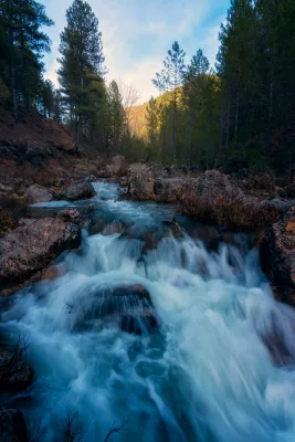
Throughout it we find numerous streams, which are suitable places for rest. Special mention is worth the Charco del Humo and the Cueva del Agua, in the middle of the tour, places with special charm, which well deserve a longer stop.
Technical Description
It is a beautiful route that has also been very well conditioned and marked. If it is addressed from bottom to top, the route begins at the detour by the cart that leads to Utrera Strike from the JF-7038, by asphalt track in just 900 meters. The route is described starting from here. From above it starts in Poyotello. At the entrance to this village, on the left, there is an era (steep platform) from which it starts our path.
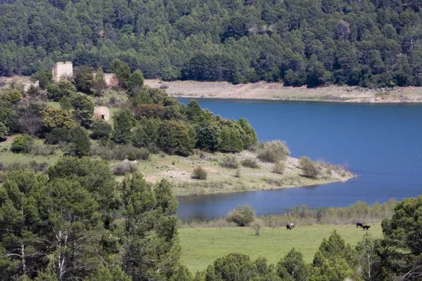
From below, it begins near the quiet village of Huberga Utrera and goes back to the Segura River next to gardens and large nogueras, in the midst of a beautiful landscape of larice pine, of which powerful limestone canteens emerge. Next to the path are the hazelnut, the wild rosewood and the agribusiness, the maple, the sabina and the complaint are frequent, as well as terraces of gardens already abandoned with large nogueras,
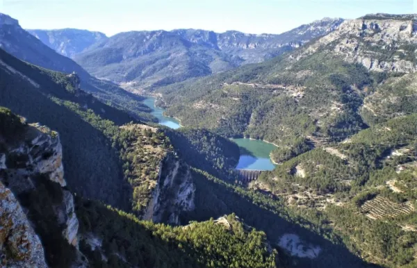
The road is narrow becoming a horseshoe road that continues to ascend along the left bank of the Segura River. The valley is narrow and we walk flanked by impressive vertical walls, baked with numerous caves and abrupt hillsides covered by oak trees. From kilometer 2.4 we find a strong upward slope for 300-400 meters and then descend another 300 meters and we go up to km 4, where we find the signposted detour to the Charco del Humo, to the right, where the river is cleared with force in transparent poches in the midst of a dense vegetation of hazelnuts, willows and mountain olms. In spring we will be able to observe endemic species in flower such as the Cazola violet (Viola cazorlensis) and the grasilla or trapamosque (Pinguicola valisneriifolia)
Displacement to the Charco del Humo: the route is in the valley and we go through it from time to time On our right the valley begins to open, as the Arroyo Patas brings its waters to the Segura, and at this point we can turn to the right just 100 m, pass an old bridge and, under it, contemplate the impressive Charco del Humo, where the river is cleared with force in transparent poches in the midst of a dense vegetation of hazelnuts, willows and mountain olms.
We return through our steps to our route to continue to climb the Segura valley and reach after 4.7 km to the Cueva del Agua, one of the most attractive of this tour, which is a prominent exponent of the Karstico Segureño landscape. From this wide cavity, through which water usually circulates, good views are enjoyed over the Segura canyon.
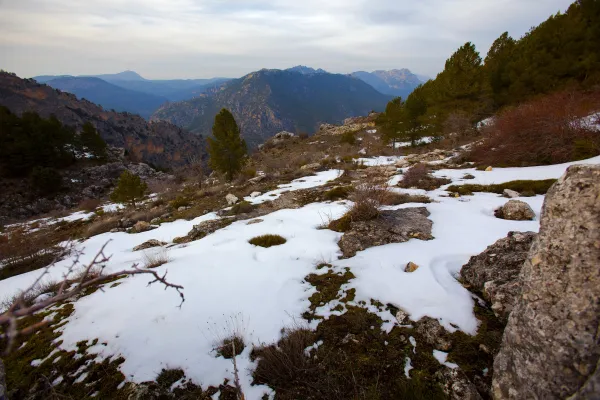
If we continue the ascending route, leaving the valley behind, and now walking a more demanding path in effort, we can reach the village of Poyotello at the end of the route, at 6.056 km from the beginning, it is located on a natural balcony on the top of the Segura canyon at 1,440 m altitude. From here, already in a typical livestock landscape, you can see a wide range of views of the area.