ALTERNATIVE GR 247.1 STAGE 1: Prado Maguillo and Forestrand House Refuge El Bodegón - Río Madera
Hiking, GR247 Forest Routes
Santiago Pontones



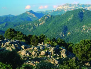

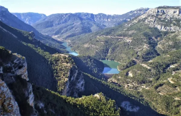
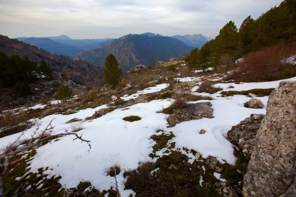
The route begins in the heart of the Fields of Henán Perea, altiplanicie located between the 1600- 1700 m altitude, almost devoid of trees, very rocky and with infinity of formations as a funnel (dolines and simas) that indicate, the difficult winter conditions and the nature of its composition. We are in the largest "sponge" in the park, the limestone absorbs the water, dissolving over the years and forming this landscape so characteristic that many resemble a lunar landscape. Although on certain occasions of the year it may even seem like a desert and dry land, nothing further than reality, under us is the largest underground aquifer of the park.
ROUTE NAME
CAMPO DEL ESPINO A CUMBRE DEL BANDERILLAS
TRAIL TYPE
Linear. Round trip
DIFFICULTY
Media
TOTAL DISTANCE (IN KILOMETERS) 7,63 km (solo ida)
Stretch of asphalt or concrete: 0
Section of track, forest road, or dry watercourse: 89.16%
Trail section: 10.84%
Sections of livestock trails: 0
HUSO 30S
ESTIMATED TRAVEL TIME
4 h (ida y vuelta)
ROAD SURFACE TYPE
Sandy and rocky
ELEVATION CHANGE
347mm
70mm
DIFFICULTY. RATING ACCORDING TO THE MIDE METHOD
2
MEANS
Severity of the natural environment
1
ITINERARY
Route guidance
2
DISPLACEMENT
Difficulty moving about
3
EFFORT
Amount of effort required
ACCESSIBILITY TYPE
TIME OF YEAR
SIGNALING
No
PERFIL DE ALTURAS

MORE INFORMATION
TUNNELS
STEEL VIADUCTS
METAL WALKWAYS
WATER POINTS
PONTOONS
GUARD BOOTHS AND BARRIERS
SWITCHMAN'S CABINS
CYCLABILITY
RECREATIONAL OR SPORTS AREAS NEAR THE TRAIL
Safe Source
AID STATIONS
LINKS TO OTHER TRAILS
SHELTERS
RECOMMENDATIONS
The route begins in the heart of the Fields of Henán Perea, altiplanicie located between the 1600- 1700 m altitude, almost devoid of trees, very rocky and with infinity of formations as a funnel (dolines and simas) that indicate, the difficult winter conditions and the nature of its composition. We are in the largest "sponge" in the park, the limestone absorbs the water, dissolving over the years and forming this landscape so characteristic that many resemble a lunar landscape. Although on certain occasions of the year it may even seem like a desert and dry land, nothing further than reality, under us is the largest underground aquifer of the park.
The area with the most abundant fresh pastures in the hottest months and therefore thousands of "segureña" sheep run through this altiplanicie during the period. Our tour has its beginning in a pastoralist shelter that is located in the countryside of Espino, from there we see the Banderillas, the final objective of it. We started in a southwestern direction on the existing forest track, which at first appears a certain linearity. This track is the most passed, especially by the pastors in their movements with the herds.
At 900 m from the start we take a turn to the right, leaving the main track to the left, in this area there are innumerable tracks of vehicles that pass through the canyon, due to the difficult conditions of passage in winter with snow, and in the melting period, Although we find several options of the pull, there is no need to worry because in the end almost all, they lead to the same place. We must maintain the direction now more towards the West. We cross the Carabina Canyon and at 1.7 km from the beginning we leave to our left some ruins, which correspond to the Cortijo del Campo del Espino, to the left of it, usually pastors put salt stones to the sheep flocks (as a food supplement) so it is very common to observe wild fauna (deer, gores, muflons or mountain goats) in that area.
We leave the ruins about 500 m away, to our left, and right ahead there is a larix pine forest, to the right a peeled hill stands out in the landscape, is the Majal de la Carrasca (1812 m), the track passes between the pine and the base of the hill, maintaining the west direction.
At 3.9 km we arrive at a fork, at the front of the road of Pinar Negro, more transited, we continue to the right by a track that is smooth between hills without trees. A few 250 m away we reach a natural balcony over the Aguamulas valley, the Guadalquivir and many other places in the Park. Our route is dimensioned in space and altitude, although from the beginning we were at more than 1700 m, is now when we acquired the feeling of height. And right now, the ascension to the Banderillas (roof of the Segura Region) begins. We continue our track, no options for the desist, now back in the south-west direction.
We soon entered the slopes of the Banderillas, to which are grasped centenary larix pine trees that withstand extreme weather conditions and a predominant bush the boj. Again we are in a very suitable area for wildlife observation, especially if it is sunrise or sunset. In addition, it is very common to meet with a lion's vulture on top of the hillsides, or to overtake us.
Spectacular views, accompany us to the left, altiplano of the Campos de Hernán Perea, Sierra Nevada, La Sagra etc. At 8.8 km from the start, the track ends to continue on a narrow path, which continues to ascend, there are no other options, in just over 800 m will take us to the summit of the Banderillas, where we will find two fire surveillance hubs and probably one of the wider panorama of the Natural Park, as we have to bear in mind that it is the highest altitude we find over the Guadalquivir Valley.
OTHER INFORMATION OF INTEREST (ARCHITECTURAL OR HISTORICAL-CULTURAL, GEOLOGICAL-ECOLOGICAL)