Valdeinfierno
Description
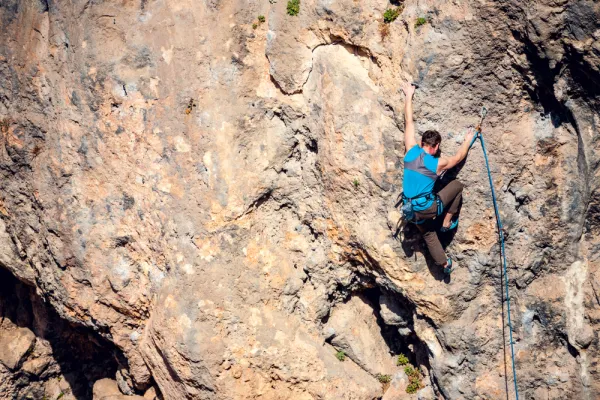
Landing school hard to locate. Explosive climb over granite. Reliable security equipment. The average height is 8 meters. The maximum height is 15 meters.
Datos de la ruta
ROUTE NAME
Valdeinfierno
TRAIL TYPE
--
DIFFICULTY
--
TOTAL DISTANCE (IN KILOMETERS) --
-
Stretch of asphalt or concrete:
-
Section of track, forest road, or dry watercourse:
-
Trail section:
-
Sections of livestock trails:
HUSO 30S
30S x = 401714 and = 4247322
ESTIMATED TRAVEL TIME
ROAD SURFACE TYPE
Road
--
--
DIFFICULTY. RATING ACCORDING TO THE MIDE METHOD
--
MEANS
Severity of the natural environment
--
ITINERARY
Route guidance
--
DISPLACEMENT
Difficulty moving about
--
EFFORT
Amount of effort required
ACCESSIBILITY TYPE
TIME OF YEAR
Spring and autumn
SIGNALING
No
MORE INFORMATION
TUNNELS
STEEL VIADUCTS
METAL WALKWAYS
WATER POINTS
PONTOONS
GUARD BOOTHS AND BARRIERS
SWITCHMAN'S CABINS
CYCLABILITY
RECREATIONAL OR SPORTS AREAS NEAR THE TRAIL
AID STATIONS
LINKS TO OTHER TRAILS
SHELTERS
RECOMMENDATIONS
OTHER INFORMATION OF INTEREST (ARCHITECTURAL OR HISTORICAL-CULTURAL, GEOLOGICAL-ECOLOGICAL)
Number of routes:50
You're up to V:10%
Votes from V + to 6c +:55%
Vies from 7a to 7c +:35%
Eight-way:0%
Technical Description
Best time:From autumn to spring
Where to drink. -In the village.
How to get there. -From Andújar take the road to the Sanctuary of the Virgin of the Head. Between kilometer 15 and 17 we will see the area of walls and blocks on our right. Parking by the road. The scalable walls and blocks are evident.