

Route del Toro Bravo
Description
This route connects us to the north-west of the park, where you will find the National Contradero-Sealing Party.
Datos de la ruta
ROUTE NAME
Ruta del Toro Bravo
TRAIL TYPE
--
DIFFICULTY
--
TOTAL DISTANCE (IN KILOMETERS) 88 km
-
Stretch of asphalt or concrete:
-
Section of track, forest road, or dry watercourse:
-
Trail section:
-
Sections of livestock trails:
HUSO 30S
ESTIMATED TRAVEL TIME
5 h
ROAD SURFACE TYPE
Road
--
--
DIFFICULTY. RATING ACCORDING TO THE MIDE METHOD
--
MEANS
Severity of the natural environment
--
ITINERARY
Route guidance
--
DISPLACEMENT
Difficulty moving about
--
EFFORT
Amount of effort required
ACCESSIBILITY TYPE
TIME OF YEAR
All year round
SIGNALING
No
MORE INFORMATION
TUNNELS
STEEL VIADUCTS
METAL WALKWAYS
WATER POINTS
PONTOONS
GUARD BOOTHS AND BARRIERS
SWITCHMAN'S CABINS
CYCLABILITY
RECREATIONAL OR SPORTS AREAS NEAR THE TRAIL
AID STATIONS
LINKS TO OTHER TRAILS
SHELTERS
RECOMMENDATIONS
The ideal time to visit from October to the end of April. Set up for 4 hours minimum.
OTHER INFORMATION OF INTEREST (ARCHITECTURAL OR HISTORICAL-CULTURAL, GEOLOGICAL-ECOLOGICAL)
- Peñallana vineyards
- The Scoriales, area with cattle of ligia
- National Contradero-Sealing Cow
- Mirador Los Alarcornes
- Mirador Los Pastores
- El Centenillo, former mining village of Baños de la Encina
- La Carolina, La Aliseda recreational area
Technical Description
The tour begins at point 0 of the road J-5010 to the Sanctuary of the Virgin of the Head and Puertollano. In the first three kilometers we move between the family gardens and the irrigations of the terraces of Guadalquivir to pass, at the point of kilometer 4,500, by olive land. From this point, coinciding with the state's stallion stop, the terrain becomes more serrano, first by shrubs and pasture dehesa, gradually passing to high density repopulation pines. At the kilometer point 12,300 we can visit the Visitor Center of the Natural Park Viñas de Peñallana, a place where magnificent recreational farms, known as "Viñas," are located. At the kilometer point 14,200 we take the right deviation on the JH-5002 road, which runs between more or less mixed pineas with lentils, coscojas and jars of great faunistic wealth and cynetic and livestock dedication. At this crossing there are two restaurants, last point for breakfast or a snack in two or three hours. The road has a regular state of conservation.
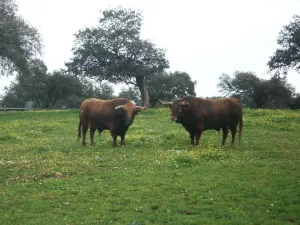
Around the 18th kilometer of the tour, the pineapple disappears, the landscape is dehesa of pastures with oak and cork trees, mainly, and panoramic views of the saw open on both sides. Towards kilometer 21 begins a magnificent adhesado encore in which the bulls of the Finca de los Escoriales, of the iron of D. Germán Gervás, founded in 1959, are pasted. In the km 24,100 we found the mines of Los Escoriales, which was already exploited by the Romans. At the kilometer 24,400 we are at a crossroads and a tentadero. The detour to the left will lead us to the Jandula Embalse. Following to the right we will pass through the Tapicas farms, the Farms of Flores- Albarrán, Navas of Benjamin Sordo or The Alarms of Samuel Flores, the latter since 1928, places where we can discover the bravo bull in its middle, the fences of protection and management, the places of food and abrevadero, along with some protected species or cynetics. From the kilometer point 32,800 you can see magnificent views that must not be lost: to the right, of the Sierra de Ambroz (761 m.), and to the left of the Embalse del Rumblar and the Castle of Burgalimar, in Baños de la Encina. From here on the road continues north, passing through the big house-cortijo of Los Alarcones. The landscape opens to the mountains of Ambroz and Los Calderones, at the northeastern end of the Natural Park of the Sierra de Andújar. At point kilometer 42, and coinciding with the beginning of the National Cote of Selladores- Contadero, we will see areas of small pinars that intermingle with the dehesa and the matorral; later the pinar spots are larger and dense although retaining some copies of alcornoque. The road improves and becomes descending, turning from the house of Selladores to the southeast. The landscape, leaving Selladores- Contadero, changes to a mountain of shrubs dominated by the lentisco jara and natural pastures; thus we arrive at Nava del Sach, in the kilometer 64, where there are catalogued rock paintings, to ascend from here to El Centenillo, a former mining village, in which environment we can see numerous scaffolding of the mines that operated until the 1950s, now converted into a residential core. In this small town we can make a recess to take an appetizer and taste the typical dishes of the place, including hunting meat stew and serrano products. We continue the last part of the route, already on a road of saw in perfect condition of conservation to La Carolina, distant about 16 km, descending from El Centenillo to the Rio Grande, where the pine definitely disappears to follow already on the ground of bushes and pastures and cross the river of the Campana.