Trail El Santuario
Description
The proverbial depopulation of Sierra Morena, and the consequent preservation of its natural wealth, has here, in the Andújar saw, one of its clearest manifestations. In an agribusiness territory, 30 kilometres from Andújar, the sanctuary of the Virgin of the Head is raised, which finds its meaning in such a strange location. For centuries he has attracted a large number of pilgrims from remote places and year by year, he has concentrated crowds in one of the country's most popular romaneries. The path brings together in its brief journey nature and history, landscapes and tradition.
Datos de la ruta
ROUTE NAME
Sendero El Santuario
TRAIL TYPE
Linear
DIFFICULTY
Baja
TOTAL DISTANCE (IN KILOMETERS) 3 km
-
Stretch of asphalt or concrete:
-
Section of track, forest road, or dry watercourse:
-
Trail section:
-
Sections of livestock trails:
HUSO 30S
ESTIMATED TRAVEL TIME
46 min
ROAD SURFACE TYPE
Lane - road
ELEVATION CHANGE
82mm
82mm
DIFFICULTY. RATING ACCORDING TO THE MIDE METHOD
2
MEANS
Severity of the natural environment
1
ITINERARY
Route guidance
1
DISPLACEMENT
Difficulty moving about
1
EFFORT
Amount of effort required
ACCESSIBILITY TYPE
On foot
TIME OF YEAR
All year round
SIGNALING
No
MORE INFORMATION
TUNNELS
STEEL VIADUCTS
METAL WALKWAYS
WATER POINTS
PONTOONS
GUARD BOOTHS AND BARRIERS
SWITCHMAN'S CABINS
CYCLABILITY
RECREATIONAL OR SPORTS AREAS NEAR THE TRAIL
AID STATIONS
LINKS TO OTHER TRAILS
SHELTERS
RECOMMENDATIONS
OTHER INFORMATION OF INTEREST (ARCHITECTURAL OR HISTORICAL-CULTURAL, GEOLOGICAL-ECOLOGICAL)
- Mediterranean mountain and oak and cork dehesas.
- Cortijo La Huerta de los Fráiles.
- Membrellar Arroyo.
- Popular sanctuary on the hill of the Cabezo with various associated infrastructure and equipment.
Technical Description
If you come from Andújar on the road A-6177 towards the shrine of the Virgin of the Head, we will have to get to its vicinity, thus walking about 30 kilometers, to be located at the point of start of the path, located next to the road two hundred meters before the last crossing to the sanctuary.
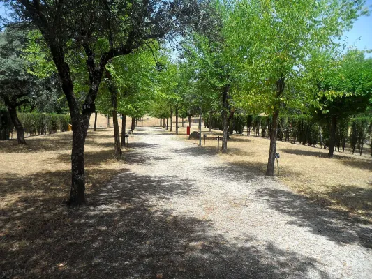
We are at the foot of the hill of the Cabezo, the promontory where the sanctuary that we have in front of us is located, less than a kilometre away in a straight line and about 50 meters away. Surrounded by a forest of black pines, we take the way to the south-west, just up to a crossing - at about three hundred meters - where we have to turn 90 degrees to our right. We soon arrived at a cortijo called La Huerta de los Fráiles, a name that makes clear reference to its use by religious guardians of the sanctuary. We will round the building by recovering the south-west direction to keep it alone for two hundred meters, until we reach a crossing at which we will deviate by a track to the right.
We will pass under a high-voltage electric line and we will immediately cross the Membrellar stream, from where we can see panoramic views towards the valley of the Jandula River as it passes through the New Place, an emblematic public mountain for its great ecological and cynetic wealth. We gradually approach the slopes of the hill of the Cabezo and the urbanized space that occupy there various cofradies and facilities linked to the sanctuary and to the famous and multitudinary Romany that is celebrated on the last Sunday of April.
Moving in the same direction on foot of the hill, we will reach the asphalt road on which we start our way, to which we will join on our left to walk it just over 50 meters, always with due caution.
Thus we will reach the steep street of the Sanctuary, which goes up to it with a considerable slope of about three hundred meters. Above the hill ends the path, although here we are offered different offers, such as visiting the sanctuary and its surroundings, or approaching the lookout from where a wide view of Sierra Morena is covered.