

Torres - Hondacabras - Fuenmaandor - Puerto de Torres - Castillejos - Mata Bejid - Centro de visitantes del Natural Park
Description
This route crosses the Sierra Magina massif by immediate areas to the high mountain. The tour begins and ends at the limits of the Natural Park, from south to north, through it completely.
Is part of

Datos de la ruta
ROUTE NAME
Torres - Hondacabras - Fuenmayor - Puerto de Torres - Castillejos - Mata Bejid - Centro de visitantes del Parque Natural
TRAIL TYPE
--
DIFFICULTY
--
TOTAL DISTANCE (IN KILOMETERS) --
-
Stretch of asphalt or concrete: --
-
Section of track, forest road, or dry watercourse: --
-
Trail section: --
-
Sections of livestock trails: --
HUSO 30S
ESTIMATED TRAVEL TIME
ROAD SURFACE TYPE
Forest track
--
--
DIFFICULTY. RATING ACCORDING TO THE MIDE METHOD
--
MEANS
Severity of the natural environment
--
ITINERARY
Route guidance
--
DISPLACEMENT
Difficulty moving about
--
EFFORT
Amount of effort required
ACCESSIBILITY TYPE
TIME OF YEAR
SIGNALING
No
MORE INFORMATION
TUNNELS
STEEL VIADUCTS
METAL WALKWAYS
WATER POINTS
PONTOONS
GUARD BOOTHS AND BARRIERS
SWITCHMAN'S CABINS
CYCLABILITY
RECREATIONAL OR SPORTS AREAS NEAR THE TRAIL
AID STATIONS
LINKS TO OTHER TRAILS
SHELTERS
RECOMMENDATIONS
OTHER INFORMATION OF INTEREST (ARCHITECTURAL OR HISTORICAL-CULTURAL, GEOLOGICAL-ECOLOGICAL)
Technical Description
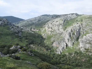
From Torres, and through the Pila Pellenda parquet, a mountain road is started towards Albanchez de Magina. A few four kilometres away we find a right turn, which gives access to the youth camp area Hondacabras. These sites were cattle's rest on the freckles that passed through these mountains. In this place begins a forest track between pine trees that gradually ascends for 4 Km, something beyond the Nita Fountain. When we get to the crossing we will change direction to make the promotion to the Port of the Mata. The floor of the track is firm, but we will find some outstanding ramps that the less experienced can invite them to take off their bikes. In 3.5 km the port is reached, a step between mountains - some above 2,000 meters. The landscape is a gift for the view: all the southern side of the Natural Park, mountains more than 2,000 meters of altitude (Almadén, 2.036 m., Ponce, 2.006 m and Cerro Cárceles, 2.061 m.), and dehesas in height of complaints, flocks of sheep..., and on the horizon the province of Granada. The rest of the way is down. Five and a half kilometres from the port we arrived at the Castlejo de Mata Bejid, a beautiful place that housed a garrison, which watched this passage on the Middle Ages border, and that until the first half of the 20th century it housed several families of settlers who cultivated the dehesas along the way. This castle was donated to the city of Jaén by the Catholic Kings in 1494, in reward for the services provided in the conquest of Cambil and Alhabar. Two kilometers of olive trees take us to the Cambil-Huelma road. At this point it is worth looking at the corrijada of Mata Bejid, where the spirit of the belle époque with rural dyes is still revived. It is a private property that has an interesting chapel, gardens, house of the gentlemen and even a garage of regionalist style. From here we can choose to go down to the town of Cambil, by the course of the Oviedo River (5 Km.), or better to get close to the new Visitors Center of the Natural Park just three km away. In addition to information from all over the Park, the centre has a shop, meringers, children's games, fountain, services and a walk area for people with reduced mobility.