

Route de los Puentes



Is part of

Datos de la ruta
ROUTE NAME
Ruta de los Puentes
TRAIL TYPE
--
DIFFICULTY
Baja
TOTAL DISTANCE (IN KILOMETERS) 28 km
-
Stretch of asphalt or concrete: --
-
Section of track, forest road, or dry watercourse: --
-
Trail section: --
-
Sections of livestock trails: --
HUSO 30S
ESTIMATED TRAVEL TIME
2 h 30 min
ROAD SURFACE TYPE
ELEVATION CHANGE
335mm
335mm
DIFFICULTY. RATING ACCORDING TO THE MIDE METHOD
--
MEANS
Severity of the natural environment
--
ITINERARY
Route guidance
--
DISPLACEMENT
Difficulty moving about
--
EFFORT
Amount of effort required
ACCESSIBILITY TYPE
TIME OF YEAR
SIGNALING
No
MORE INFORMATION
TUNNELS
STEEL VIADUCTS
METAL WALKWAYS
WATER POINTS
PONTOONS
GUARD BOOTHS AND BARRIERS
SWITCHMAN'S CABINS
CYCLABILITY
RECREATIONAL OR SPORTS AREAS NEAR THE TRAIL
AID STATIONS
LINKS TO OTHER TRAILS
SHELTERS
RECOMMENDATIONS
Route without difficulty. Only a few forces will have to be saved for the reels of the end. It can be done at any time of the year, in summer the central hours of the day will be avoided. Water should be provided in Las Casillas.
OTHER INFORMATION OF INTEREST (ARCHITECTURAL OR HISTORICAL-CULTURAL, GEOLOGICAL-ECOLOGICAL)
Technical Description
At the entrance of Las Casillas is the post that indicates the beginning of the route. Following Francisco Molina Malonado Street, you can reach the Constitution Square. There, a street descends to the left and soon becomes a dirt lane that goes directly down to the Vega of the Víboras River. After having rolled about 400 meters per asphalt, you have to deviate (km. 2.2) and take on the right a track that starts next to a villa.
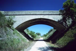
Later on, the path of the dam is left, also to the right. Soon after, the ruins of the Víboras castle are seen on the opposite side. After 3 kilometers, it flows into the former national (km. 10.7). Through its asphalt is the pedanía of the Venta Pantalones, the river Víboras is once again crossed and it begins to rise until it finds the dirt lane (km. 12.4) that links with the layout of the old Oil Train. The route is now headed for the site known as El Pontón, where you can admire a spectacular modernist viaduct that rises a few meters from a Roman stone bridge. The same way of the train goes back and there is a ruined foothold (km. 18,9). At this point you have to leave the railway platform to take a cash track, the street of the Carriles. First it crosses the old national and within 2 kilometers it flows into the district of Las Casillas. At a half-climb there is the detour (km. 23.6) that leads to a quarry and to the foot of the Víboras castle. There it continues along the left lane that with some strong repo ends at the entrance of the village.
The Jaén-Campo Real railway line saw the last train pass in 1984. After twelve years of abandonment the administration today wants to turn this forgotten iron road into a true green corridor, suitable for ecotourism. Along its 121 km the road passes through places of unique beauty, such as El Pontón, where through a bold viaduct it saves the skulls of the Víboras river. A few meters away, a raging Roman bridge puts a delicate counterpoint in the form of decimononic engineering.
