Hiking Route el Aguardentero (La Osera)
Description
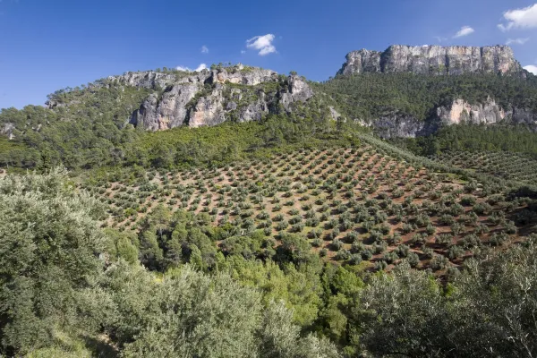
This path will allow you to discover one of the most charming environments in the Las Villas mountains. It runs along the natural channel of the river Aguascebas Chico, where we will discover unusual and unexpected corners. Following him, on our right, we found fenced land of ancient crops and a small cortijo half-melting. This place is known as "Las Ramblillas." In the deep valley you can see the river Aguascebas Chico.
We deviate from the road, in order to see, upstream, a spectacular leap of water, with a large poza in its base, whose waters look an emerald green by the reflection of the lush vegetation surrounding it. Let us take our way back, to reach a small hill, with a very particular silhouette. It is the Paso del Aguartedo, place of impressive views towards the countryside.
The path is conditioned and low, with a serpentating route, on a steep and rocky slope. On our left we found a striking oquity - an ashtray - where the shepherds used to keep their cattle. Below we reach a small lookout, where the path is fork. We follow the one on the right, until we get back to the channel to contemplate the majestic cascade of the Osera, perhaps one of the highest and beautiful waterfalls of Andalusia.
We continue along the path marked, by the narrow and steep ravine, enjoying the multiple pozas of the channel, to a walkway that crosses the river and back the path to the Odera lookout. If at this point we continue along the road that goes parallel to the channel, we will reach the explanade of La Osera, place where the vehicles are left when it is accessed from Mogón.
For these wonderful places it is very easy to observe the flight of the leonate vulture. The real eagle is also present and, if we look well, we can even see the little perdicular eagle.
Is part of

Datos de la ruta
ROUTE NAME
Ruta de senderismo el Aguardentero (La Osera)
TRAIL TYPE
--
DIFFICULTY
Baja
TOTAL DISTANCE (IN KILOMETERS) --
-
Stretch of asphalt or concrete: --
-
Section of track, forest road, or dry watercourse: --
-
Trail section: --
-
Sections of livestock trails: --
HUSO 30S
ESTIMATED TRAVEL TIME
ROAD SURFACE TYPE
Road
--
--
DIFFICULTY. RATING ACCORDING TO THE MIDE METHOD
--
MEANS
Severity of the natural environment
--
ITINERARY
Route guidance
--
DISPLACEMENT
Difficulty moving about
--
EFFORT
Amount of effort required
ACCESSIBILITY TYPE
TIME OF YEAR
Spring
SIGNALING
No
MORE INFORMATION
TUNNELS
STEEL VIADUCTS
METAL WALKWAYS
WATER POINTS
PONTOONS
GUARD BOOTHS AND BARRIERS
SWITCHMAN'S CABINS
CYCLABILITY
RECREATIONAL OR SPORTS AREAS NEAR THE TRAIL
AID STATIONS
LINKS TO OTHER TRAILS
SHELTERS
RECOMMENDATIONS
The path can also be done in the ascending sense, starting from Mogon.
OTHER INFORMATION OF INTEREST (ARCHITECTURAL OR HISTORICAL-CULTURAL, GEOLOGICAL-ECOLOGICAL)
Technical Description
The most recommended option is to make the path down. From the reservoir of Aguascebas, the walk is 4.5 km, from the km 18.8 of the road JH-7155 (Transversal de las Villas). At this point, to our left are the houses of the reservoir and, right behind you, we can observe an old quarry, where you walk the path.