




Section Jaén - Torredelcampo
Description
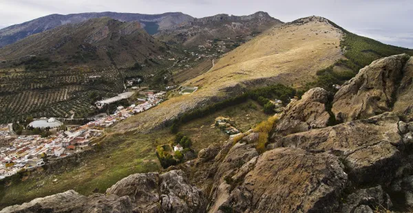
The stretch of the Mozarto Road that extends from Jaén to Torredelcampo is a journey of approximately 13 km, with an accumulated gap of + 350 m and -200 m. Classified as of moderate difficulty, this stage offers an accessible challenge that allows pilgrims to immerse themselves in an experience that combines the urban environment of Jaén with the natural landscape of the South Sierra de Jaén.
_
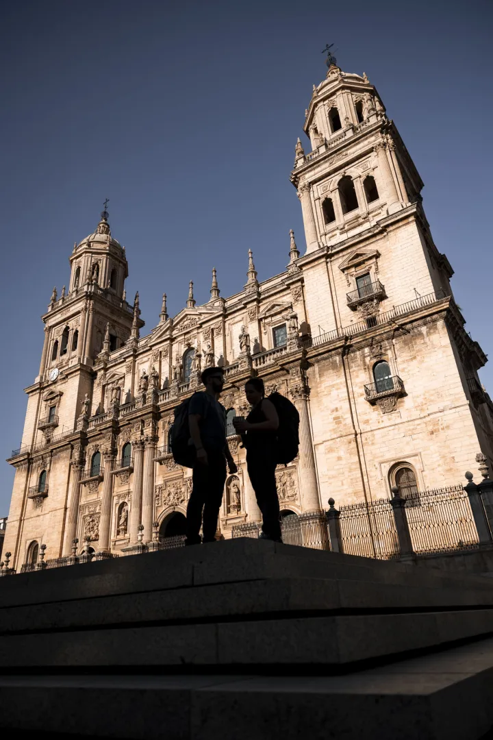
The stage begins in the Plaza de Santa María, pressuring it is the Cathedral that houses one of the most important relics for Christianity: "the Holy Face." Following the yellow arrows we enter the street Maestra, entering into ancient neighborhoods where the memory of the Arab, Jewish and Christian cultures persists. The tour takes us to the Arc of San Lorenzo, the Plazoleta of Santiago, the Church of San Juan, the Palace of Villardompardo, which conserves important Arab Baths of the 10th century, the Convent of Santo Domingo or the Church of the Magdalena with its recollect courtyard. The information centres of the Pilgrim are located in the Office of Tourism of Jaén, Centre of Tourism Dynamization of the Province of Jaén and Palacio Villardompardo - Baños AArabs.
From here we will continue on the road of Córdoba following our way to the city of Torredelcampo.
TRANSITION TO RURAL ENVIRONMENT
As you leave Jaén, the road is headed for the Cordoba road. The pilgrims will follow the old road to Torredelfield, gradually ascending through residential areas until leaving behind the last buildings of Jaén. Once outside the urban core, the road enters the South Sierra, offering a change of landscape towards a more natural and rural environment.
The tour includes the downhill of several streams, which mark the beginning of a more ascending section. The pilgrims will pass through roads leading to the Vicar's House and the Sierra de Jabalcuz before facing a rise to a highway fence. Continuing, you reach a crossing with the Megatin road. After going down about 1 km, the route goes up again, taking the pilgrims to Torredelcamp.
LLEGATE AND EXPLORATION OF TORREDELCAMPO
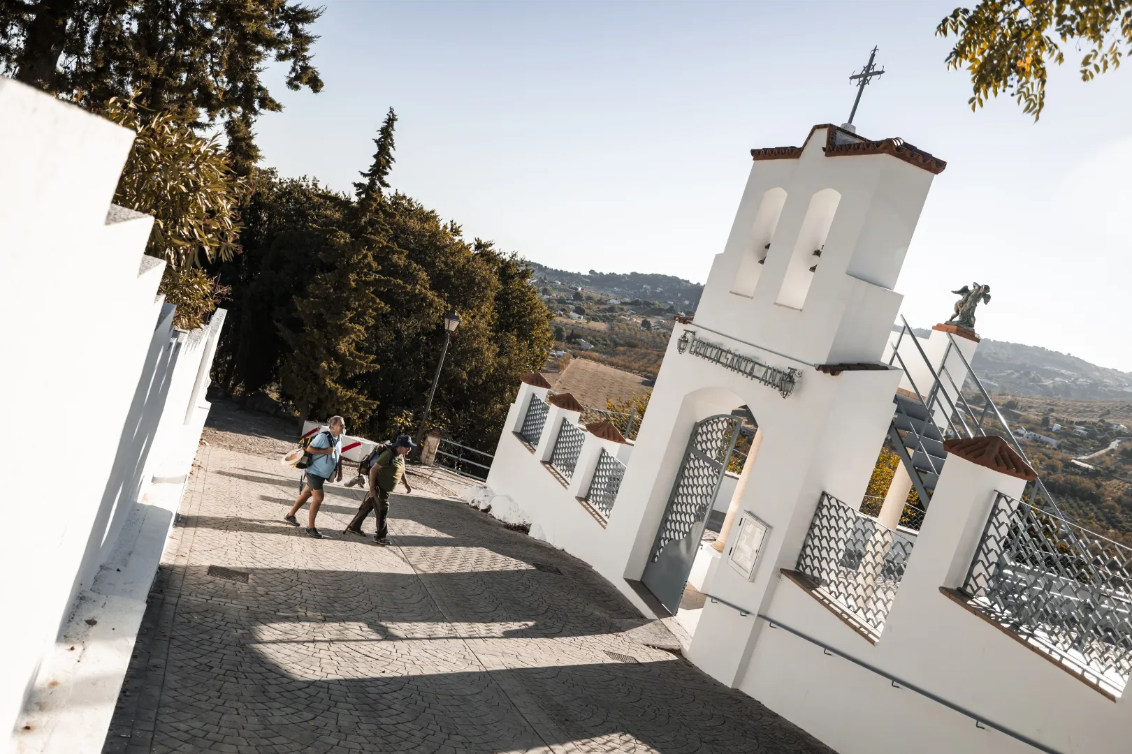
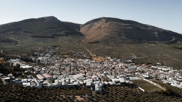
As you approach Torredelcampo, the road enters through Andalucia Street, you will go through this welcoming town until you meet the Church of San Bartolomé, and the City Hall (Punto de Información al Peregrino), to continue to search for the exit to the old road of Santa Ana to which you will arrive in a short but pending rise. The origin of the present municipality is very related to the former Iberian inhabitants of Cerro Miguelico, in the I and II A.D. part of the population is moved to the present site of Torredelcampo. After the end of the conflicts at the end of the emirate, the inhabitants of the area are forced to concentrate on a single settlement. Near the Hermitage of the Patrona is the plain of Santa Ana, a recreational area with water and shadows that will bring you a well-deserved rest. But not only, but we will also find part of the legacy of his story with the remains of a Visigoda Necropolis and an old Oppidum Ibero.
The itinerary continues on the ancient road to Jamilena.
CONCLUSION OF THE RECORRID
The Jaén to Torredelcampo stage offers an experience that balances the urban environment with the natural landscape of the Sierra Sur de Jaén. The moderate difficulty of the journey makes it an accessible option, providing an opportunity to experience the beauty and history of the region. During this stage, pilgrims not only enjoy a challenging journey, but also have the opportunity to connect with the cultural heritage and tranquility of this part of the Mozarian Way.
Datos de la ruta
ROUTE NAME
Tramo Jaén - Torredelcampo
TRAIL TYPE
--
DIFFICULTY
Moderada
TOTAL DISTANCE (IN KILOMETERS) 11,5 km
-
Stretch of asphalt or concrete:
-
Section of track, forest road, or dry watercourse:
-
Trail section:
-
Sections of livestock trails:
HUSO 30S
ESTIMATED TRAVEL TIME
ROAD SURFACE TYPE
Road
ELEVATION CHANGE
400mm
350mm
DIFFICULTY. RATING ACCORDING TO THE MIDE METHOD
--
MEANS
Severity of the natural environment
--
ITINERARY
Route guidance
--
DISPLACEMENT
Difficulty moving about
--
EFFORT
Amount of effort required
ACCESSIBILITY TYPE
TIME OF YEAR
SIGNALING
No
PERFIL DE ALTURAS

MORE INFORMATION
TUNNELS
STEEL VIADUCTS
METAL WALKWAYS
WATER POINTS
PONTOONS
GUARD BOOTHS AND BARRIERS
SWITCHMAN'S CABINS
CYCLABILITY
RECREATIONAL OR SPORTS AREAS NEAR THE TRAIL
AID STATIONS
LINKS TO OTHER TRAILS
SHELTERS
RECOMMENDATIONS
OTHER INFORMATION OF INTEREST (ARCHITECTURAL OR HISTORICAL-CULTURAL, GEOLOGICAL-ECOLOGICAL)