Route de la Ascensión al Pico Jabalcuz
Description
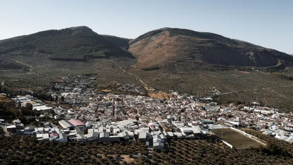
The road offers magnificent panoramic views of the landscape of the province of Jaén, through an interesting tour of the countryside to the Betic mountains, with an average slope of not more than 6%, although in some sections the slope is much greater.
Datos de la ruta
ROUTE NAME
Ruta de la Ascensión al Pico Jabalcuz
TRAIL TYPE
--
DIFFICULTY
Alta
TOTAL DISTANCE (IN KILOMETERS) 32,8 km (ida y vuelta) / 32,9 km (opción Jaén)
-
Stretch of asphalt or concrete:
-
Section of track, forest road, or dry watercourse:
-
Trail section:
-
Sections of livestock trails:
HUSO 30S
ESTIMATED TRAVEL TIME
ROAD SURFACE TYPE
Dirt and gravel lanes. Local paved roads only at the beginning and the end.
--
--
DIFFICULTY. RATING ACCORDING TO THE MIDE METHOD
--
MEANS
Severity of the natural environment
--
ITINERARY
Route guidance
--
DISPLACEMENT
Difficulty moving about
--
EFFORT
Amount of effort required
ACCESSIBILITY TYPE
TIME OF YEAR
All year round
SIGNALING
No
MORE INFORMATION
TUNNELS
STEEL VIADUCTS
METAL WALKWAYS
WATER POINTS
PONTOONS
GUARD BOOTHS AND BARRIERS
SWITCHMAN'S CABINS
CYCLABILITY
RECREATIONAL OR SPORTS AREAS NEAR THE TRAIL
AID STATIONS
LINKS TO OTHER TRAILS
SHELTERS
RECOMMENDATIONS
Given the character of continuous ascent, it is recommended to make successive stops and to hydrate properly. For the stay at the summit and for the descent, it is essential to have a coat. In winter it is no wonder that the final stretch is snowed or beaten by strong winds. In the decrease it is recommended to maintain a moderate speed. In the spring and summer periods, the promotion is advised in the first hour of the morning. Another alternative, when the road is well known, is to make the evening rise and contemplate one of the best starry skies you can imagine. It is recommended to start the tour in the km. 11,800 of the Via Verde, in the old station of Torredelfield.
OTHER INFORMATION OF INTEREST (ARCHITECTURAL OR HISTORICAL-CULTURAL, GEOLOGICAL-ECOLOGICAL)
Technical Description
The route of this ascension begins at the Torredelcampo Station (km. 11,800 of the Via Verde del Oil), located at 620 meters altitude, and ascends to the summit of Mount Jabalcuz, at 1,614 meters. Its summit is a magnificent view of the landscape of the interior of Andalusia, from which you can perfectly observe the encounter of the Betic Cordilleras with the Depression of the Guadalquivir. From the urban centre, on an asphalt slope we go to Cerro Miguelico (km. 2,400), a promontory that hosts an interesting Iberian site (necropolis excavated in the rock), well known for being the place where the Hermitage of Santa Ana is located. In this place there is a road area, with a water supply. Continuing on the same road we passed by the bosquet of La Bañizuela, and later by an active quarry. In the km. 4,900 found the remains of another abandoned quarry. A kilometer later we arrived to a stone house surrounded by a bosquet of walnuts, which we will border on the right road. In the next detours we will always follow the front, along the main lane.
At point Kilometric 7,600, in a clear area, we find a road crossing, where we will always continue along the main lane (we will despise a right and two left). After this crossing we have in front of us a valley and the Devil's crest: the ascent begins in the mountain area. At the km point 9,600 we find the barrier that only limits the passage to motor vehicles. The pinar accompanies us to the Puerto del Aire (1.030 m.), at the point of 12 200 km from where for the first time we enjoy the landscapes of the eastern part of the province of Jaén (at the bottom of Sierra Magina Natural Park).
We only have to finish the promotion until the end of the lane (km. 16,400). A sidewalk, less than 100 meters, leads us to the summit, where the fire surveillance house is located as a perfect lookout. From this place the view in any direction is all an experience. From this summit you can see much of the province of Jaén, to its limits with Córdoba and Granada. We are on the edge of the high Andalusian mountain: be careful with the hydration and the coat!. To the north is the entire countryside (the route of the Green Way of Oil is almost entirely observed) and the Guadalquivir Valley, to Sierra Morena. To the south, with clear days, the Sierra Nevada summit line will be observed, including the highest summit of the Iberian Peninsula, the Mulhacén, with 3,481 m. To the east the horizon extends from the peaks of the Natural Park Sierras de Cazorla, Segura and the Villas to the roof of the province the Pico Magina (2,197 m.), in the natural park of the same name. The western panorama is reserved for the Sierra de la Grana and the Cordobese countryside. At this summit, the municipal terms of Jaén, Torredelcampo and the Villares converge, which are seen in the sight of birds during the ascent and from the summit.
The return can be made on the same way up, to Torredelfield, or to Jaén in the Air Port (down to the east) by a lane of similar characteristics. After 4,400 km. We find another barrier. 3,600 km more take us to the road C-3.221, which is accessed by the service road of the residential area of the old resort of Jabalcuz, is the one that leads us to Jaén. In front of this crossing is a rural accommodation with restaurant ("La Casa de Piedra"). From this point we pedaled 4,500 km. more to the city of Jaén. Either of the two descending routes is a reward for the effort made.