Río Guazalamanco
Description
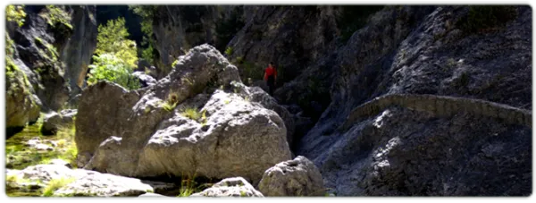
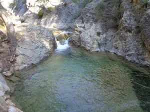
Guazalamanco is a mountain channel of permanent and turbulent waters, loaded with oxygen and gelid glass. Each of its corners invites us to recreate our senses, to remain still, in silence, as if we wanted to merge with nature and return to our origins. If you forget the camera in the car, when you discover the stream you will return to your steps to restart the road, now with the machine ready.
Is part of

Datos de la ruta
ROUTE NAME
Río Guazalamanco
TRAIL TYPE
Circular
DIFFICULTY
Baja
TOTAL DISTANCE (IN KILOMETERS) --
-
Stretch of asphalt or concrete: --
-
Section of track, forest road, or dry watercourse: --
-
Trail section: --
-
Sections of livestock trails: --
HUSO 30S
ESTIMATED TRAVEL TIME
ROAD SURFACE TYPE
Forest Track and Trail
--
--
DIFFICULTY. RATING ACCORDING TO THE MIDE METHOD
--
MEANS
Severity of the natural environment
--
ITINERARY
Route guidance
--
DISPLACEMENT
Difficulty moving about
--
EFFORT
Amount of effort required
ACCESSIBILITY TYPE
TIME OF YEAR
SIGNALING
Sí
MORE INFORMATION
TUNNELS
STEEL VIADUCTS
METAL WALKWAYS
WATER POINTS
PONTOONS
GUARD BOOTHS AND BARRIERS
SWITCHMAN'S CABINS
CYCLABILITY
RECREATIONAL OR SPORTS AREAS NEAR THE TRAIL
AID STATIONS
LINKS TO OTHER TRAILS
SHELTERS
RECOMMENDATIONS
OTHER INFORMATION OF INTEREST (ARCHITECTURAL OR HISTORICAL-CULTURAL, GEOLOGICAL-ECOLOGICAL)
Technical Description
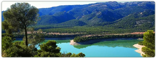
Once the asphalt ramp is over, the most painful stretch of the road, we reach an excellent lookout that allows us to enjoy a good view of the reservoir and the Valentine Barrio. A little later the track runs parallel to the river. When it wanders the way, without crossing, we follow the shore to the corners full of charm that we will meet. Later we will be forced to leave the shore to access a lane. We continue upstream, until we reach the Dike Cascade, very easy to distinguish because in its crown it has stone walls. A little lower, hidden in the bush, a beautiful leap of water is hidden that we must not miss.
Overcoming the Cascade of the Dique, part of a path that, at first, crosses the channel twice and takes us to the head of the river. Leaving the bottom of the ravine for a long time, and then returning to it, when the road ends on a forest track, we reach the bottom of the Cerrada de Navas, where the Guazalanco offers one of its most beautiful pictures.
However, to get to this point from above and to make the way down the stream, you can make an interesting route from the Nature Hall and Botanical Garden of El Hornico: Route of Guazalamanco on the Prays of Arredondo. This circular itinerary is signposted and has 13.2 (circular) length. If two vehicles are available and leaving one on the Cuesta del Cement, we reduce the route to 8.8 km and, in addition, we avoid the most flat and monotonous part of the route, the Dehesa del Rincón.
The most direct access to the Guazalamanco River is by the Dehesa del Rincón. From Pozo Alcón you have to take the A-326, up the Avenida de la Bolera, direction to Castril. By passing the campsite de la Bolera and the Km. 7, we take a detour that comes to our left and that borders the Forest House of la Bolera (it indicates to the Hornico). On an unasphalted road, always following the main road, 6,7 km from its start a fork to the left, in a slope, is left, which is asphalted (Cuesta del Cement). Although with an apron we can reach the Pasada de Guazalamanco, by a forest track parallel to the channel, the most recommended option is to leave the vehicle at the foot of the hill and take a small walk to the Cascade del Dique (round and round 2.5 km), and enjoy the many corners that this beautiful and wild mountain stream offers us.