Hiking Route Guazalamanco
Description
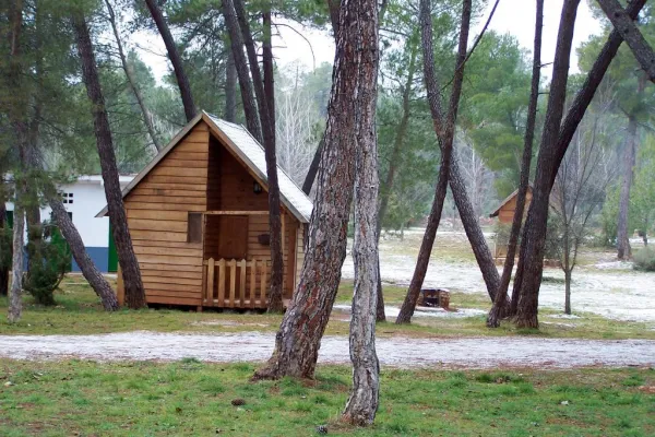
We started the route in El Hornico. We left the car in the parking lot of the Botanical Garden and went to the old Forest House, now a nature classroom, hostel and rural house. Before we reach the first building, on our right we find the starting sign and, behind it, an old cavalry path that ascends through the skirt of the mountain. A wooden beacon, with red band, indicates the km 0 of the route. We will find other wood indications on the itinerary, which belong to other routes, but we will only obey those with a red ring at the top.
Is part of

Datos de la ruta
ROUTE NAME
GUAZALAMANCO POR LOS PRADOS DE ARREDONDO
TRAIL TYPE
Circular
DIFFICULTY
Media
TOTAL DISTANCE (IN KILOMETERS) 12,2 km
-
Stretch of asphalt or concrete: 0.82%
-
Section of track, forest road, or dry watercourse: 47.95%
-
Trail section: 51.23%
-
Sections of livestock trails: 0
HUSO 30S
30S x = 508368 and = 4184165
ESTIMATED TRAVEL TIME
5 h 45 min
ROAD SURFACE TYPE
Sandy and rocky
ELEVATION CHANGE
1069mm
1310mm
DIFFICULTY. RATING ACCORDING TO THE MIDE METHOD
1
MEANS
Severity of the natural environment
2
ITINERARY
Route guidance
1
DISPLACEMENT
Difficulty moving about
3
EFFORT
Amount of effort required
ACCESSIBILITY TYPE
On foot
TIME OF YEAR
All year round
SIGNALING
No
PERFIL DE ALTURAS

MORE INFORMATION
TUNNELS
STEEL VIADUCTS
METAL WALKWAYS
WATER POINTS
PONTOONS
GUARD BOOTHS AND BARRIERS
SWITCHMAN'S CABINS
CYCLABILITY
RECREATIONAL OR SPORTS AREAS NEAR THE TRAIL
Packaging of the Bolera and recreational area of the Hoyo de los Pinos or the Bolera
AID STATIONS
LINKS TO OTHER TRAILS
SHELTERS
RECOMMENDATIONS
OTHER INFORMATION OF INTEREST (ARCHITECTURAL OR HISTORICAL-CULTURAL, GEOLOGICAL-ECOLOGICAL)
The route is marked with direct arrows and with kilometric posts.
Technical Description
We started the route in El Hornico. We left the car in the parking lot of the Botanical Garden and went to the old Forest House, now a nature classroom, hostel and rural house. Before we reach the first building, on our right we find the starting sign and, behind it, an old cavalry path that ascends through the skirt of the mountain. A wooden beacon, with red band, indicates the km 0 of the route. We will find other wood indications on the itinerary, which belong to other routes, but we will only obey those with a red ring at the top.
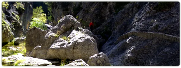
At about 950 metres from the starting point, we cross the Sabina Bridge, over the Arroyo de la Venta, which in this section is usually leaked down under the bed edges. A few meters away we reached a forest track and turned left. We follow it until we reach km 2 of our tour, where we will be very attentive because at about 50 meters we take a path (without indicators) that begins to our right. From here we are expected 2.3 km of ascent, in the hardest part of the journey. In the middle of the repulse the path forges. The right-hand option shows old vehicle tracks. Although the two variants take us to the same place, we will choose the one on the left, a softer track. When the slope is crowned, we reach the Collado de los Hercas, a crossing of roads where two jalones indicate the route to follow (the exit further north). We can enjoy a good panorama if we deviate about 300 meters along the road that comes out to our right (it is a jorro, that is, a wooden way of drawing); then we will return to this point and follow the indicators.
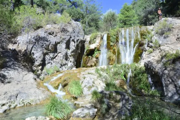
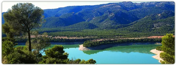
About five minutes away we find the ruins of the Forest House of the Prados de Arredondo. By passing the building, the dividing path; we continue on the right, as the beacon tells us. Half a kilometre later we reached the Guazalamanco stream, just where the Cerrada de Navas ends. In this place, if we deviate along the way up, we reach a delicious corner, ideal for a pleasant break. After the refreshment, we continue on the forest track, which we find as we cross the current and, at the height of km 6 of our itinerary, we leave it to follow, on the right, a path that communicates with a path that descends down the hillside. At 800 meters we find the creek again, which we wade twice before we reach the Cascade del Dique. From here we run through the forest track that descends at the same time as the channel, until it is separated from it. 200 meters later we will view the reservoir of the Bolera.
If we have chosen the reduced version (1), down the asphalt slope we will find the first vehicle, with which we can return to El Hornico, where the other one awaits us. If not, we follow the road of land, flat in almost all its way, through the Dehesa del Rincón, until we reach our starting point, 4 Km later.
(1) Reduced option: If it is a group and at least two vehicles are available, one will leave it in the Hornico and the others at 4.1 km following the main ground road, until it reaches a fork, where the left deviation is at cost and asphalt. Logically the Hornico car will have been used to bring the driver or drivers to the starting point. With this option we will save the 4 km most monotonous and dangerous (by the movement of vehicles) of the route.