

Recreational Area El Peralejo – Pico Mágina - Miramundos (R6)




Description
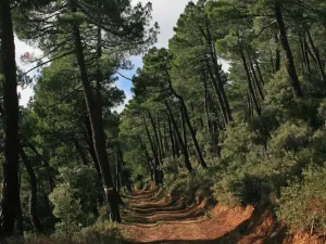
High mountain route that part of the El Peralejo Recreative Area and the Mata Bejid Visitors Center, ascends by tracks and trails between pine trees and old livestock elements (chozones, tinadas) to the Cañada de las Cruces and the upper hill. From there it continues by ventilated looms and karmic terrain to the geodetic vertex of Magina (2,165 m) and the Miramundos shelter, with spectacular views, to return on the same itinerary to the point of beginning.
Is part of

Datos de la ruta
ROUTE NAME
Área Recreativa El Peralejo – Pico Mágina - Miramundos (R6)
TRAIL TYPE
--
DIFFICULTY
Alta
TOTAL DISTANCE (IN KILOMETERS) 22,8 km
-
Stretch of asphalt or concrete:
-
Section of track, forest road, or dry watercourse:
-
Trail section:
-
Sections of livestock trails:
HUSO 30S
ESTIMATED TRAVEL TIME
ROAD SURFACE TYPE
Trail
MAXIMUM ELEVATION CHANGE 2560mm
--
--
DIFFICULTY. RATING ACCORDING TO THE MIDE METHOD
--
MEANS
Severity of the natural environment
--
ITINERARY
Route guidance
--
DISPLACEMENT
Difficulty moving about
--
EFFORT
Amount of effort required
ACCESSIBILITY TYPE
TIME OF YEAR
SIGNALING
Sí
MORE INFORMATION
TUNNELS
STEEL VIADUCTS
METAL WALKWAYS
WATER POINTS
PONTOONS
GUARD BOOTHS AND BARRIERS
SWITCHMAN'S CABINS
CYCLABILITY
RECREATIONAL OR SPORTS AREAS NEAR THE TRAIL
AID STATIONS
LINKS TO OTHER TRAILS
SHELTERS
RECOMMENDATIONS
OTHER INFORMATION OF INTEREST (ARCHITECTURAL OR HISTORICAL-CULTURAL, GEOLOGICAL-ECOLOGICAL)
Technical Description
Classical and demanding Ascension to the Pico Magina, roof of the province of Jaén, with extension to the nearby Miramundos. A high mountain route that links lapiaces, crest and umberies, with traces of serrano trades (tinadas, neveros, old paths) and a final panorama of enormous amplitude. Hard, yes; also fully rewarding. The route starts next to the Visitors Center of Mata Bejid (El Peralejo Recreative Area), passing through a Mediterranean landscape of bushes, oaks and pine that soon takes on serrano character. In the first compasses there are points linked to the traditional use of the mountain, such as forklifts and livestock structures, before linking with tracks and beamed paths that gradually gain height. As the ascent progresses, the itinerary reaches milestones such as the Tiny of the Cañada de las Cruces, where the land opens in a heap of pastures and the great summit string is beginning to be clearly read: the Peña de Jaén and, later, the relief of Miramundos. From here, the track is lost and gives way to a more mountainous path: the firm becomes stony, there are limestone boats and loose stone sections that require attention. The atmosphere changes to the high mountain, with very marked karmic forms and vegetation adapted to the cold and wind. In the bifurcation area, the road allows to link the two main tops of the route. The rise to the Pico Magina (2.165 m) culminates in the geodetic vertex, with views covering a wide mosaic of saws and valleys. A snowpit (snow well), fragile vestige of ancient mountain-taking, is located very close. The detour to Miramundos (2.077 m) adds a section of windy and panoramic crest, with a stone shelter that offers shelter when time changes and a complete reading of the karmic relief: dolins, canchales and lapiaces. After the visit to Miramundos, the itinerary returns to the main route and descends on the same route, returning to the pinars and, finally, to the surroundings of the recreational area, where the water and the shadows close the day. General recommendations A demanding and mountain-friendly route: see the weather (wind, cold and sudden changes), wear coat clothes by layers and sufficient water. The essential mountain footwear; in sections of loose and lapiaz stone a firm and unhurried step should be taken. Respect the signage and avoid getting out of the trail in areas with sensitive flora. In fragile elements such as neveros or ruins, it observes without access to or stepping on unstable structures.
