


Ravine ofl Gargantón
Description
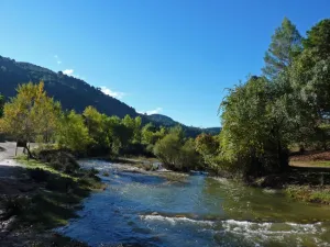
Short and very nice route that runs through the Garganton ravine following the course of the river and its traditional waterfalls. From the parking lot next to the bridge, the track is transformed into a riverside path that crosses several times the channel between chopos and gardens until it reaches the birth of the river. The return takes place on the way of service of the acequia, overlooking the slopes of Magina and the gardens of Bélmez de la Moraleda.
Is part of

Datos de la ruta
ROUTE NAME
Barranco del Gargantón
TRAIL TYPE
--
DIFFICULTY
Media
TOTAL DISTANCE (IN KILOMETERS) 2,9 km
-
Stretch of asphalt or concrete: --
-
Section of track, forest road, or dry watercourse: --
-
Trail section: --
-
Sections of livestock trails: --
HUSO 30S
ESTIMATED TRAVEL TIME
ROAD SURFACE TYPE
Trail
MAXIMUM ELEVATION CHANGE 197mm
--
--
DIFFICULTY. RATING ACCORDING TO THE MIDE METHOD
--
MEANS
Severity of the natural environment
--
ITINERARY
Route guidance
--
DISPLACEMENT
Difficulty moving about
--
EFFORT
Amount of effort required
ACCESSIBILITY TYPE
TIME OF YEAR
SIGNALING
No
MORE INFORMATION
TUNNELS
STEEL VIADUCTS
METAL WALKWAYS
WATER POINTS
PONTOONS
GUARD BOOTHS AND BARRIERS
SWITCHMAN'S CABINS
CYCLABILITY
RECREATIONAL OR SPORTS AREAS NEAR THE TRAIL
AID STATIONS
LINKS TO OTHER TRAILS
SHELTERS
RECOMMENDATIONS
OTHER INFORMATION OF INTEREST (ARCHITECTURAL OR HISTORICAL-CULTURAL, GEOLOGICAL-ECOLOGICAL)
Technical Description
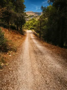
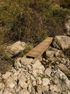
Short and very nice route that follows the course of the Garganton River between pinars and limestone slopes, with return by a traditional acequia still in use. A fresh and serene tour, where the water marks the pace and alternates riverside sections with views towards the valley and the summits of Sierra Magina. The itinerary begins next to the Garganton bridge, on the local road, and begins with a short climb per track that allows you to gain perspective over the valley. The lane is soon abandoned to take a halfway path, from which views are opened towards the Gate of Magina and the high summits, with Miramundos as a reference. The path descends to reach the way of the Garganton River, which from here guides the march. The route goes upstream between pinars and clear slopes, crossing the stream through small wooden walkways that facilitate the passage and provide a friendly character to the tour. The valley fits, the environment becomes damp and the rumor of water accompanies every step. The central point of the itinerary is the Birth of the Garganton River, where the water flows directly from the limestone, forms a short poza and is channelled down valley. This spring feeds the traditional acequia that irrigates the gardens of Bélmez de la Moraleda, a hydraulic system of historical origin that remains active and constitutes a cultural and landscape heritage of great value. From birth, the route returns along the path of the waterfall, always in gentle descent. The route runs along the left side of the valley, between orchards and olive groves, offering a clear reading of the traditional agricultural landscape and the sustainable use of water. Finally, the itinerary links with the main path of the Garganton and returns to the starting point, closing a balanced journey between water, riverside and panoramic of Magina. General recommendations Route suitable for all people used to walking. See the weather, especially after rain, when the flow can increase. Use shoes with good grip in wet sections and respect the waterfalls and walkways, avoiding stepping on the margins so as not to damage this fragile hydraulic heritage.