


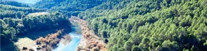


Hiking Route Acebeas - Navalperal
Description
This route allows you to admire one of the most unique botanical enclaves of the Iberian Peninsula and enjoy wonderful panoramic views. A particularly humid and fresh microclimate is given in the area of Las Abeas. Thanks to him, under the canopy of pine larice grows an amazing hazelnut - the southernmost of Spain - with plenty of large stalks. There are many climbing plants such as ivy and clematide, and there are very few species in Andalusia, such as wild strawberry and noble liver. The set transmits a sense of freshness and plant abundance that is typical of the northern forests.
Is part of

Datos de la ruta
ROUTE NAME
PR-A 176 Acebeas-Cumbre de Navalperal
TRAIL TYPE
Linear. Round trip
DIFFICULTY
Media
TOTAL DISTANCE (IN KILOMETERS) 3,25 km (solo ida)
-
Stretch of asphalt or concrete: 0
-
Section of track, forest road, or dry watercourse: 83.08%
-
Trail section: 16.92%
-
Sections of livestock trails: 0
HUSO 30S
30S x = 536380 and = 4241201
ESTIMATED TRAVEL TIME
1 h 55 min ida y vuelta
ROAD SURFACE TYPE
Sandy and rocky
ELEVATION CHANGE
343mm
24mm
DIFFICULTY. RATING ACCORDING TO THE MIDE METHOD
2
MEANS
Severity of the natural environment
1
ITINERARY
Route guidance
2
DISPLACEMENT
Difficulty moving about
2
EFFORT
Amount of effort required
ACCESSIBILITY TYPE
Horse, on foot and bike
TIME OF YEAR
All year round
SIGNALING
No
PERFIL DE ALTURAS

MORE INFORMATION
TUNNELS
STEEL VIADUCTS
METAL WALKWAYS
WATER POINTS
PONTOONS
GUARD BOOTHS AND BARRIERS
SWITCHMAN'S CABINS
CYCLABILITY
RECREATIONAL OR SPORTS AREAS NEAR THE TRAIL
Las Azebeas, La Peña del Olivar, Los Negros
AID STATIONS
LINKS TO OTHER TRAILS
SHELTERS
RECOMMENDATIONS
The ideal time to visit from October to the end of April. Set up for 4 hours minimum.
OTHER INFORMATION OF INTEREST (ARCHITECTURAL OR HISTORICAL-CULTURAL, GEOLOGICAL-ECOLOGICAL)
The entire route runs along the edge of one of the Park Reserve areas, an area with maximum protection level (Grade A) due to the ecological values it houses. Path marked PR.
Technical Description
This route allows you to admire one of the most unique botanical enclaves of the Iberian Peninsula and enjoy wonderful panoramic views. A particularly humid and fresh microclimate is given in the area of Las Abeas. Thanks to him, under the canopy of pine larice grows an amazing hazelnut - the southernmost of Spain - with plenty of large stalks. There are many climbing plants such as ivy and clematide, and there are very few species in Andalusia, such as wild strawberry and noble liver. The set transmits a sense of freshness and plant abundance that is typical of the northern forests.
As we ascend, there are oaks, maples and oaks mixed with the pines, and finally the clare vegetation giving way to the piornal and to the lastoning. The route ends in the surveillance shed, promontory air from which very wide views are dominated. Before you go down, you recommend a walk through the Calar de Navalperal to enjoy its praises and its typical karmic landscape.
The exceptional nature of the hazelnut and acebos forest in southern Spain, together with the presence of many endemic or endangered plant species, has made this area a reserve area of Las Acebeas- Nava del Espino. It therefore enjoys the highest level of protection within the Natural Park.
At 600 m from the beginning we find the Forest House of the Azebeas This is two beautiful houses, the first for use by environmental agents and the second, recently restored, was formerly at the service of forest engineers. There are several strands planted. At this point the forest track is narrow and turn left.
At 2700 m we left the forest track and turned left on a well-marked path. (If we prefer, we can also follow the track, which makes a wide and soft loop by rodeo the central area of the calar, to join again with the path). The path passes through a navel and is headed towards a few stone mojones.
And finally in the km 3.2 we arrived at the fire surveillance shed. Impressive panoramic areas of the provinces of Jaén, Ciudad Real, Albacete and Granada. To the north you can see the manchegan plains, the mountains of the Alcaraz saw and the Calar del Mundo. To the west, the cliffs of Segura La Vieja, the high valley of Trujala, Orcera and the memorial tower of the castle of Segura de la Sierra. To the South we see the Yelmo and to the bottom the Banderillas, the great mole of La Sagra and the saw of Cazorla. And to the east we contemplate the Cerrico de Las Mentiras and the nearby calares of Navalespino and Morillas.

