Description
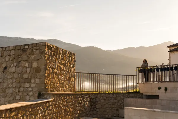
The road is simply spectacular. After passing through the Forest Pass, under the capricious pious forms of the Picones de Fique, along the two slopes of the Barranco del Garbanzal, we reached the ruins of the forest house, of which there is only a majane of stones. So far we'll have gone about 2 km from the chain. If we follow the forest track, we enter the next ravine, much wider and more open, than as the stream that runs through it, it bears the name of Extremera. Some 1,200 m later we reached the crystalline water channel, waded by the forest track. If we keep running up the vaguade we get to a spring, considered the birth of the stream.
The name of the Forest Pass has a source that is worth knowing. The current wide road was formerly a cavalry path that communicated the Garbanzal forest house, with the area of Tícar and that more than thirty years ago became a forest track to allow access to vehicles in the event of emergencies, thanks to the theson and imagination of a forest guard, Alfonso Bosques. The track, in the first section, had to save the obstacle of a vertical wall (Picones de Fique), so the work was craved impossible for the superior of the agent, who denied the attempt.
Forests was in charge of a maintenance crew, to clean the gutters and fix the forest tracks. Taking advantage of the main guard's vacation, he got to work, almost without means. Based on masonry and hard work, in just twenty days he managed to widen the lane, allowing the movement of all-terrain vehicles, which facilitated rapid access to an area to which, in the event of a forest fire, he could only access on foot or give a rodeo of almost 40 km. Even to make a blow on the rock he used fair rockets, the only explosive he had within his reach. Since then, the locals have known the place with the last name of the guard.
We suggest...
- At the beginning of the walk, next to the chain, there is a natural lookout in one of the promontories of the Picones, with excellent views.
- Another highly recommended option is to make a small route that goes above the Fique Picones and that reaches the head of the Extreme Barrio, to a place known as La Bujea, which is under the Glove Picón. To this end, leaving the vehicle in the place indicated above, we continue on the main track, which ascends by the lack of the Rayal Picon, to enter, by the pine, to a clear through which a stream circulates. Meters above the forest track, following the course of the water, we found the birth of it. This small channel is known as the Bujea stream and disappears in the middle of the ravine. However, this is the true birth of the Extreme Arroyo, since the waters below are actually the same as those of the Bujea, which appear after a stretch of underground circulation.
By reference to the Port of Tícar, 500 metres from the highest point of the road, in the direction of Pozo Alcón, there is a forest track to our left, in a wide entrance where we can leave the vehicle. The firm is good, so we can drive in another 800 meters, up to a wide curve (with a pine in the interior vertex) with space to park. A few meters later (either on foot or on a bike) of the main lane part another track that ascends the slope, to enter between the rocks (there is a chain). Following that lead we reached the Picones de Fique and the Barrio del Garbanzal. If we continue later, already in the next ravine, we arrive at the birth of the Extreme Arroyo.
Is part of