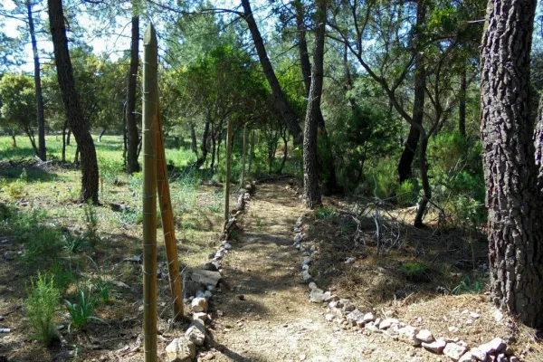
Trail Balcón de Despeñaperros
Description
This new path has a length of almost 4 km. and being circular can be performed in both
senses. It starts in the corner that gives access to the Camping Despeñacolos, next to the old section of
the N-IV, on the outskirts of the town of St. Helena.
Datos de la ruta
ROUTE NAME
Sendero Balcón de Despeñaperros
TRAIL TYPE
Trail
DIFFICULTY
Baja
TOTAL DISTANCE (IN KILOMETERS) 3,8 km
-
Stretch of asphalt or concrete:
-
Section of track, forest road, or dry watercourse:
-
Trail section:
-
Sections of livestock trails:
HUSO 30S
ESTIMATED TRAVEL TIME
1 h
ROAD SURFACE TYPE
Trail
--
--
DIFFICULTY. RATING ACCORDING TO THE MIDE METHOD
--
MEANS
Severity of the natural environment
--
ITINERARY
Route guidance
--
DISPLACEMENT
Difficulty moving about
--
EFFORT
Amount of effort required
ACCESSIBILITY TYPE
On foot
TIME OF YEAR
All year round
SIGNALING
No
MORE INFORMATION
TUNNELS
STEEL VIADUCTS
METAL WALKWAYS
WATER POINTS
PONTOONS
GUARD BOOTHS AND BARRIERS
SWITCHMAN'S CABINS
CYCLABILITY
RECREATIONAL OR SPORTS AREAS NEAR THE TRAIL
AID STATIONS
LINKS TO OTHER TRAILS
SHELTERS
RECOMMENDATIONS
- In front of COVID19, keep the safety distance and carry a mask, avoid agglomerations and contact with surfaces, wash your hands frequently, use hydroalcoholic gel and consult the available digital materials. Take care of your health and others.
- It works to prevent fires. Do not throw cigarettes or any other object that produces combustion.
- By consuming local products and having companies in the area you will contribute to rural development.
- He lives with the local people and other users. It respects private property and property.
- Unwind in a sustainable way: public transport, bike, walk, shared vehicle...
- Noise is another form of pollution. In silence you will enjoy your experience more.
- It facilitates the use of people with special needs.
- The trash doesn't come back alone. Take her with you to the nearest container. Reduce, reuse, recycle.
- Don't leave a mark on your way through nature.
- It practices a responsible and committed tourism with the environment. Be a real ecotourist!
- Respect the facilities at your disposal. We all pay for your maintenance.
- Check the weather forecast before starting your activity.
- Avoid going out alone. If you do, it communicates tour and time of return to other people.
- Extreme caution under adverse conditions and with the occasional presence of animals or motor vehicles.
- Please provide prior information on the possible existence of cynegetic activity.
- It has water, sun protection, proper clothes and shoes.
- It carries a mobile with enough battery in case of emergency (112), but remember that there is not always coverage.
- Don't even bother animals. You would negatively alter his behavior.
- For your safety and the safety of the environment, don't get out of the signposted road or take shortcuts.
- Remember that the capture of animals, light fire, fish and collect plants or minerals is prohibited.
- If you bring a dog, take him with his strap and make sure he doesn't bother other animals or people.
- Your safety is our concern, but it's your responsibility.
Thank you for your cooperation!
OTHER INFORMATION OF INTEREST (ARCHITECTURAL OR HISTORICAL-CULTURAL, GEOLOGICAL-ECOLOGICAL)
Technical Description
If taken in the sense of the clockwise from the point of start, the path enters
quickly in a pine pine pineapple pineapple pineapple with some
Pines resineros, cypresses and oaks. The first 350 meters of path run through an area
trees with abundant shadows and free of shrubs, as it constitutes the safety zone against
camping fires. This makes this section an ideal site for mushroom search in the autumn.
The path continues another 170 meters through a more intricate area of Mediterranean vegetation in the
that abounds the rosemary and the jars under the tree, which leads us to a spectacular lookout
Panoramic suspended on the old road N-IV. From the viewpoint you have an unparalleled vision
of the Natural Park, as the path is located on the South end. The panoramic view of 180
degrees allows to see the whole mountain of Despeñacos from the Collado de la Estrella, the Port of the King, he
Salto del Fraile, Navavacas, the Castle of Castro Ferral and following the line of the Collado de la
Star to the East, you can see the Paso de Despeñacolos and to its right the Collado de los
Gardens from where the park looks at Aldeaquemada.
Leaving the lookout behind, the path runs 900 meters through an old wooden draw track
completely flat through a lush mixed forest of pine, cypress, oak and cork,
where again the noble bush of the Mediterranean mountain gives a touch of naturality to the visitor
which loses the notion of distance to the people, but which, let us not forget, is just over 1 km from
distance.
Arrived at the end of the track, the path turns abruptly to the right to return to St. Helena
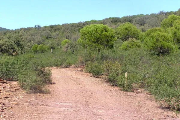
using a wider forest path, which also runs under a canopy of pineapple pine
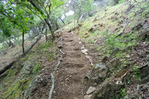
Great. It is from that point where the only difficulty of the path is found, for during
400 meters is raised by a light cost with a slope about 5% to reach the
limit of the park where again it becomes completely flat. The final section runs through an area of
transition between forest and agricultural space, bordering just the southern perimeter of the campsite
Cracking dogs, passing through their access door and ending right where it started.
The path shows as main attractions its closeness to the people of St. Helena, its affability,
the abundance of shadows for hot days, the great botanical biodiversity and, above
all, the privileged views from the viewpoint that invites to let the imagination fly contemplating
this unparalleled landscape and, why not, to reflect on the countless travelers of so many cultures
who have used this natural passage between the plateau and Andalusia.