
Description
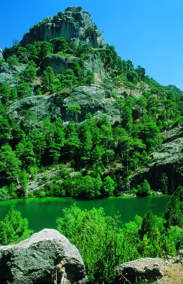
Crow Stone and Empanade Summit
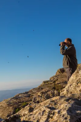
The summits of the Park leave an unbeatable mark on the memory of those who visit them. Among them are the Empanadas (ceiling of the Park with its 2107 m altitude), the Cabañas, the Banderillas, the Blanquillo, the Yelmo, the Almorchón, the Palomas, the Gilillo and the Rayal, among others.
The summits of the Park leave an unbeatable mark on the memory of those who visit them. Among them are the Empanadas (ceiling of the Park with its 2107 m altitude), the Cabañas, the Banderillas, the Blanquillo, the Yelmo, the Almorchón, the Palomas, the Gilillo and the Rayal, among others.
The tops are an exceptional ecosystem, due to the special adaptation that living beings must suffer. Over 1800 m of altitude, a number of climatic, edaphic, orographic and geographical conditions match that make its vegetation unique. The first thing we'll see is that there are no forests. At this point the wind, the very low temperatures, the snow and the little soil available make the development of the trees impossible. The vegetation is reduced to woody matas attached to the ground with a motilated look. They are the piornal and other smaller, whitish rakes. This vegetation is called whitish.
So between blancizales and piornals have settled the summits of the Park. These blanks are made up of species that are covered with a white toment, to protect themselves from the high radiation that exists at that height in the summer and from the strong winter frost. Among them are notable bethic and local endemisms without a vernacular name such as Hormatophylla baetica, Andryala agardii, Santonina elegans, Convolvulus boissieri, Arenaria tetrachetra, Scorzonera albicans, Pterocephalus spatulathus, among others.
The piornal is made up of a series of plant species with an igloo-shaped look to support the wind and the weight of the snow. Among the species of piorns are the blue piorno or cambrón (Erinacea anthyllis), the old scrapes (Hormathophylla spinosa), the fine pyrone (Echinospartum boissieri) and others without a vernacular name such as the Astragalus nevadensis nevadensis and the Genista longes. Among these two formations are the lastonar, plant formation dominated by a gramline, the laston (Helictotrichum filifoliun), which colonizes the most degraded areas of the high mountain and the summits of the Park.
A much more comfortable option than the two we suggest is to climb to the Yelmo summit, accessible by car. The ecological and landscape characteristics are similar, and the views are extraordinary, but the ease of access is paid with the inevitable landscape degradation of the buildings of repeaters, antennas, etc. installed at the summit.
LOCATION OF THE EMPLOYMENT
Let's go to the summits selected for this section, one of them is the summit of the summits, El Empanadas, which with its 2107 m altitude is the roof of the Park. To get up you need to have good physical form and take time. We must approach by vehicle, by forest track to the tornadoes of Rambla Seca. If we come from the saw of Cazorla, we will reach the road of the Navy of San Pedro, to a control that has a fenced with a door. We open it and a few meters later we find the aforementioned tornips on our right. If we arrive from the Segura saw, we must cross the fields of Hernán Pelea to Rambla Seca. Next to the tornajos comes a track, already in worse condition, that we must do walking if we do not have an SUV. Through it we go into a valley in whose end we find the ruins of the old forest house of the Cabrilla. From here, already necessarily on foot, we will follow the stream that passes by and we go back. Soon we started going up a ramp. When we reach the hill we will continue to climb to our right, until we reach the top. All the way up we will see how the pineapple of larices or salgareños is being made clear to disappear and an impressive piornal, with rareras and rake juniper, will accompany us to the summit.
_
To reach this point, less effort is needed, but it does not lose its beauty. The Crow Stone (1820 m) is in the Calar de Gila. To access, we must take the lead from the birth of the Segura to Cañada de la Cruz and follow it to the entrance to this enclave. This track is surrounding the northeastern part of the Cañada until you reach a crossing with a track to our right. The first crossing that we are on the right is the track that takes us to Hoya Maranza to Hoya Espinosilla and to the road that links Pontones with Santiago de la Sword. This track has a little over 6 km, but we won't go through it all. Once at it, about 3 km away, we find a crossing to our right that leads us to a small aerodrome, where they can land planes. It is easy to detect, and once in it, in a south direction we are raised a rock as a monolith, which is the Crow Stone.
Is part of