Hiking Route Senda de Pescadores
Description
The Guadalanimín River is made up of small streams that come down from the Cabilla saw at the height of the Majal de la Carrasca, receives the Arroyo de los Arenales and already with a permanent channel flows through the bottom of a deep ravine in a south direction. It receives in the Vado de las Carretas to the stream of San Pedro, of intermittent waters, and in the Cerrada de la Canaliega to the stream of the Tornillos de Gualay. Always in the south direction and at the bottom of a deep ravine receives the streams of the Acebadillas and the Cold stream, at the height of the closed of the same name and flows into the Guadiana Menor river, at the height of the Negratin reservoir, between the municipalities of Cuevas del Campo and Zújar.
Is part of

Datos de la ruta
ROUTE NAME
SENDA DE PESCADORES
TRAIL TYPE
Linear
DIFFICULTY
Media
TOTAL DISTANCE (IN KILOMETERS) 9 km (solo ida)
-
Stretch of asphalt or concrete: 0
-
Section of track, forest road, or dry watercourse: 0.01
-
Trail section: 0
-
Sections of livestock trails: 0
HUSO 30S
30S x = 510810 and = 4192109
ESTIMATED TRAVEL TIME
5 h 20 min (ida y vuelta)
ROAD SURFACE TYPE
Sandy and rocky
ELEVATION CHANGE
386mm
235mm
DIFFICULTY. RATING ACCORDING TO THE MIDE METHOD
2
MEANS
Severity of the natural environment
1
ITINERARY
Route guidance
1
DISPLACEMENT
Difficulty moving about
3
EFFORT
Amount of effort required
ACCESSIBILITY TYPE
Horse, on foot and bike
TIME OF YEAR
All year round
SIGNALING
No
PERFIL DE ALTURAS

MORE INFORMATION
TUNNELS
STEEL VIADUCTS
METAL WALKWAYS
WATER POINTS
PONTOONS
GUARD BOOTHS AND BARRIERS
SWITCHMAN'S CABINS
CYCLABILITY
RECREATIONAL OR SPORTS AREAS NEAR THE TRAIL
Point of revival or rest next to the Cortijo del Saso del Peral
AID STATIONS
LINKS TO OTHER TRAILS
SHELTERS
RECOMMENDATIONS
The Vado de las Carretas is a link point with another very well-known path, which is circular and that runs through the upper part of the Barrio del Gualatentín, Fuente Steel, the Strait of Perales and the Trench.
OTHER INFORMATION OF INTEREST (ARCHITECTURAL OR HISTORICAL-CULTURAL, GEOLOGICAL-ECOLOGICAL)
The tour is marked by beacons with directional arrows.
It has great botanical wealth with spectacular examples of larix pine and centenary complaints.., abundant presence of large rapacious birds (leonate vulture, real eagle, real owl...)
Deep-ravine geomorphological formation (Guadalanimin and Cerrada de la Canaliega) between the Cortijo de la Paulera and the Cortijo de Poyo Tribaldos.
Technical Description
The Guadalanimín River is made up of small streams that come down from the Cabilla saw at the height of the Majal de la Carrasca, receives the Arroyo de los Arenales and already with a permanent channel flows through the bottom of a deep ravine in a south direction. It receives in the Vado de las Carretas to the stream of San Pedro, of intermittent waters, and in the Cerrada de la Canaliega to the stream of the Tornillos de Gualay. Always in the south direction and at the bottom of a deep ravine receives the streams of the Acebadillas and the Cold stream, at the height of the closed of the same name and flows into the Guadiana Menor river, at the height of the Negratin reservoir, between the municipalities of Cuevas del Campo and Zújar. Its channel serves as a divisive between the saw of the Cabrilla and that of the well
The tour begins on the track that runs through the reservoir of the Bolera by its left margin in the forest house of the Molinillo, which can be reached by ground track in any type of vehicle.
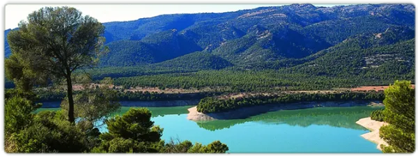
200 meters from the start signal, there is a fork, which we will take to the right, walking the tail of the Bolera reservoir.
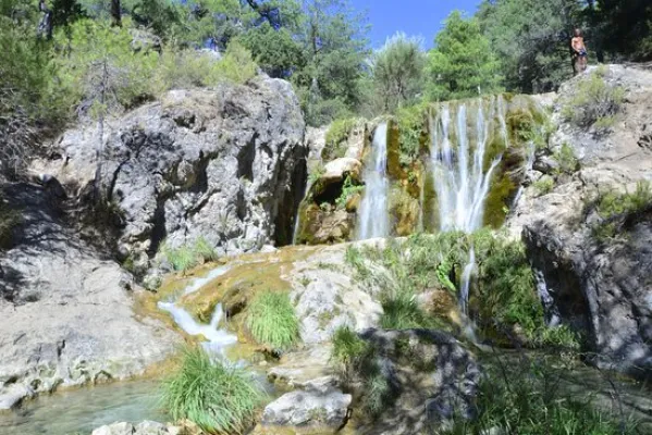
At 900 m we reach a bridge that crosses the Guadaltiín River, with crystal clear and pure waters, in a place of unique beauty that is the Cerrada de la Herradura. From here, and already on the right bank of the valley, a rise of approximately 3 km begins that will take us to the Cortijo del Raso del Peral. The rise is continued, just 200 m from passing the bridge are left the Cortijos de los Tontos, leaving also the edge of a cut on the Guadalanimin that well deserves to be seen, with several clings and closed. Later on we left to our left the cortijo of the Puntal de Ana María. The Cañada del Mesto, which we can travel through and which is used by flocks of sheep and goats in their annual journeys in search of fresh pastures, runs through this section.
As the Cortijo del Raso del Peral passes, the track begins a slight descent through numerous ruinous cortijadas and others in very good condition such as the Canalilla 5 km, the Paulera 6.5 km and Poyo Tribaldos 7.2 km from the beginning.
Finally the track reaches the river, in the area known as Vado de las Carretas, a pleasant and paradoxical place that well deserves a stop. The river will have to be watered, if we want to reach the cortijos of the Vado de las Carretas, to do so by crossing it we will have to follow the front and despise the track that goes to the right following the channel. These cortijos, still inhabited, are only 1,000 m from where we are.