Greenwaand (Vía Verde) del Aceite
Description
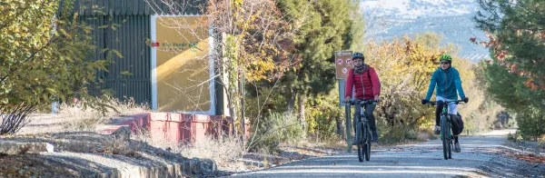
The Green Way of Oil is presented as a new and attractive offer of interior tourism based on the development and recovery of the infrastructure of the old abandoned railway Jaén-Campo Real (Córdoba) as a green corridor, for the practice of cycling, hiking and other sports in direct contact with nature.
Built between 1882 and 1893, this railway belonged to the line Linares- Puente Genil, which was dedicated throughout much of the 20th century to the transport of different metals from the linarian mines and, especially, from the abundant olive oil to the port of Málaga and the markets of the southern Peninsula, so it was popularly called the Oil Train. Technical and commercial reasons motivated their abandonment in 1971, and the transport of passengers and goods was finally closed on 1 January 1985.
All of its layout, from Jaén to the provincial limit, runs by sepentating olive-countryside grounds that make up a landscape of authentic olive-sea splattered by typical Andalusian cortijos. The presence of the Serras de Jabalcuz, la Grana, la Caracolera and del Achillos, located very close to the South and the East of the Via Verde, provide diversity to the relief and the landscape.
Is part of

Datos de la ruta
ROUTE NAME
Vía Verde del Aceite
TRAIL TYPE
Trail
DIFFICULTY
Baja
TOTAL DISTANCE (IN KILOMETERS) 55 km
-
Stretch of asphalt or concrete: --
-
Section of track, forest road, or dry watercourse: --
-
Trail section: --
-
Sections of livestock trails: --
HUSO 30S
ESTIMATED TRAVEL TIME
5 h
ROAD SURFACE TYPE
Ballast sealed with aggregate base and double asphalt surface treatment.
ELEVATION CHANGE
250mm
--
DIFFICULTY. RATING ACCORDING TO THE MIDE METHOD
--
MEANS
Severity of the natural environment
--
ITINERARY
Route guidance
--
DISPLACEMENT
Difficulty moving about
--
EFFORT
Amount of effort required
ACCESSIBILITY TYPE
Suitable and practical with some sections with inclination, more information at: www.viasverdisaccesibles.es
TIME OF YEAR
All year round
SIGNALING
No
PERFIL DE ALTURAS

MORE INFORMATION
TUNNELS
2
STEEL VIADUCTS
9
METAL WALKWAYS
3
WATER POINTS
PONTOONS
5
GUARD BOOTHS AND BARRIERS
3
SWITCHMAN'S CABINS
1
CYCLABILITY
RECREATIONAL OR SPORTS AREAS NEAR THE TRAIL
6, from Jaén (The Fuentezuelas' polysports complex) and from each of the five stations.
AID STATIONS
LINKS TO OTHER TRAILS
SHELTERS
RECOMMENDATIONS
Users: cyclists, walkers and wheelchair people.
Regardless of the way you decide to travel this route, it is recommended to use comfortable clothes and footwear and adapted to the time of the year. Although it is not convenient to do so in the middle of summer due to the heat. You must not forget to wear enough water and, if you go on a bike, it is always recommended to wear a helmet.
For more information visit:http: / / www.viasverdes.com
OTHER INFORMATION OF INTEREST (ARCHITECTURAL OR HISTORICAL-CULTURAL, GEOLOGICAL-ECOLOGICAL)
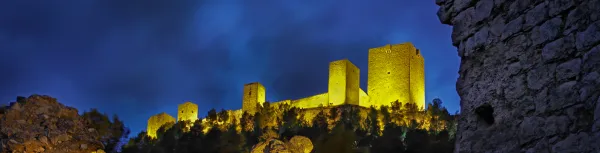
Cultural heritage: Monumental set of Jaén. The medieval castle of Alcaudete. Medieval Bridge of the Vipers. Archaeological route of the Torreones. Urban assemblies of Luque, Zuheros, Doña Mencía, Cabra and Lucena. Cueva de los Murcielagos en Zuheros.
Ramal a Baena: Urban complex of Luque and Baena, archaeological park of Torreparedones, the Historical and Archaeological Museum of Baena, church of the ancient Convent of the Agustinos Descalzo in Luque.
Technical Description
The tour begins at the edge of the city centre of Jaén, next to the municipal sports complex Las Fuentezuelas. The first 2 km, used by hiking and cycling, have several rest areas. From here on, we will cross, on a service road, the north-west circumvalation of Jaén to resume the trail to the town of Torredelcamp. After passing through a new alternative road that saves the A-316 motorway, we arrive at the Torredelcampo station (km. 11,100) located in this urban nucleus.
After two tunnels (the first lit 333 meters long), two viaducts and the rest area of the Quebradas, we will reach the nearby town of Torredonjimeno. From Torredonjimeno Station (Km. 1,600) we will continue in the direction of Martos, for which we will have to cross two long metal walkways that allow the crossing with the road A-316. La Via Verde crosses the city centre of Martos and offers the possibility to make interesting visits to the city.
We left Martos, in a southwestern direction, towards the border with the province of Córdoba. New intersections with the national road are resolved by installing a lower step and a new gateway. In Km. 33, coinciding with the proximity of the Salado stream, the landscape changes and becomes more abrupt and serrano, already in the foothills of the Sierra Sur massif. The railway crosses rivers and streams in the middle of impressive ravines, through metal viaducts with lengths between 70 m and 224 m. These complex engineering works, which were designed by the French Alessandre and Delapierre, date back to the end of the 19th century, magnificent examples of oblonted architecture, and which constitute extraordinary views on the rural landscapes of the province of Jaén.
The rest area of the isolated station of Vado-Jaén is located at km 37. The old railway platform continues its course in the direction of the Alcaudete Station, passing the impressive viaduct on the Víboras River (224 m long and 80 m high), the remains of an abandoned balast quarry, called La Muela, and some sections of lush Mediterranean vegetation in which they stand out oak, retama and majajelos, as well as old almonds.
Leaving the Alcaudete station behind, at 48,400 km, we will reach a crossing with the A-316 road, saved by a high gateway.
After passing through the building for the railway houses, the Green Way of Oil connects with the Biking Routes of Sierra Sur de Jaén (signposted), which enter the cycloturist in the heart of the massif of the same name, and runs right next to the Laguna Honda Natural Reserve (Km. 50,500); at this point you can see the abundant and rich avifauna that dwells in this 65 Has. wetland of extension: evil, real anade, squid or small zampullin.
On the right bank of the Green Way, a road leads to another natural space protected from the environment: the Natural Reserve of Laguna del Chinche, of 6.5 Has. of extension and with an interesting perilagunar vegetation. The last miles pass through a very eroded site where deep ravines are frequent, in whose slopes the thyme and the spartum occupy a land, not suitable for the olive tree, which sometimes offer excellent panoramic views of the Vadomojón reservoir. The jiennese part of the Green Way of Oil concludes on the great iron bridge over the Guadaljoz River, right in the tail of the reservoir, 199 m long.
From this point the green track connects with that of the Cordobese Subbetic.