


GR-48
Description
The GR 48 Path of Sierra Morena is the long-distance route that allows you to cross this mountain range from west to east. They are 590 Km of signposted itinerary and conditioning that begin their journey in the Portuguese town of Barrancos, on the border of Andalusia with Portugal, and from there it leads us to a tour of the provinces of Huelva, Sevilla, Córdoba and Jaén, ending in the municipality of Santa Elena, opening the door to the Natural Park of Despeñaparos.
Datos de la ruta
ROUTE NAME
GR-48
TRAIL TYPE
Circular
DIFFICULTY
--
TOTAL DISTANCE (IN KILOMETERS) --
-
Stretch of asphalt or concrete: --
-
Section of track, forest road, or dry watercourse: --
-
Trail section: --
-
Sections of livestock trails: --
HUSO 30S
30S x = 391352 and = 4212409
ESTIMATED TRAVEL TIME
ROAD SURFACE TYPE
--
--
DIFFICULTY. RATING ACCORDING TO THE MIDE METHOD
--
MEANS
Severity of the natural environment
--
ITINERARY
Route guidance
--
DISPLACEMENT
Difficulty moving about
--
EFFORT
Amount of effort required
ACCESSIBILITY TYPE
TIME OF YEAR
Spring and autumn
SIGNALING
Sí
MORE INFORMATION
TUNNELS
STEEL VIADUCTS
METAL WALKWAYS
WATER POINTS
PONTOONS
GUARD BOOTHS AND BARRIERS
SWITCHMAN'S CABINS
CYCLABILITY
RECREATIONAL OR SPORTS AREAS NEAR THE TRAIL
AID STATIONS
LINKS TO OTHER TRAILS
SHELTERS
RECOMMENDATIONS
OTHER INFORMATION OF INTEREST (ARCHITECTURAL OR HISTORICAL-CULTURAL, GEOLOGICAL-ECOLOGICAL)
Technical Description
The entire route has been divided into 28 linear stages and one circular alternative route in the province of Seville. All of them can be comfortably completed during a single day of hiking. Each stage begins and ends either in one of the municipalities through which the trail passes or in places where food and overnight accommodation are available, such as the Sanctuary of the Virgen de la Cabeza in the Sierra de Andújar.
In the province of Jaén, the GR 48 is divided into five stages. Some of these are among the longest in the whole of Sierra Morena and, without detracting from the routes through the other three provinces, they are among the most highly appreciated by hikers because of their exceptional beauty.
The Jaén section of the GR 48 is characterised by its varied landscapes. Along the route, the typical wooded pastureland of Sierra Morena, where livestock graze, alternates with the steep slopes of the Sierra de Andújar and the foothills of Despeñaperros. Here, gorges, ravines and medium-altitude mountains create an evocative landscape reminiscent of high-mountain regions.
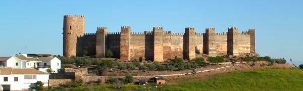
The Sierra Morena trail in Jaén is divided into five stages, taking us from Marmolejo to the centre of Santa Elena. Along the way, the route passes close to important landmarks such as the Sanctuary of the Virgen de la Cabeza, the outstanding historical heritage of Baños de la Encina and the former mining pasturelands around La Carolina. The journey crosses constantly changing landscapes in which Mediterranean woodland blends with more rugged natural surroundings, creating spectacular scenery whose colours vary throughout the year and are at their finest in autumn and spring.
However, this route offers much more than scenery. The absence of major towns in the heart of the mountains has allowed the area to remain exceptionally well preserved, making it relatively easy to observe birds and mammals at almost any point along the GR 48.
The great biodiversity of this territory provides an opportunity to observe unique species of both fauna and flora. The Sierra de Andújar is one of the last remaining strongholds of the Iberian lynx, as well as being home to other protected species such as the cinereous vulture and the golden eagle. As this area is one of the most important hunting regions in Spain, sightings of large mammals such as red deer, fallow deer and wild boar are very frequent and almost commonplace. Extensive cattle-grazing estates with herds of fighting bulls are another attraction, becoming more common as the trail continues towards the north-east of the province, particularly along the central section between the Sierra de Andújar Natural Park and the Despeñaperros Natural Park.
In addition to the species already mentioned, those interested in herpetology will find a significant amphibian population along the Jaén section of the GR 48. This includes species found exclusively on the Iberian Peninsula, such as the Iberian painted frog, the Iberian newt and the Iberian midwife toad.
The vegetation encountered along the route consists mainly of typical Mediterranean woodland and scrub, dominated by holm oak forests with rockroses, mastic trees and wild olive trees. These are complemented by examples of the conifer plantations established in the mid-20th century, particularly the pine forests around the Sierra de Andújar and near Santa Elena in Despeñaperros. Along the streams and rivers crossed by the GR 48, hikers can also appreciate riverside woodland, such as that found along Los Santos Stream during the first stage, the Jándula River during the second and the Campana River during the final stage.
When walking the GR 48, it should be remembered that the stages cover long distances and are best completed over full days. Food and supplies are available at the beginning and end of each stage. Nevertheless, particularly on the longer stages, it is advisable to carry plenty of water, as Sierra Morena is typically dry and there are few springs where hikers can quench their thirst. The time of year should also be considered carefully, as summers in Sierra Morena are extremely hot, with very high temperatures during the summer months. Anyone wishing to complete the trail during July or August should therefore plan their schedule carefully and alternate periods of walking with adequate rest.
In addition to the sensory pleasure of walking along this trail, each stage leads to fascinating places that reveal the rich heritage left in the province by different civilisations. Throughout the route, there are numerous reasons to make short detours and explore the past: archaeological sites and prehistoric cave paintings provide a connection with ancient history; the magnificent medieval heritage of Baños de la Encina and the nearby battlefield of the Battle of Las Navas de Tolosa in Santa Elena recall the Middle Ages; while the elegant urban layouts of the New Settlements of Sierra Morena and the surrounding mining remains provide evidence of the province’s more recent history.


