This municipality is part of:
Pegalajar
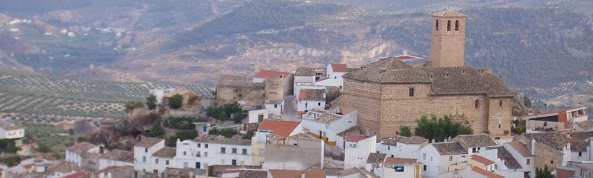
A town in the west of the district of Sierra Mágina. The municipal area extends into the far northeast corner of the Sierra Mágina Natural Park, which forms part of the Subbaetic mountains and boasts beautiful and spectacular countryside. The town is located at the bottom of the Serrezuela, at 798 m above sea level, where the waters from the spring known as ‘Fuente de la Reja’ surface, which supplies water to la Charca and la Huerta, important features of the local countryside. Pegalajar’s municipal area covers 80 km2 and is located in the valley of the Guadalbullón river, 18.8 km from the city of Jaén.
Information
Data of interest
Tourist area Sierra Mágina
Distance to the capital (km) 21
Altitude above sea level (m) 818
Extensión (Km2): 79
No. of Inhabitants 3145
Demonym Pegalajeños
Postal Code 23110
The small village of La Cerradura is included in the township. The olive groves dominate the local agriculture and occupy almost half of the land, concentrated in the south and east of the municipal areas on the slopes of the numerous peaks that crown the Pegalajar landscape. The economy is based on olives and olive oil production.
In the township of Pegalajar, there are 26 declared assets of cultural heritage of Andalusia, six of which are also national Assets of Cultural Interest. These include: the Iglesia de Santa Cruz (Church of the Holy Cross), Torre de la Cabeza (Tower of Cabeza), Arco de la Encarnación (Arch of the Incarnation), Castillo de las Peñuelas (Castle of the Peñuelas), Arrabal Medieval (Medieval Quarter), Casa Consistorial (Town Hall), the Ermita de la Virgen de las Nieves (Chapel of the Virgin of the Snows), the Fuente de la Reja spring, la Charca, la Huerta, the mills, the bullring and the Caves of the Serrezuela
Source of information
Imágenes
Contenido Audiovisual
? ![]()