


Cerro de Monuera Trail
Between the Despeñaperros Natural Park and the Cascada de la Cimbarra Natural Park, this path will allow us to see the full splendour of what the Sierra Morena has to offer in just over 8 kilometres.
We are in the municipality of Aldeaquemada, one of the new towns created by Carlos III, and a visit to it is a must in order to recover our strength when we finish this pleasant trail. This is a circular path, running in a clockwise direction.

TYPE OF TRAIL
Path
Difficulty
Half
START POINT
The path starts a few metres from the A-6200 road coming from the A4 motorway (exit km 250, direction Cádiz) towards Aldeaquemada. The start is at kilometre 16 approximately, on the right.
TOTAL DISTANCE (IN KILOMETERS)
8.700
ESTIMATED RUN TIME
2 hours and 45 minutes.
Type of firm
Track
DIFFICULTY. ASSESSMENT ACCORDING TO METHOD MEASURE
0
MEDIO.
Severity of the natural environment
0
Itinerary
Orientation in the itinerary
0
Displacement
Difficulty moving
0
EFFORT.
Amount of effort required
SIGNALING
Sí
MUNICIPAL TERMS BY WHICH IT RUNS
Aldeaquemada NorteRECOMMENDATIONS
- Compared to COVID19, keep a safe distance and wear a mask, avoid crowding and contact with surfaces, wash your hands frequently, use hydroalcoholic gel and consult the digital materials available. Take care of your health and that of others.
- Collaborate to avoid fires. Do not throw cigarettes or any other object that produces combustion.
- By consuming local products and having local businesses you will contribute to rural development.
- Live respectfully with the local people and other users. Respect private goods and properties.
- Travel in a sustainable way: public transport, cycling, walking, car sharing
- Noise is another form of pollution. In silence you will enjoy your experience more.
- Make it easy for people with special needs to use it.
- Trash does not come back alone. Take it with you to the nearest container. Reduce, reuse, recycle.
- Don't leave a trace of your passage through nature.
- Practice responsible tourism and be committed to the environment. Be a true ecotourist!
- Respect the facilities made available to you. We all pay for their maintenance.
- Consult the weather forecast before starting your activity.
- Avoid going out alone. If you do, inform other people of the route and time of return.
- Be extremely careful in adverse conditions and in the occasional presence of animals or motor vehicles.
- Find out beforehand if there is any hunting activity.
- Bring water, sun protection, suitable clothing and footwear.
- Carry a mobile phone with a sufficient battery in case of emergency (112), but remember that there is not always coverage.
- Do not disturb or feed the animals. You will negatively alter their behaviour.
- For your safety and that of the environment, do not leave the marked path or take shortcuts.
- Remember that it is forbidden to capture animals, light fires, fish and collect plants or minerals.
- If you bring a dog, keep it on a leash and make sure it does not disturb other animals or people.
- Your safety is our concern, but it is your responsibility.
Thank you for your cooperation!
DESCRIPTION
Once you have walked the first 200 metres from where you left the car, you will find the fork in the road, and you should take the track on the left. From this point onwards, you will enter a shady area where you will see the best examples of flowers on this path: a grove of Quercus pyrenaica mixed with mustard (Sorbus torminalis), which will not leave you indifferent, especially if you follow the route in autumn or spring. They will accompany you for about 800 metres, mixed with magnificent specimens of cork oak (Quercus suber) and holm oak (Quercus ilex), until you reach a new fork in the road, which you take again to the left. If you have been sufficiently careful, you will have noticed that on your left you can enjoy some magnificent views of the village of Aldeaquemada.
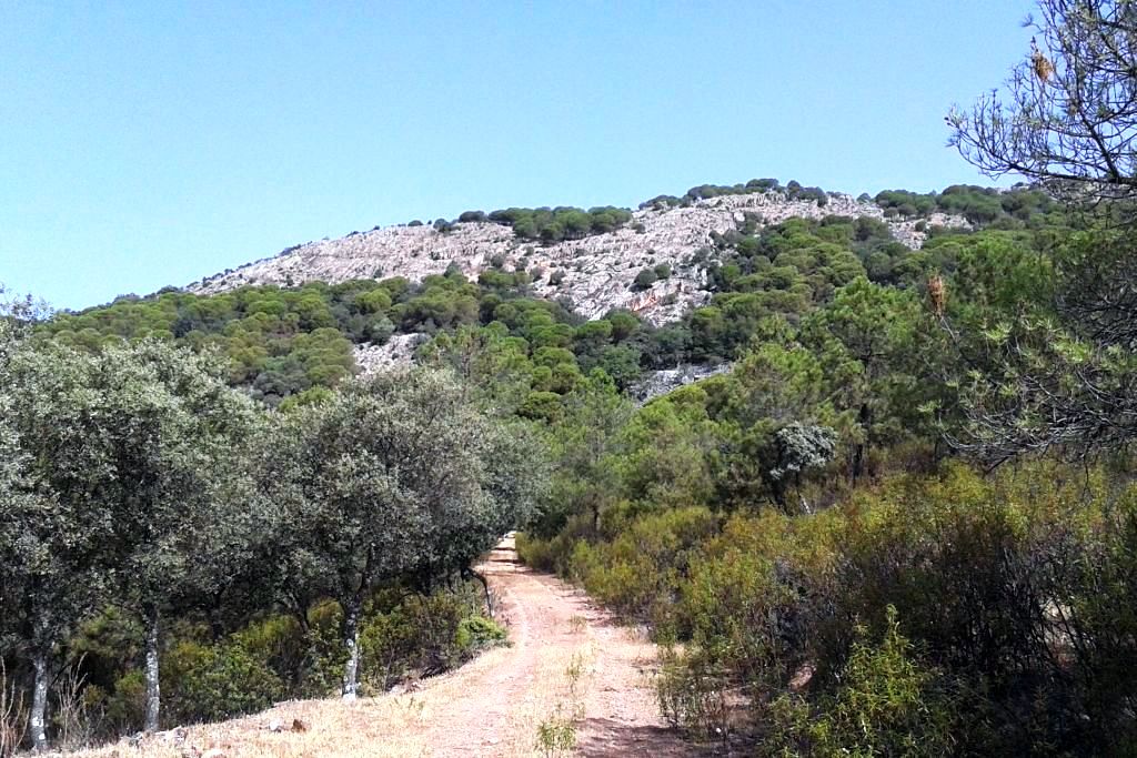
For a further 900 metres the vegetation will turn into black pine forests (Pinus pinaster), accompanied by strawberry trees (Arbutus unedo) and junipers (Juniperus communis). It is easy that, so far, we have already seen some specimens of deer starting their career when they have heard us, since it is an area where this species is most wanted. At this point we will come to a firebreak that must be crossed. This forest fire defence infrastructure marks the boundary between Mount El Chortal (owned by the Junta de Andalucía, which we have been walking on until now) and Mount Dehesa Navalacedra (owned by the Aldeaquemada Town Hall). For 700 metres we will walk through a mixed mass with stone pine (Pinus pinea) as the most important species at the beginning, which will then give way to the quercines (with good specimens of gall oak, Quercus faginea) when a small valley begins to accompany us on our left.
At the end of the path, you will come to a forest track that you take to the right, and then leave it about 800 metres further on, taking the path that comes out on the right. We have just entered the public mountain El Chortal again. For about 2 kilometres we will be walking along a sunny path, in the shade of pine trees, which will make the path easier to walk. You will be able to see three stone quarries on your way, typical of these natural areas. Once we have reached a wildlife observation tower, our path will turn into a slightly sloping path (the most difficult part of the trail) that will descend to the bottom of the valley, and then go up again.
This is the Arroyo del Tomadero, which in its first few metres will delight us with exuberant riverside vegetation with the alder (Alnus glutinosa) and ash tree (Fraxinus angustifolia) as its protagonists, accompanied by a tangle of undergrowth that makes it impenetrable in some places. Halfway up, a fountain (not drinkable) will help us to refresh ourselves in order to finish the ascent of this valley. One and a half kilometres upstream you will cross the Arroyo del Tomadero to leave it behind, climbing up the path for another kilometre until you reach the main track. Take this path to the right, and 400 metres further on you will come to the fork in the road that marks the beginning of the path. If we are careful, we will be able to see a fire watchtower on our right in this final section, which will observe us from the top of Monuera Hill, which we will have circled for just under 3 hours.
Source of information
Follow us #JaénParaísoInterior


