


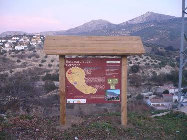
Ruta Natural del Cerrejón

Difficulty
Low
TOTAL DISTANCE (IN KILOMETERS)
3,7 km
ESTIMATED RUN TIME
1h. 30 m
DIFFICULTY. ASSESSMENT ACCORDING TO METHOD MEASURE
0
MEDIO.
Severity of the natural environment
0
Itinerary
Orientation in the itinerary
0
Displacement
Difficulty moving
0
EFFORT.
Amount of effort required
SIGNALING
Sí
MUNICIPAL TERMS BY WHICH IT RUNS
Los Villares Sierra SurRECOMMENDATIONS
- Wear comfortable shoes and clothing appropriate to the time of year.
- Always be accompanied by another or other hikers.
- Calculate your tour to complete it before sunset.
- In the event of an accident, call the emergency number 112.
DESCRIPTION
It is a circular route that runs entirely along rural roads and whose starting point is the access lane to the municipal dump, in the middle of the urban area, ending at the Mirador del Molino del Rey, also in Los Villares. first 500 m., looking behind us, we can appreciate a beautiful panoramic view of Los Villares, Canjorro, as well as Peña de Castro. Continuing the ascent, we will leave the municipal landfill and the Pedregoso river on our right. From the Casería de la Venta we descend, through a partially paved path, to the place of Los Molinos, next to the Frío river. On the left bank of the river, we will pass a fountain located just at the foot of the route, about 500 meters before the end of the itinerary. The Cerrejón Route ends at the park-viewpoint located next to the Molino del Rey.
Follow us #JaénParaísoInterior


