


Etapa 1: Prado Maguillo y Refugio Casa Forestal El Bodegón - Río Madera

This first Stage of the Variant GR 247.1 joins two of the most emblematic small inhabited nuclei in the deep interior of the Natural Park, in the Sierra de Segura. The first is formed by the villages of Los Anchos and Prado Maguillo, and the second is made up of those of Arroyo Canales and Río Madera.
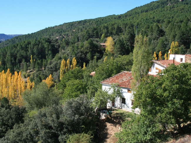
They are isolated, lonely mountain villages surrounded by a beautiful environment. The former, at a higher altitude, attract attention for the good conservation of popular architecture, of great simplicity and with an aesthetic fully integrated into the landscape. The La Morringa Recreational Area stands out, which is a very pleasant and shaded space with a fountain and tables next to the Madera River, whose waters flow gently among the riverside vegetation.
Most of the route runs along the forest track that runs through the Valley of Arroyo de las Tres Aguas, linking the valleys of Los Anchos and Río Madera through thick forests of black pine or salgareño. The Stage is short, and there is the option of linking it in the same day with one of the other Stages of the Bosques del Sur Trail with which it connects, or with a section of them, but we recommend doing it without haste and staying quietly in any of the two extremes of it, because they have plenty of attractions for it.
Technical information
Route Name Rutas Bosques GR247
Rutas Bosques GR247 1: Etapa 1: Prado Maguillo y Refugio Casa Forestal El Bodegón - Río MaderaHUSO 30S
Prado Maguillo: x537248 y4231561
Río Madera: x533157 y4233191
Prado Maguillo: x537136 y4231354
Río Madera: x533045 y4232984
TOTAL DISTANCE (IN KILOMETERS)7781
Asphalt or cement section 2,19 %
Section of track or forest road or promenade 87,79 %
Senda section 10,02 %
tramos-de-Vía-pecuaria 0 %
ESTIMATED RUN TIMEO
2 h 12 minMAXIMUM SLOPE248 m
DIFFICULTY. ASSESSMENT ACCORDING TO METHOD MEASURE
1
MEDIO.
Severity of the natural environment
1
Itinerary
Orientation in the itinerary
1
Displacement
Difficulty moving
2
EFFORT.
Amount of effort required
TOTAL DISTANCE (IN KILOMETERS) 19540 M
Start
Prado Maguillo is reached by taking a detour in the village of La Venta Rampias, which is on the JF-7038 road.
Final
The Aldea de Río Madera is accessed from Segura de la Sierra by the JF-7038, and from Hornos by the JF-7039, which starts from the A-317a road that goes up the Garganta de Hornos.
INTERMEDIATE POINTS
PLACE
POSITION
TYPE OF ROAD
Km 6,7
Carretera
CYCLABILITY
Some steep slopes shortly before the end of the Stage in Río Madera
WATER POINTS
Prado Maguillo, La Morringa Recreational Area, Arroyo Canales, Río Madera
PREFRESHING POINTS
On the trail: There is no
Near the trail: Segura de la Sierra
LINKS WITH OTHER TRAILS
GR-147, PR-A 199
Rutómetro
Prado Maguillo
Our route begins in Prado Maguillo, a small mountain village very close to Los Anchos. Both are in an environment of extraordinary beauty and preserve the popular architecture quite well. We go out between orchards, most of them already abandoned, and after 500 meters, on the left, there is a small hill to which it is essential to climb (they are very few meters) to enjoy the wonderful views that are contemplated from it: the Los Anchos valley in foreground and, in the background, the ridges of El Calarico, Poyo Gavilán and Poyo Alto.
To the left there is a path that, after 650 meters, takes us to the El Bodegón Forest House, one of whose auxiliary buildings has been rehabilitated as a refuge. The house and the warehouse –which was called barraca- are already in ruins, but the place, which is a wide clearing in the middle of the forest, is charming.
Returning to our route, we continue down the lonely forest track in the middle of a large black or salgareño pine forest with holm oak undergrowth, a captivating landscape that will accompany us until the end of the Stage. We go between the Loma del Mirandante and the Calar de Peña Rubia, through the embedded valley of the Arroyo del Prado de los Fresnos.
Soon we will hear the murmur of its waters, mixed with the song of the abundant forest birds. To the right, on the other side of the valley, the unmistakable silhouette of Peña Rubia appears, with its vertical walls that, living up to its name, have a striking golden and sepia color that is accentuated by the last lights of the afternoon.
At approximately kilometer 3, at the ...
To the left there is a path that, after 650 meters, takes us to the El Bodegón Forest House, one of whose auxiliary buildings has been rehabilitated as a refuge. The house and the warehouse –which was called barraca- are already in ruins, but the place, which is a wide clearing in the middle of the forest, is charming.
Returning to our route, we continue down the lonely forest track in the middle of a large black or salgareño pine forest with holm oak undergrowth, a captivating landscape that will accompany us until the end of the Stage. We go between the Loma del Mirandante and the Calar de Peña Rubia, through the embedded valley of the Arroyo del Prado de los Fresnos.
Soon we will hear the murmur of its waters, mixed with the song of the abundant forest birds. To the right, on the other side of the valley, the unmistakable silhouette of Peña Rubia appears, with its vertical walls that, living up to its name, have a striking golden and sepia color that is accentuated by the last lights of the afternoon.
At approximately kilometer 3, at the bottom of the valley the waters of the Arroyo del Prado de los Fresnos converge with those of the Arroyos de La Cerecera and La Cuesta del Majano. For this reason, from that point on, the channel that results has the beautiful name of Arroyo de las Tres Aguas.
The cool and shady environment of the valley favors the existence of isolated holly trees, being able to admire a small group of them at kilometer 3.8. A little further on we see below the ruins of the Peña Rubia Mill and its old water conduit, which tell us about a past in which people worked to survive, but where water was much more abundant, because the one that circulates today he could hardly move a mill wheel with the necessary continuity.
At kilometer 4.4 there is a water spring that comes out through a conduit on the right side of the forest track.
Bridge over the Arroyo de Las Tres Aguas
The route reaches the bottom of the valley and we cross over this river, which soon after flows into the Madera River. It is a refreshing place with an abundance of wicker and reeds, as well as the crossing over the Madera River by a ford some 400 meters further on. The sheet of water that we have to cross is usually very thin, but if it has rained a lot it may have some difficulty. You also have to be careful in winter, a time when it can have an ice layer. From the ford, and now through the Valley of the Madera River, we walk another 400 meters with the river on our right. In this section we can appreciate that the vegetation is abundant, but it is also necessary to know that the conditions of freshness and humidity make the area an enclave of relevant botanical importance. There is, for example, a population of a horsetail (similar to the horsetail) called Equisetum palustre, a plant typical of the north whose few Andalusian populations are only in this Natural Park. You can also see the centaurea (Centaurea nevadensis), exclusive to the limestone mountains of eastern and southeastern Spain, and the Cazorla ajonjera (Carlina baetica), a plant with a restricted distribution to the Natural Park and nearby mountains.
La Morringa Recreational Area
This Area is a good place to rest and even to take a nap, perhaps that is why the mountain people gave it this name, which in local speech is synonymous with dreaming. It is a very pleasant and shaded space that has a fountain and tables next to the Madera River, whose waters flow gently among the riverside vegetation. Then we go out onto the Río Madera valley road and walk along it for just 200 meters to take a path that goes to our left. It is a jorro (wooden log road) with some steep slopes that soon becomes a path. At kilometer 7, 4 we arrive at a hill where there are views towards the small Valley of Arroyo Canales, where we see the village of the same name where our Stage will end. In this same hill we cross a forest track that, to the left, would take us to the Los Jarales and Los Asperones farmhouses.
Arroyo Canales and Río Madera
The Stage ends in the small village of Arroyo Canales, a few meters after crossing the stream of the same name and the orchards that it irrigates. Along the small road that passes through the village, to the right, we would arrive in a few minutes at the village of Río Madera, which has fewer houses, but with its hermitage, its sale, its small square and its old forest house has always been and continues being the landmark of the lush and seductive valley of Río Madera. If instead of going down to the village of Río Madera we want to continue along Stage 2 of Variant GR 247.1, we just have to cross Arroyo Canales, and when we reach the road, continue along the path that starts opposite.
Additional information
El cortijo serrano, a combination of practicality and simplicity
The Valle de Los Anchos, from which this route starts, is perhaps the area where what remains of the popular architecture of these mountains is best preserved. Joaquín Gómez Mena, an excellent connoisseur of the Natural Park, summarizes its main characteristics.
The mountain dwelling, as a general rule, is rectangular in shape and has thick walls that range between 50 and 70 centimeters, made with stones and tuffs joined with mortar, which serves as protection against the summer heat and against the cold of winter. The surface of this rectangle ranges from 25-35 meters wide by 30-40 meters long.
On the lower floor there are generally three rooms that are aligned. The first is a kitchen-dining room, where the access door to the house is located and which has one or two not very large windows. In this kitchen-dining room is the fireplace or fireplace, which has the dual function of heating the room in winter and serving to cook food and heat water.
In most ...
El cortijo serrano, a combination of practicality and simplicity
The Valle de Los Anchos, from which this route starts, is perhaps the area where what remains of the popular architecture of these mountains is best preserved. Joaquín Gómez Mena, an excellent connoisseur of the Natural Park, summarizes its main characteristics.
The mountain dwelling, as a general rule, is rectangular in shape and has thick walls that range between 50 and 70 centimeters, made with stones and tuffs joined with mortar, which serves as protection against the summer heat and against the cold of winter. The surface of this rectangle ranges from 25-35 meters wide by 30-40 meters long.
On the lower floor there are generally three rooms that are aligned. The first is a kitchen-dining room, where the access door to the house is located and which has one or two not very large windows. In this kitchen-dining room is the fireplace or fireplace, which has the dual function of heating the room in winter and serving to cook food and heat water.
In most homes, on both sides of the fireplace there are two cabinets built into the wall, where cooking utensils are kept. Sometimes in one of these holes the cantareras were placed with the water that was brought from the fountain.
The other two rooms are two bedrooms, one for the couple and the other for the children. They have small ventilation windows and are very austere, as there is only one bed and a chest to store clothes. From one of the bedrooms, the staircase leads to the upper floor, where the chamber is located.
The roof of this plant is of a descending height, or as we say today, sloping ceilings, because the roof is inclined, generally to a water, so that the rainwater runs. This chamber has one or two small windows to ventilate the room, where the products of the slaughter are cured and stored. The ceiling of the chamber is not plastered, showing the logs of wood that make up beams and the wooden planks placed on top of them. Finally, a layer of mud and tiles are arranged on the planks.
Next to the human rooms, but separated by a wall and with independent entrances, are the stables for livestock, which have mangers for mules and donkeys. In some cortijos these blocks are separated from the house, in front of it or to one side of it. Other constructions of the farmhouse separate from the family home are corrals and sheepfolds for goats and sheep, the pigsty and the chicken coop.
There are also other infrastructures of common use for different families of a farm. Among them, the threshing beds for grain stand out, which are located on generally high and well ventilated grounds to take advantage of the effect of the air, they are almost always circular in shape and their floor is made of pebbles, perfectly placed as if of a mosaic is involved. Many of these eras are currently abandoned and it is regrettable that they end up being lost in the near future, because they form part of the cultural heritage of the Natural Park regions.
Another element in common use is the bread oven, built with stone and clay and with a vaulted shape. It can be found protruding from the walls of the house to which it is attached or, more frequently, as an independent construction among other buildings in the farmhouse. The plant of these ovens is usually circular or square, and they are covered with Arabic tile.
Also the fountains and laundries, which were essential elements in the daily life of the village, are another heritage that is being lost in many places and that, although the installation of running water in the houses means that they are hardly used, they should be kept perfectly preserved.

Follow us #JaénParaísoInterior


