


Prado Maguillo y Refugio Casa Forestal El Bodegón - Refugio Era del Fustal

This stage, in the northeastern part of the park, takes place entirely in wooded lands dominated by the black pine from which the calares emerge, which are the flattened mountains so frequent in the north of the natural park. It begins in the Los Anchos valley, which is one of the most photogenic in the park and has charming villages that still preserve the popular architecture.
Almost the entire route of this stage is along forest tracks, which is logical considering that we travel through an area whose great forest wealth has been exploited since time immemorial. La Cañada del Saucar is the only village we will find, and derivation 8 of the GR 247 starts from there, which ascends to Puntal de la Misa, in the great Calar del Cobo, which constitutes one of the best viewpoints in the Sierra de Segura.
The route passes through several privileged points from which imposing panoramic views are contemplated, such as the Collado de Góntar, the Collado del Ventano and the Poyo de la Víbora. Very close to the first, although off the trail, is La Raja, a high and very narrow crevice that a ...
This stage, in the northeastern part of the park, takes place entirely in wooded lands dominated by the black pine from which the calares emerge, which are the flattened mountains so frequent in the north of the natural park. It begins in the Los Anchos valley, which is one of the most photogenic in the park and has charming villages that still preserve the popular architecture.
Almost the entire route of this stage is along forest tracks, which is logical considering that we travel through an area whose great forest wealth has been exploited since time immemorial. La Cañada del Saucar is the only village we will find, and derivation 8 of the GR 247 starts from there, which ascends to Puntal de la Misa, in the great Calar del Cobo, which constitutes one of the best viewpoints in the Sierra de Segura.
The route passes through several privileged points from which imposing panoramic views are contemplated, such as the Collado de Góntar, the Collado del Ventano and the Poyo de la Víbora. Very close to the first, although off the trail, is La Raja, a high and very narrow crevice that allows passage.
Also noteworthy is the ecological importance of much of the territory covered by the route, which passes through Mount El Espino, included in the Acebeas-Nava del Espino Reserve Area, especially protected for harboring species of flora whose distribution territory is very limited. Some are even in danger of extinction.
Maple trees and holly trees will accompany us at some points along the route, which also passes through placid places that were once inhabited, such as the charming valley that forms the Fuente del Tejo stream at its head, where fallow deer and deer are attracted by the old fruit trees already neglected. In the whole area that runs through this stage, there is an abundance of great wildlife, being frequent to observe the flight of the golden eagle and hear the bellowing of the deer in autumn.
The stage also allows access to derivation 9, one of the most attractive on the Bosques del Sur trail, which ascends to the Espino calar, in the middle of the reserve area and from which very extensive horizons of the provinces of Jaén and Albacete can be seen. We highly recommend going through this bypass, because in the small circular loop of the path at the top of the calar you can experience the exciting sensation of walking through a huge terrace open to the four cardinal points of the natural park.
The main protagonists of the stage you are about to discover are the black pine forests and the calares, which are the flattened mountains so frequent in the north of the natural park. There are hardly any villages or farmhouses, but there is a reserve area of ??great botanical importance. Nature in its purest form.
In the entire area that runs through this section, there is an abundance of great wildlife, being frequent to observe the flight of the golden eagle and hear the bellowing of the deer in autumn.
Technical information
Route Name Rutas Bosques GR247
Rutas Bosques GR247 20: Prado Maguillo y Refugio Casa Forestal El Bodegón - Refugio Era del FustalHUSO 30S
Prado Maguillo: x537248 y4231561
Refugio Era del Fustal: x536615 y4240606
Prado Maguillo: x537136 y4231354
Refugio Era del Fustal: x536504 y4240394
TOTAL DISTANCE (IN KILOMETERS)17350
Asphalt or cement section 3,11 %
Section of track or forest road or promenade 96,89 %
Senda section 0 %
tramos-de-Vía-pecuaria 0 %
ESTIMATED RUN TIMEO
4 h 51 minMAXIMUM SLOPE290
DIFFICULTY. ASSESSMENT ACCORDING TO METHOD MEASURE
2
MEDIO.
Severity of the natural environment
2
Itinerary
Orientation in the itinerary
1
Displacement
Difficulty moving
3
EFFORT.
Amount of effort required
TOTAL DISTANCE (IN KILOMETERS) 19540 M
Start
Prado Maguillo is reached by taking a detour in the village of La Venta Rampias, which is on the JF-7038 road.
Final
The end point of this Stage is at the junction known as La Era del Fustal, where the road that goes up to the Sierra from Segura de la Sierra converges with the one that goes up from Siles to Las Acebeas and continues towards Río Madera and Pontones .
INTERMEDIATE POINTS
PLACE
POSITION
TYPE OF ROAD
5,8
Forest track
9,8
Forest track
CYCLABILITY
Without difficulties
WATER POINTS
Prado Maguillo, vicinity of Cañada del Saucar, source in forest house km 8.8. At the end of the Stage there is no source, although in its description several alternatives from nearby sources are commented.
PREFRESHING POINTS
On the trail: no
Near the trail: Segura de la Sierra, Orcera
LINKS WITH OTHER TRAILS
PR-A 199, GR 147, PR-A 196, PR-A 178
Rutómetro
Prado Maguillo
The Prado Maguillo village is one of the most strategic places on the Bosques del Sur trail, since it is the beginning or end of three stages: 19, which comes from La Toba; the 20, through which we reach the refuge of the Era del Fustal, and the stage 1 of the variant GR 247. 1, which goes to the valley of the Madera river. Prado Maguillo preserves the popular architecture well and is located in the beautiful valley formed by the Arroyo de la Cañada del Saucar and Los Anchos, situated in a true natural viewpoint in front of the Morro de los Corzos, Los Picachos Coloraos and El Calarico. The valley is dotted with villages and farmhouses, and although today very few people live in them permanently, in the past it was a fairly populated and productive area.
The route begins in a northeasterly direction and develops mostly along a forest track. During the first kilometers we travel parallel to the Arroyo de la Cañada del Saucar, located on the right. Leaving the village, there is a magnificent panoramic view of the valle ...
Prado Maguillo
The Prado Maguillo village is one of the most strategic places on the Bosques del Sur trail, since it is the beginning or end of three stages: 19, which comes from La Toba; the 20, through which we reach the refuge of the Era del Fustal, and the stage 1 of the variant GR 247. 1, which goes to the valley of the Madera river. Prado Maguillo preserves the popular architecture well and is located in the beautiful valley formed by the Arroyo de la Cañada del Saucar and Los Anchos, situated in a true natural viewpoint in front of the Morro de los Corzos, Los Picachos Coloraos and El Calarico. The valley is dotted with villages and farmhouses, and although today very few people live in them permanently, in the past it was a fairly populated and productive area.
The route begins in a northeasterly direction and develops mostly along a forest track. During the first kilometers we travel parallel to the Arroyo de la Cañada del Saucar, located on the right. Leaving the village, there is a magnificent panoramic view of the valley, which impresses especially in autumn with the colorful poplars and walnut trees that exist in the orchards, in contrast to the green of the forests on the slopes and the ocher and gray of the powerful limestone walls that accompany us. We must highlight the black pine forests that in this first section we will find, due to the tall, straight and slender size of their specimens. The area is also rich in grasslands, hence the livestock interest in this valley since times gone by, in which there was a way of life closely linked to the Segureño sheep and the cultivation of the innumerable orchards that we find, today mostly abandoned. . During the first 2.8 kilometers of this stage it coincides with the short-distance path called PR-A 199 Circular Prado Maguillo, so the beacons that indicate continuity are marked in white, red and yellow.
Cortijos of the Cañada del Saucar
On the left are several farmhouses still inhabited, some of them recently restored preserving the traditional architecture. At this point begins, to the right and crossing the stream, derivation 8 of the Bosques del Sur trail, specifically the one that leads to the Puntal de la Misa, which with its 1796 m altitude has one of the best views of the natural park .
To continue our stage we continue parallel to the Cañada del Saucar stream, along which we traveled from the beginning, without crossing it. This rises a little further up and descends between pine forests and orchards until it flows into the Madera river very close to Venta de Rampias.
Fork Road to La Tobilla
At this point we find two options: to the left we leave the PR-A 199, which has accompanied us from the beginning, and which heads towards farmhouses such as the Cortijo de Prado Espinosilla and La Tobilla, and then, from the Arroyo de las Tres Waters, return to Prado Maguillo through the Collado de Prado Puerco, thus closing a circular route.
The option on the right, through which our stage continues, takes us through the head of the Cañada del Saucar. 500 meters from the crossroads we pass an old pool on the left, and just at this point, on the other side of the stream, there are some reed beds where a water source is located.
The forest track leaves the ravine and begins a steeper climb up one of the slopes of Cerro de Góntar, which offers us great panoramic views. The area has little trees due to a fire that occurred in 2005.
Collado de Gontar
We finish the climb to 1560 meters of altitude at the Collado de Góntar, a well-known place in this part of the park because it can be seen from many places, and from which, in turn, great views can be seen in all directions. There is a rocky wall on the right with very striking shapes. You have to approach it to enter the Crack of Góntar, a corridor that faces the other side of the rock, which is barely the width of a person with crossed arms, and which in summer months serves as a resting place for cattle thanks to the shade provided by its high walls and the freshness provided by the air currents that are generated. With a bit of luck we will be able to observe some marine fossil in the area that tells us about the geological past of these mountains.
A few meters from the hill we find a crossroads with a black pine in the middle. We must turn left to go downhill for several kilometers. The forest track on the right would take us to the villages of La Peguera del Madroño and El Madroño in the Segura river valley.
Bypass to Calar del Espino
We find a small car park on the track to the right, and to the left, along a narrower track, starts the derivation 9 of the GR 247 Bosques del Sur. It is about the ascent to Calar del Espino, one of the largest and most spectacular calares in the park with almost two kilometers in length (see description in the corresponding chapter). Our stage continues placidly along the main track, in front, flanked by a thick black pine forest.
Source
We came out into a clear canyon that we circled to the left. Formerly it was an orchard area and today it is fenced. A few meters away we find a lonely farmhouse, in good condition, right on the edge of this valley. Before reaching it, under the track that is at a higher level, a few meters in some junqueras, there is a source that rarely dries up.
At the next bend in our path we are surprised by the Cortijos de La Viuda, which were the home of the inhabitants of this entire area, hence these clearings dedicated to orchards. The farmhouses are semi-dilapidated, but the old wood oven they used for self-sufficiency is quite striking. In the cultivation area near this farmhouse and in others near the delightful valley at the head of Arroyo de la Fuente del Tejo, plum, walnut and other fruit trees abound here and there that have been neglected for many years, but which attract wild boars, deer and fallow deer, which can be surprised, especially during the first and last lights of the day.
Forest Trail of the Huecos de Bañares JF-7014
We come out onto another dirt track, much wider, and we must turn left, ascending again. Very soon the first maples begin to appear and as we climb the views are gaining in depth.
Collado del Ventano
When we reach 1450 meters of altitude we arrive at Collado del Ventano. To the right there is a path that would bring us closer to the rock that gives the place its name and that cannot be seen from the track. It is located about 200 meters from the track and is a large pierced stone that resembles a natural window. When we continue the march we will be able to appreciate it from the track.
Then the track goes down and rises slightly until it reaches another hill at 600 meters from Collado del Ventano. To the right of this, a few meters away, we find a gentle promontory that is the Poyo de la Víbora, from which there is a great view of the Sierra del Agua, the calares del Mundo, Mentiras and Navalperal, and the valley of the River Tus. The space through which we have walked between the two hills is, in addition to a landscaped balcony, a botanical jewel, with numerous maples and some holly trees in the middle of a magnificent forest of black or salgareño pines.
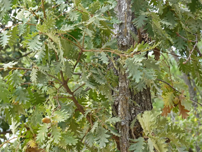
From this point, first in slight descent and later in several ascents and descents, our wide track crosses the Navalespino estate for more than four kilometers, leaving its farmhouse on the left. In the first section of descent from Poyo de la Víbora there are several Pyrenean oaks, quite rare in the park.
Era of the Fustal
We come out onto the JF-7016 road that, on the left, would take us in less than a kilometer to the Navalcaballo area, where there is an old and beautiful forest house that has a fountain and is currently used as the base of the Forest Defense Center ( CEDE FO).
To continue our route, however, when leaving the paved road we must turn to the right. We will see a mountain in front with a small building on a rocky promontory, which is the Navalperal guardhouse. To our right we will find a fountain, but it is usually dry.
Fustal Era Refuge
It is located right at the junction of the JF-7016 and JF-7012 highways, already next to Mount Navalperal. It is an old road laborer house that has been rehabilitated for hikers overnight. In this place there is no fountain, but we have several options. The closest one is to go along the highway to the Madera River for 0.8 kilometers to the aforementioned Navalcaballo forest house, where the Forest Defense Center is located and in front of which there is a fountain. The second is the fountain that has been built next to the Las Acebeas forest house, 1.6 kilometers away following stage 21 of GR 247. And the third is to take the road to Segura de la Sierra, where we will find a fountain at 1 , 6 kilometers, in front of the Cortijo de Lope.
Additional information
The black or salgareño pine, emblem of the Natural Park
There is no tree more representative of the natural park than the salgareño or laricio pine (Pinus nigra ssp. Salzmanii). And not only because of its ecological importance but also because, thanks to the good quality of its wood, it has starred in the economic and social history of the regions that today are integrated into the park, along which it has sometimes been enhanced and spoiled, and sometimes destroyed by greed and blind interest. The name by which this pine has always been known in these mountains is Salgareño, which has its logic, because this word comes from twill, which is how various willows are called here, whose branches are thin and graceful. . Salgareño, therefore, refers to the slenderness of this pine, whose bearing is very straight and elegant.
It can exceed 40 meters in height and is often over 500 or 600 years old. The Pino Galapán, in the municipality of Santiago-Pontones, is famous for being the largest in the park, and apparently dating from the midd ...
The black or salgareño pine, emblem of the Natural Park
There is no tree more representative of the natural park than the salgareño or laricio pine (Pinus nigra ssp. Salzmanii). And not only because of its ecological importance but also because, thanks to the good quality of its wood, it has starred in the economic and social history of the regions that today are integrated into the park, along which it has sometimes been enhanced and spoiled, and sometimes destroyed by greed and blind interest. The name by which this pine has always been known in these mountains is Salgareño, which has its logic, because this word comes from twill, which is how various willows are called here, whose branches are thin and graceful. . Salgareño, therefore, refers to the slenderness of this pine, whose bearing is very straight and elegant.
It can exceed 40 meters in height and is often over 500 or 600 years old. The Pino Galapán, in the municipality of Santiago-Pontones, is famous for being the largest in the park, and apparently dating from the middle of the 17th century. There are millennial salgareños in the natural park (there are three specimens that are between 1020 and 1041 years old), but they do not stand out for their size because they live in more difficult soil and climate conditions. Salgareño pine wood is relatively easy to work, but it is hard and highly resistant to rot, which is why it was once highly valued by the naval industry. In fact, until recent times, the serranos called the main mast to the large salgareño pine trees with a straight trunk, as they were destined to be the main mast of the ships' rigging.
Currently, the European Union certifies the quality of Salgareño pine through its corresponding Community Mark, which represents recognition of the quality of the products made with its wood.
Its beautiful trunks of ashen gray bark dominate the landscape of large wooded areas from an altitude of 1,300 meters, where most of the most valuable ecosystems of the park are located. It appears solitary in the highest areas, with a harsh climate and poor soil, because there is no other tree there that can withstand such conditions. And it competes at lower altitudes and with better soils with oak or gall oak (Quercus faginea), maple (Acer granatense) and melojo (Quercus pyrenaica), at the expense of whose felling has expanded its range throughout the history.
As we can see at this stage, the Salgareño pine forests are impressive due to the straight shape of their trunks, the contrast of the intensely dark green of the crowns with the light gray of the calcareous rocks and the special luminosity of the high areas where they grow. . In Spain, the salgareño occurs in the Pyrenees and in the south of the Iberian Cordillera, especially in the Serranía de Cuenca, but the largest and best preserved forest masses are those of the natural park, Sierras de Cazorla, Segura and Las Villas , in whose logo occupies a prominent place.
It is a tree that prefers calcareous soils and resists drought very well, but it needs a little more water than the two species of pines that dominate in lower areas - the black and the Aleppo. However, it can handle the cold much better than them. Although it prefers cool and deep soils, it has great facility to adhere to rocks, which are so abundant in higher areas, thanks to its long and shallow secondary roots.

Follow us #JaénParaísoInterior


